Categories
About Me Forest fire Las Conchas Fire New Mexico

Fire Fire EveryWhere

Have any of you ever had to evacuate your home? It is a scary proposition, and not fully understood until one has to do it. Many thoughts come to you when you can’t return to your home;
-Did I get all my pictures, my Grandmother’s Quilt?, Did I get all my jewelry? Do I have enough clothes since I don’t know how long I will have to stay away from home? etc., etc.
Meanwhile we watch the TV news and check out the internet for the latest news on the internet.
It is great living in the mountains, but the threat of forest fires is something we have to live with just like others live with the threat of floods and /or tornadoes, or anything Mother Nature throws at us.
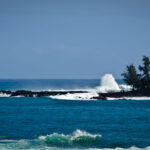
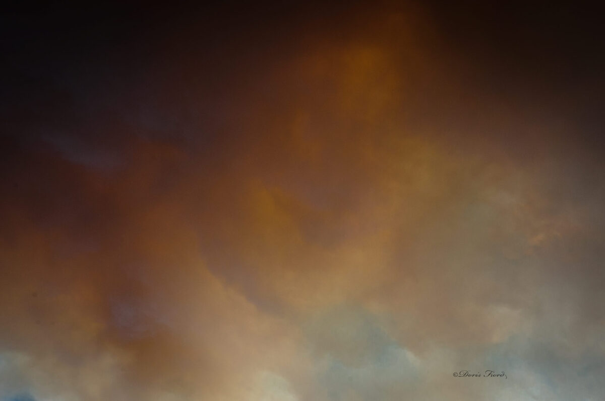
! Smoke over my house from the fire Sunday evening

Las Conchas Wildfire – June 27 11:30 am – New Acreage Figures
Posted on June 27, 2011 by lmlujan

June 27, 2011 at 11 a.m.
LAS CONCHAS WILDFIRE UPDATE
Fire Name: Las Conchas
Time/Date Started: 1:00 p.m. on Sunday, June 26, 2011
Location: Jemez Ranger District, Santa Fe National Forest; approximately 3 miles south of Los Alamos. The fire started on private land off of NM 4 at mile marker 35.
Legal Description: T18N, R4E, SEC 4
Cause: Unknown, under investigation
Fuels: Mixed Conifer, Ponderosa Pine
Size: 43,624 acres (a map of the fire is attached).

The increase in size is due to extreme fire behavior associated with prolonged drought, red flag conditions and better mapping. Last night’s infrared flight confirmed the acreage this morning. The data from the infrared flight detects heat on the ground and that is how we determine fire size. Although the fire has moved through the area, the severity of the fire area has not been determined. Some areas may have burned hotter than others. Fires often have areas that lightly burn as well as areas where the fire burns more severely. The fire also moved east toward old fire scars.

% Contained: 0
Resources Committed: Joe S. Reinarz’ Type 1 Incident Management Team has been ordered. Seven Hotshot crews (Type 1 crews), 12 Type 2 Crews, 7 engines, and 20 aircraft (12 air tankers and 8 helicopters). Numerous resources on-scene and more are en route. In fire management we all work together. We are working with local, state and federal agencies.
Weather: Today’s weather: mostly sunny in the morning then partly cloudy with a slight chance of dry thunderstorms in the afternoon. Chance of precipitation: 10 percent. Max temperatures: 80-84 degrees. Relative humidity: 10-15 percent. North winds 6 to 10 mph with gusts up to 16 mph diminishing through sunrise. Winds will shift to the southwest by late morning and increase to 12 to 18 mph with gusts up to 25 mph by late afternoon. Gusty and erratic winds expected near thunderstorms in the afternoon.
Structures/threats: Structures, powerlines, natural gas lines, Bandelier National Monument and Los Alamos National Laboratory (LANL). The fire has not entered lab property.
Evacuations: Cochiti Mesa, Las Conchas, Bandelier National Monument, and campgrounds near the fire were evacuated yesterday.

Related Images:

Categories
Photography

Is this the Start of the Picture Revolution??

http://www.lytro.com/picture_gallery

Shoot now, focus later. That’s just the start of what you can do with a Lytro camera, the camera that captures the entire light field. A Lytro can also help you remember more of what happened at that party last weekend. And, it may also clue you in on the identity of that dude offering free jailhouse-style tattoos.

This is the start of the picture revolution. Visit their Picture Gallery to experience living pictures for yourself.

Related Images:

Categories
About Me NAPP Outdoor Photography Resources and Links

Is It time to Join NAPP?

v

National Association of Phototshop Profressionals is a great organization for those of us who use Phototoshop, Lightroom and other of the Adobe software. NAPP provides help with all areas of the software, with Tutorials, videos and even a “New to Photoshop” section, just to name a few!

Check it out

Related Images:

Categories
About Me NAPP Resources and Links

You “gotta” see THE GRID

kelbytv.com/thegrid/

The Grid with Scott Kelby & Matt Kloskowski is a live talk-show about photography, Photoshop & other industry-related topics.
Each week features a new guest on the show like Terry White, Moose Petterson, Dave Black, Scott Bourne etc.

The discussions get rather heated and Scott doesn’t mince words in telling it like it is, and when replying to the Twitter comments that stream in during the show.
One doesn’t need to agree with everything that is said to learn a lot about Cameras (Nikon vs Canon!!), Digital darkroom Software (Lightroom vs Aperature), What is “cheating” in regards to using Photoshop for the finished photograph etc. Great Conversations!

I enjoy the show, and watch the replays when I am unable to watch it live.
kelbytv.com/thegrid/

Related Images:

Categories
About My Travels Gondola Venice

The True Heart of Venice– Ponte di Rialto–Rialto Bridge

This bridge was built between 1588 and 1591 to span the Grand Canal and remained the only way to cross the canal by foot until 1854 with the addition of the Academia Bridge! The Rialta Bridge has three walkways one of which was designed to allow passage of galleys.
It is especially pretty at Sunset

Rialta Bridge

Related Images:

Categories
About My Travels Gondola Travel Venice

Sorry for the long Silence!

A recent picture of my hubby just before we took a Gondola ride in Venice! Many more pictures to follow so stay tuned!

I uploaded a few new photos on Flickr

Venice (Italian: Venezia [veˈnɛttsja] is a city in northern Italy known both for tourism and for industry, and is the capital of the region Veneto.

The name is derived from the ancient people of Veneti that inhabited the region as of 10th century B.C. The city historically was the capital of the Venetian Republic. Venice has been known as the “La Dominante”, “Serenissima”, “Queen of the Adriatic”, “City of Water”, “City of Masks”, “City of Bridges”, “The Floating City”, and “City of Canals”. Luigi Barzini, writing in The New York Times, described it as “undoubtedly the most beautiful city built by man”. Venice has also been described by the Times Online as being one of Europe’s most romantic cities.

The city stretches across 117 small islands in the marshy Venetian Lagoon along the Adriatic Sea in northeast Italy. The saltwater lagoon stretches along the shoreline between the mouths of the Po (south) and the Piave (north) Rivers. The population estimate of 272,000 inhabitants includes the population of the whole Comune of Venezia; around 60,000 in the historic city of Venice (Centro storico); 176,000 in Terraferma (the Mainland), mostly in the large frazioni of Mestre and Marghera; and 31,000 live on other islands in the lagoon. There is a recent concern that Venice will be come a living museum with no Venetians living in Venice, just tourists!

The Republic of Venice was a major maritime power during the Middle Ages and Renaissance, and a staging area for the Crusades and the Battle of Lepanto, as well as a very important center of commerce (especially silk, grain and spice trade) and art in the 13th century up to the end of the 17th century. This made Venice a wealthy city throughout most of its history.[6] It is also known for its several important artistic movements, especially the Renaissance period. Venice has played an important role in the history of symphonic and operatic music, and it is the birthplace of Antonio Vivaldi, and the place that Richard Wagner died.

A fun city–Visit it soon!

Related Images:

Categories
About Me About My Travels Cruise Photography Outdoor Photography

More HDR News

There is an article reviewing the Top HDR Software in the April issue of Outdoor Photographer.

But the latest HDR news!

HDR is the latest craze in Photography and now it will even be on the ipad!
The newest how-to app for the iPad is now available: Rick Sammon’s HDR Portfolio (soon to be renamed – Rick Sammpn’s iHDR). This app is packed with HDR photos (his latest), info and movies. A great way to learn and experience HDR. Same great content, but when the new version is release, it will feature a Favorites section, which is very cool.

When one takes photos to be used for HDR a tripod in a necessary item. What about a tripod on a moving ship? That is how I took this picture, on a sail-away from the Island of Moorea on a cruise in the South Pacific, but I thought it turned out to be an interesting picture! What do you think?
Click on the picture to enlarge.

Related Images:

Categories
About Me About My Travels Bora Bora French Polynesia underwater Photography

Colorful Crocea Clams Plus other Beauties of the Pacific Ocean

Colorful Crocea Clams plus other beauties of Pacific Ocean
One of my favorite things to do is Scuba Dive. This trip I was unable to dive, so snorkeled instead. Here are some pictures from underwater Bora Bora in a beautiful area called The Coral Garden.


Bora Bora, located about 160 miles northwest of Tahiti and approximately 2,600 miles south of Hawaii, was discovered in 1722, and is arguably the most beautiful island on the planet. Colorful Crocea Clams Plus other Beauties of the Pacific Ocean are just some of the things seen under water

Its ancient name of Vava’u suggests that the original inhabitants of this seven-million-year-old island arrived from Tonga.

And interestingly, in the local Tahitian language there is no “B,” so its actual name is then Pora Pora, meaning “first born.”

Bora Bora’s fabled blue lagoon is, according to novelist James A. Michener, “so stunning, that there are really no adequate words to describe it.”

Volcanic in origin, Bora Bora’s rugged main island, and a few smaller islands, are completely surrounded by coral reefs.

Made famous by books, movies, and its stunning beauty, the island is now besieged by tourism and overcrowding. Regardless, if you must visit a South Pacific island (and you should), Bora Bora would be an excellent choice.

Related Images:

Categories
About My Travels Animoto Arizona Costa Rica Crocodilles Cruise Photography Travel

Using Animoto– Tarcoles River Costa Rica and Roses

Two videos using Animoto software

I am playing with production of video and still shows using Animoto, http://animoto.com/

“Award-winning Animoto Pro lets you instantly combine your photos and video clips into sharp, sexy, HD videos.

At the heart of Animoto is our patent-pending Cinematic Artificial Intelligence that thinks like an actual director and editor. It analyzes and combines user-selected images, video clips and music with the same sophisticated post-production skills and techniques that are used in television & film. No two videos are ever the same.”

Can’t decide if I like the software or not.

The Rose video was made using all still photos taken after a rain storm in Tucson–Except for the last photo, which was from a Tournament of Roses Parade.

What do you think?

Create your own video slideshow at animoto.com.

Related Images:

Categories
Bergen Norway UNESCO site

Sites above Bergen Norway

Bergen – World Heritage City

Bergen has given a warm welcome to its visitors for more than 900 years. Bryggen has become a symbol of our cultural heritage and has gained a place on UNESCO’s World Heritage List. The old Hanseatic wharf is architecturally unique and is perhaps one of the most familiar image in all of Norway.

Bergensers are proud of their city and of their city’s traditions. They look after their past because it is a part of their living present. A city with its feet in the sea, its head in the skies and its heart in the right place – full of infectious enthusiasm, and happy to share it with visitors. Welcome to Bergen, the old city with a young outlook.

Surrounded by seven mountains, Bergen is ideal for enjoying the beauties of nature. A few minutes’ ride on the Fløibanen funicular will take you from the city center to the top of Mt. Fløyen where there are numerous hiking trails.

Check out the Jack Carter Facebook page to see my corresponding pictures.

Related Images:

Categories
About My Travels Cruise Photography Hawaii Hilo Holland America Cruise Line

Scenes that caught my fancy!

Rotterdam ship bell–Each HAL ship seems to have a bell, some times it is just hard to find it!

One doesn’t see phone booths very often anymore,
These caught my attention in Hilo,
and they are also “prettier” than most!

Related Images:

Categories
About My Travels Cruise Photography Hawaii Hilo Holland America Cruise Line

Off the Beaten Path in Hilo

On a recent Cruise on Holland America Line we traveled from San Diego to Hilo Hawaii– our first siting of land! The trip map is featured on the first picture in the gallery


The coastal town of Hilo is the largest settlement on the island of Hawaii and overlooks Hilo Bay. Mauna Loa, considered an active volcano, and Mauna Kea, a dormant volcano, are located nearby. Hilo’s location on the eastern side of the island makes it the wettest city in the United States and one of the wettest cities in the world with an average yearly rainfall of 127.77 inches. Some areas of Hilo have been known to receive more than 200 inches of rainfall!

The Wailuku River rushes through old lava rocks and lava tubes creating a “boiling” effect. The Kaumana Caves are reached by climbing down an almost vertical staircase. These caves were formed by the 1881 eruption of Mauna Loa.

A trek through white sand lagoons filled with a mixture of salt water and artesian well water from below the surface and surrounded by unique lava formations, leads one to a beautiful sheltered lagoon in which to swim.

Related Images:

Categories
About My Travels Bora Bora French Polynesia Southern Hemisphere Viatape

Snorkeling with Sharks and Manta Rays

Snorkeling with Sharks and Manta Rays
We snorkeled with Blacktip Reef Shark (Carcharhinus melanopterus) in Bora Bora. It is easily identified by the prominent black tips on its fins (especially on the first dorsal fin and the caudal fin). Among the most abundant sharks inhabiting the tropical coral reefs of the Indian and Pacific Oceans, this species prefers shallow, inshore waters and its exposed first dorsal fin is a common sight in the region. Most blacktip reef sharks are found over reef ledges and sandy flats, though they have also been known to enter brackish and freshwater environments. This species typically attains a length of 1.6 m (5.2 ft).

Blacktip reef sharks have extremely small home ranges and exhibit strong site fidelity, remaining within same local area for up to several years at a time. They are active predators of small bony fishes, cephalopods, and crustaceans, and have also been known to feed on sea snakes and seabirds. Accounts of the blacktip reef shark’s life history have been variable and sometimes contradictory, in part reflecting geographical differences within the species. Like other members of its family, this shark is viviparous with females giving birth to 2–5 young on a biennial, annual, or possibly biannual cycle. Reports of the gestation period range from 7–9, to 10–11, to possibly 16 months. Mating is preceded by the male following closely behind the female, likely attracted by her chemical signals. Newborn sharks are found further inshore and in shallower water than adults, frequently roaming in large groups over areas flooded by high tide.

Timid and skittish, the blacktip reef shark is difficult to approach and seldom poses a danger to humans unless roused by food. However, people wading through shallow water are at risk of having their legs mistakenly bitten. This shark is used for its meat, fins, and liver oil but is not considered to be a commercially significant species. The International Union for Conservation of Nature (IUCN) has assessed the blacktip reef shark as Near Threatened. Although the species as a whole remains widespread and relatively common, overfishing of this slow-reproducing shark has led to its decline at a number of locales.

http://www.iucn.org/

http://animals.nationalgeographic.com/animals/fish/blacktip-shark/
During that time we also saw a Lemon shark ( Negaprion brevirostris), a shark that belongs to the family Carcharhinidae that can grow 10 feet (3.0 m) long.[1] It is known as the lemon shark because at certain depths, the light interaction with the local seawater can make this shark have a tanned and yellow pitted appearance, much like the surface of a lemon.

Black Tipped Sharks
Black Tipped Sharks
Black Tipped Shark
Black Tipped Sharks
Black Tipped Shark
Black Tipped Sharks
Black Tipped Shark
Black Tipped Shark
Black Tipped Sharks
Black Tipped Sharks
Manta
Manta
Manta
Manta
Manta Ray
Manta
Manta Ray
Manta
Manta Ray
Manta

The Manta Rays are also plentiful in the area, are used to humans, and swam all around over and under us and feel like velvet. What the giant manta rays do with humans is unique in this world. A totally wild animal, that can be twice the mass of a horse, seeks out and revels in human physical contact. Manta rays are the largest rays and are closely related to sharks. These harmless rays have a short tail and no stinging spine. They are very acrobatic; they can even leap from the water. Remoras (Echeneida) are frequently seen with mantas, staying near the manta’s mouth (even inside the gill cavities). The remoras probably feed on parasites on the manta’s body and eat bits of the manta’s food. These graceful swimmers are up to 29.5 ft (9 m) wide, but average about 22 ft (6.7 m) wide. The largest weigh about 3,000 pounds (1350 kg).

Mantas are dark brown to black on top with paler margins; they are mostly white underneath. Mantas eat microscopic plankton, small fish, and tiny crustaceans. They funnel the food into their mouth while they swim, using two large, flap-like cephalic lobes which extend forward from the eyes. Mantas have no teeth; they sieve their food.

Related Images:

Categories
About My Travels Magellanic Clouds Southern Cross Southern Hemisphere Stargazing

Star Gazing in the Southern Hemisphere

Did you know that you can’t see the North Pole star after you cross the equator, midsouthern latitudes (15-45 degrees south), but the southern sky is brighter, and there are more stars to see!

Among the exciting celestial treasures that await the traveler who ventures deeper south is the Milky Way–well you say I can see it anywhere, but in the Southern sky it is brighter, especially in our summer, their winter. The Magellanic Clouds, though, can only be seen in the southern hemisphere. Never heard of the Magellanic Clouds?–

From the southern hemisphere the brightest galaxy to be seen is the Large Magellanic Cloud, a smaller galaxy than Andromeda (which we can see in the northern hemisphere), but 14 times brighter. With the naked eye the Large Magellanic Cloud looks like a gray patch in the sky, and the Small Magellanic Cloud nearby looks like a smaller gray patch.

In the 16th century , Portuguese explorer Ferdinand Magellan was the first to note the position and appearance of these two patches, remarking on their uniqueness in the heavens. Today we know they are satellite galaxies of our Milky Way, with the Large Magellanic Cloud about 5 percent of the mass of the Milky Way, and the Small Magellanic Cloud 1 percent of the mass of the Milky Way Galaxy.
Reference: Night Watch
A Practical Guide to Viewing the Universe by Terence Dickinson 4 Edition

On a recent trip across the equator I saw the Large Magellanic Cloud, but the most impressive celestial sight to me was my first sighting of the Southern Cross. Maybe it was impressive because I was also able to get pictures of it! Laying on a deck chair on the Sky Deck of a Cruise ship at 4 or 5 am is amazingly wonderful! You say you aren’t a morning person, well neither am I but I still marveled at the beauty of the sky at those hours, and got up without the aid of an alarm clock! I do have a great lady to Thank for opening my eyes to the southern sky; Famous HAL lecturer, Star Lady Donna. Check her out www.stargazing.ca
Another site to check Skyandtelescope.com for interesting articles, Sky at a glance, Interactive Sky Chart, etc. You can also get Sky Calender on Twitter http://twitter.com.skymaps, then buy yourself a Planisphere for your Latitude and go out and look at the stars!

Related Images:

Categories
Hawaii

Beach & Sunset in Hilo Hawaii–Think warm on this cold February Day


View Larger Map

Related Images:

Categories
About My Travels Costa Rica Cruise Photography

Costa Rica Tarcoles River

baby-CrocodilleYellow-crowned-night-HeronWood Stork-leg-up-Crocodille Green IguanaRoseate-spoonbill-(Ajaia-ajaia)-black-necked-stilts-(Himantopus-mexicanus)Roseate-spoonbill-(Ajaia-ajaia)-black-necked-stilt-(Himantopus-mexicanus) Blue-Heron-Great-White CraneCrocodille CrocodilleMangrove CrabCommon-Basilisk Lizard-

Related Images:

Categories
Winter

Happy 2011

Watched the Tournament of Roses Parade–Pictures to follow

Just a Sample— Pac Man

Related Images:

Categories
About My Travels Snow Travel Winter

Happy New Year from Pasadena!

Happy New Year!
Windy and Cold here–Sunny CA yes but—also can get cold—Not quite this cold!


OOPS the Snowman was made in WA last week! Lemon tree in Pasadena.

The Tournament of Roses Parade is Tomorrow! Can’t wait to see it!

Related Images:

Categories
Manger Scene Merry Christmas

Merry Christmas

As Christmas Day draws near, we must pause and remember the reason for the season. God sent his Son to be born in a Manger.
Let us be Thankful

Related Images:

Categories
Snow Winter

Snow!

Beautiful snow today, but didn’t get to take any photos!

By the way– Have any of you ever used the Cotton Carrier? www.cottoncarrier.com
A great way to carry the camera on hikes or cross country skiing: leaves your hands free, and the camera (Nikon D3) snug against your body. Hope to try it out this weekend with the skis!

Another great selection of camera carrying equipment comes with the Think Tank system. www.thinktankphoto.com
I have used each of the various belts at different times with and without the harness, to attach the camera (Nikon D3) and various sized bags as needed. Rain covers come with each bag, and have come in very handy while traveling/ hiking in rainy areas.

Related Images: