Categories
About My Travels Egypt Karnak

Temple of Karnak

Temple of Karnak in Egypt:

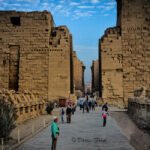
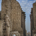
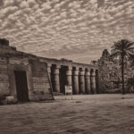
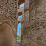
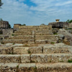
Karnak Temple in Egypt is located in Thebes which is now (Modern Luxor), and is actually a temple complex, formerly known as Ipet-isut (Most select of places) by the ancient Egyptians. A city of temples built over 2000 years and dedicated to the Theben triad. The great temple at the heart of Karnak is so big, St Peter’s, Milan and Notre Dame Cathedrals could be lost within its walls. The Hypostyle hall at 54,000 square feet with its 134 columns is still the largest room of any religious building in the world.

“In ancient Egypt, the power of the god Amun of Thebes gradually increased during the early New Kingdom, and after the short persecution led by Akhenaten, it rose to its apex. In the reign of Ramesses III, more than two thirds of the property owned by the temples belonged to Amun, evidenced by the stupendous buildings at Karnak Temple complex. Although badly ruined, no site in Egypt is more impressive than Karnak. It is the largest temple complex ever built by man, and represents the combined achievement of many generations of ancient builders. The Temple of Karnak is actually three main temples, smaller enclosed temples, and several outer temples located about three kilometers north of Luxor, Egypt situated on 100 ha (247 acres) of land. Karnak is actually the sites modern name. Its ancient name was Ipet-isut, meaning “The Most Select (or Sacred) of Places”.

The Temple of Karnak is a “vast complex built and enlarged over a thirteen hundred year period. The three main temples of Mut, Montu and Amun are enclosed by enormous brick walls. The Open Air Museum is located to the north of the first courtyard, across from the Sacred Lake. The main complex, The Temple of Amun, is situated in the center of the entire complex. The Temple of Monthu is to the north of the Temple of Amun, and next to it, on the inside of the enclosure wall is the Temple of Ptah, while the Temple of Mut is to the south. There is also the small Temple dedicated to Khonsu, and next to it, an even smaller Temple of Opet. Actually, there are a number of smaller temples and chapels spread about Karnak, such as the Temple of Osiris Hek-Djet (Heqadjet), which is actually inside the enclosure wall of the Temple of Amun.”

Read more: http://www.touregypt.net/karnak.htm#ixzz2UuEWOe6M

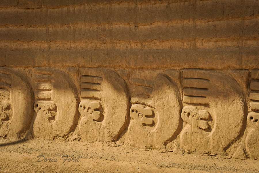
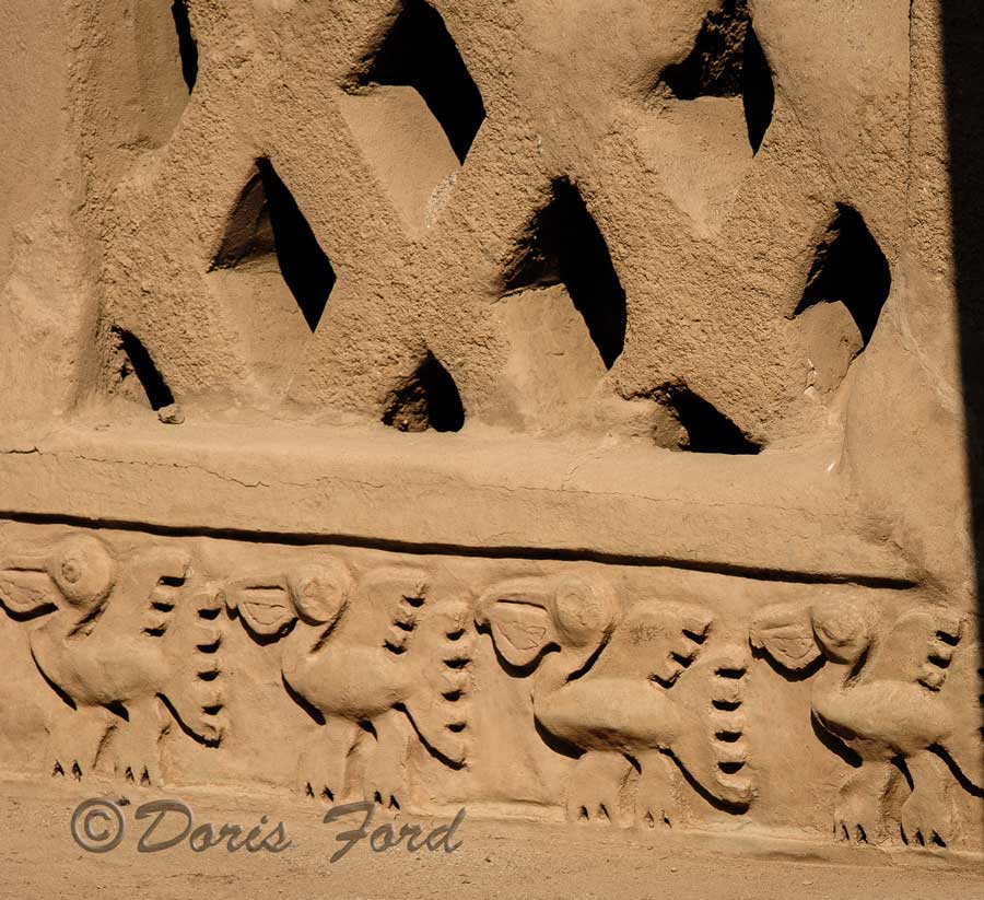
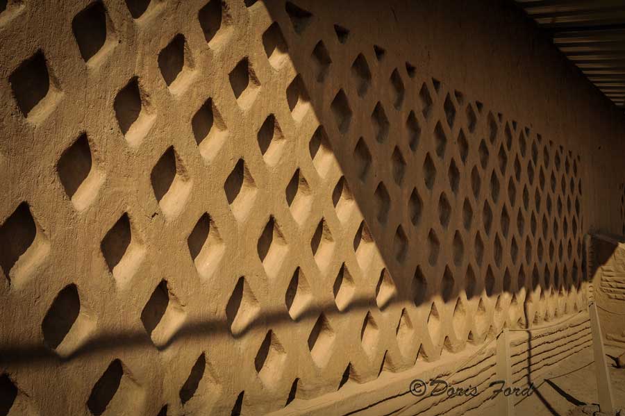
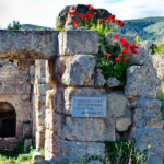
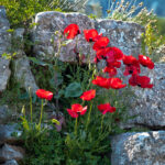
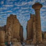
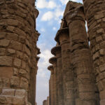
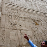
The Karnak Temple in Egypt was a highlight of our visit to Egypt. The carvings on the columns are quite well preserved in places, and some paint can be seen on rare occasions. The tall ornate columns standing in a row dwarf the visitors strolling by as they look up to admire the awesome sites.
In The Temple of Karnak one an easily visualize -“The carving of the one armed man who was the God of Fertility and the Eastern Desert, worshiped since pre-dynastic times. He was later associated with Amun as Amun-Min. He was shown as a human male with one arm and one leg and an erect, large penis. His right arm was raised, holding a flail. The flail is sometimes seen as a symbol of intercourse. The flail forms a V, while the upraised arm was thrust into the V.”
Read on about the scenes in The Temple of Karnak

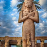
“This area (Karnak Temple) is very significant because it reveals much of the history of this area through scenes that are displayed in the complex. There are battle scenes between pharaohs and enemies, and rulers were made a permanent part of history through these memorials. Many remarkable displays of the history of this time are still standing, such as the statue of Pinedjem I which is 10.5 meters tall. The sandstone that was used in the temple’s complex was brought from over 100 miles away on the Nile River. Another amazing feature of the Precinct of Amun-Re is the panora of a freize that displays very clear images of ancient characters that still stands today. In 323 AD, when Constantine the Great recognized the Christian religion, the complex was closed down, and Christian churches were built.”
http://www.karnak.org/
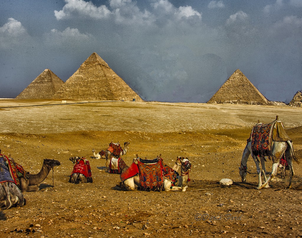
Related Images:

Categories
About My Travels Peru UNESCO site

A visit to Chan Chan

Chan Chan

Review the map on the Post of March 24th 2012 for the route taken for the South American trip.
The largest Pre-Columbian city in South America, Chan Chan is an archaeological site located in the Peruvian region of La Libertad, five km west of Trujillo. Chan Chan covers an area of approximately 20 km² and had a dense urban center of about 6 km². Chan Chan was constructed by the Chimor (the kingdom of the Chimú), a late intermediate period civilization which grew out of the remnants of the Moche civilization. The vast adobe city of Chan Chan was built by the Chimu around AD 850 and lasted until its conquest by the Inca Empire in AD 1470. It was the imperial capital of the Chimor until it was conquered in the 15th century. It is estimated that around 30,000 people lived in the city of Chan Chan.

Chan Chan was added as a UNESCO World Heritage Site on November 28 of 1986. The city is severely threatened by storms from El Niño, which cause heavy rains and flooding on the Peruvian coast. It is in a fertile, well-watered section of the coastal plain The city’s ruins are additionally threatened by earthquakes and looters. Present-day visitors to Chan Chan can enter the Tschudi Complex, believed to be one of the later citadels built in the city. There are also several other Chimú and Moche ruins in the area around Trujillo. This site was discovered by the Conquistador Francisco Pizarro.

The city is composed of ten walled citadels which housed ceremonial rooms, burial chambers, temples, reservoirs and some residences. Chan Chan is a triangular city surrounded by walls 50–60 feet high. A distinguishable aspect of Chan Chan is that there are no enclosures which open to the north. The tallest walls shelter against south-westerly winds from Peru’s coast. Northern-facing walls gain the greatest exposure to the sun, serving both to block the wind and absorb sunlight where fog is frequent. The numerous walls throughout the city create a labyrinth of passages.

The walls themselves were constructed of adobe brick and were then covered with a smooth surface into which intricate designs were carved. There are two styles of design present in these carvings: one is a ‘realistic’ representation of subjects such as birds, fish, and small mammals; and the other is a more graphic, stylized representation of the same subjects. The carvings at Chan Chan depict crabs, turtles, and nets for catching various sea monsters. Chan-Chan

Chan Chan, unlike most other coastal ruins in Peru, is located extremely close to the Pacific Ocean. In 1998, The “Master Plan for Conservation and Management of the Chan Chan Archeological Complex” is drawn up by the Freedom National Culture Institute of Peru with contributions from the World Heritage Foundation – WHR, ICCROM and GCI. The Plan is approved by the Peruvian Government, with involvement at the highest levels up until today.
From Wikipedia
http://whc.unesco.org/en/list/366

Related Images:

Categories
About My Travels Dubai

Ski Dubai- Yes its true!

Ski Dubai a Ski Slope in a Shopping Center–Yes–in Dubai, United Arab Emirates.–Where else! Ski Dubai is an indoor ski resort with 22,500 square meters of indoor ski area. It is a part of the Mall of the Emirates, one of the largest shopping malls in the world. located in Dubai, United Arab Emirates.
Ski Dubai is best viewed while eating at the Cheesecake Factory, great food and great view for one price.
Sledding, Skiing, and rolling down the hill in a ball are a few of the highlights offered at this unusual indoor ski slope. For people who live in a sandy Desert area just walking in, touching and making snowballs in all that snow is worth the admittance price.

Ski Dubai Highlights;
_DF17250

_DF17245

_DF17244

_DF17233

_DF17230

_DF17215

_DF17214

_DF17210

Snow in the Desert

Related Images:

Categories
About Me Holland America Cruise Line

Dubai and the Burj Khalifa

Dubai and the Burj Khalifa

What a city!
A lot could be said about Dubai, but it probably has all been said before. I want to focus on some of the buildings that one can see in Dubai. The first one of course will be the Tallest building in the World–the Burj Khalifa. It is an amazing building to view and to go into. The high-speed elevator will zip one to the 124th floor in less than one minute.

I feature a few pictures of the Bruj Khalifa with different views, day and night, and from the ground and from the 124th floor.

For an amazing picture from the 124th floor look at-Joe McNally’s Instagram photo http://www.huffingtonpost.com/2013/03/20/joe-mcnally-burj-khalifa-skyscraper-photo-picture_n_2917817.html–The picture I wish I had taken when I was there!

Burj Facts
1. Burj Khalifa is located in Dubai, United Arab Emirates (UAE).

2. It’s 828 metres tall (2,717 feet).

3. The exact height was not revealed until final stages of the construction.

4. It was officially opened on Jan 4, 2010.

5. It was previously known as Burj Dubai.

6. Burj means Tower in Arabic language.

7. It’s renamed after Sheikh Khalifa bin Zayed Al Nahyan, the President of UAE and ruler of Abu Dhabi.

World records

8. Tallest building – previously Taiwan’s Taipei 101 (509m).

9. Tallest free-standing structure – previously Canada’s CN Tower (555m).

10. Tallest man-made structure – previously USA’s KVLY-TV Mast (629m).

11. Tallest man-made structure ever – previously Poland’s Warsaw Radio Mast (647m).

12. Building with most floors (160) – previously USA’s World Trade Center (110).

13. Highest elevator installation.

14. Highest outdoor observation deck (~440m)

15. Highest mosque at 158th floor.

16. Highest (insert here) which requires another long list to be completed ;p

17. Fastest elevators at speed of 64km/h, or 18m/s.

18. It would take just a minute to reach from ground level to top floor.

Architecture facts

19. Burj Dubai has more than 162 floors.

20. It has 49 office floors.

21. It houses 1044 residential apartments.

22. It has a floor area of 334,000 square metres.

23. There’s 57 lifts in the tower.

24. There’s 28,261 of glass-panels on the exterior of the tower.

25. Its top spire can be seen from 95km afar.

26. The architecture features a triple-lobed footprint, an abstraction of the Hymenocallis flower.

27. The Y-shaped floor plan aims to maximize views of the Gulf.

28. Over 1,000 pieces of art from prominent Middle Eastern and international artists will adorn the tower and the surrounding Emaar Boulevard.

Environmental facts

29. The tower’s peak electricity demand is estimated at 50MVA, equivalent to roughly 500,000 100-watt light bulbs.

30. It’s expected to use an average of 946,000 litres of water each day.

31. During peak cooling conditions, the tower will require around 12,500 tons of cooling, equivalent to the cooling capacity of about 10,000 tons of melting ice.

Construction facts

32. Construction began in September 2004.

33. The tower’s architect and engineer is Skidmore, Owings and Merrill (Chicago).

34. The main constructor is Emaar Properties, a joint venture by Korea’s Samsung C&T, Belgium’s Besix and UAE’s Arabtec.

35. The construction project manager is Turner Construction Company.

36. Bill Baker is the chief structural engineer.

37. Adrian Smith is consulting design partner.

38. It took some 22 million man-hours to be completed.

39. On downside, foreign construction workers were pay as little as $4 per day.

40. Over 45,000 cubic-metres of concrete, weighing more than 110,000 tonnes, were used.

41. Concrete used was enough to lay a 2,065km-long pavement; and equivalent to the weight of 100,000 elephants.

42. Total weight of aluminium used is equivalent to that of five A380 aircraft.

43. Total length of stainless steel bull nose fins used is equal to 293 times the height of France’s Eiffel Tower.

44. The foundations were dug to depths of 50m.

Financial figures

45. Total cost estimated at US$1.5 billion.

46. The price for the offices spaces reached as high as US$4,000 per sq ft.

47. Residential spaces as high as US$3,500 per sq ft.

48. The building is part of the a 490-acre flagship development called Downtown Burj Khalifa.

Random stuff

49. Burj Khalifa is about twice the height of Empire State Building (443m).

50. It’s taller than Hong Kong’s Victoria Peak (552m).

51. It’s the first world’s tallest structure in history to include residential space.

52. It will feature the world’s first Armani Hotel, which occupies 15 of the lower 39 floors.

53. The exterior temperature at the top of will be 6°C cooler than its base (some say 10°C).

54. Jan 4, its opening date, was the birthday of Sir Isaac Newton.

55. Around 12,000 people are expected to live and work in the tower when it’s fully occupied.

56. The tower’s official website is www.burjkhalifa.ae.

Related Images:

Categories
About My Travels Indonesia

Komodo Dragons on Komodo Island Indonesia

A visit to Komodo Dragons on Komodo Island Indonesia

Dragon toenails Check out my Toenails!

Dragon walking A Dragon walking near the entrance to the Park

Komodo dragons
Look at the long Tail />

Komodo dragons smell with their tougues Komodos smell with their tongue
Komodo dragon Komodo near Kitchen

/>

Check out the Smithsonian magazine of February 2013 for more information on the Dragons.

Some information on the Dragons-Taken from Wikipedia

The Komodo dragon (Varanus komodoensis), also known as the Komodo monitor, is a large species of lizard found in the Indonesian islands of Komodo, Rinca, Flores, Gili Motang and Padar. A member of the monitor lizard family (Varanidae), it is the largest living species of lizard, growing to a maximum length of 3 metres (10 ft) in rare cases and weighing up to around 150 kilograms (330 lb). Their unusual size has been attributed to island gigantism, since no other carnivorous animals fill the niche on the islands where they live.

However, recent research suggests the large size of Komodo dragons may be better understood as representative of a relict population of very large varanid lizards that once lived across Indonesia and Australia, most of which, along with other megafauna, died out after the Pleistocene. Fossils very similar to V. komodoensis have been found in Australia dating to greater than 3.8 million years ago, and its body size remained stable on Flores, one of the handful of Indonesian islands where it is currently found, over the last 900,000 years, “a time marked by major faunal turnovers, extinction of the island’s megafauna, and the arrival of early hominids by 880 ka.”

As a result of their size, these lizards dominate the ecosystems in which they live. Komodo dragons hunt and ambush prey including invertebrates, birds, and mammals. Their group behaviour in hunting is exceptional in the reptile world. The diet of big Komodo dragons mainly consists of deer, though they also eat considerable amounts of carrion. Komodo dragons also occasionally attack humans in the area of West Manggarai Regency where they live in Indonesia.

Description-
In the wild, an adult Komodo dragon usually weighs around 70 kg (150 lb), although captive specimens often weigh more. According to the Guinness Book of World Records, an average adult male will weigh 79 to 91 kg (170 to 200 lb) and measure 2.59 m (8.5 ft), while an average female will weigh 68 to 73 kg (150 to 160 lb) and measure 2.29 m (7.5 ft).[15] The largest verified wild specimen was 3.13 m (10.3 ft) long and weighed 166 kg (370 lb), including undigested food. The Komodo dragon has a tail as long as its body, as well as about 60 frequently replaced, serrated teeth that can measure up to 2.5 cm (1 in) in length. Its saliva is frequently blood-tinged, because its teeth are almost completely covered by gingival tissue that is naturally lacerated during feeding. This creates an ideal culture for the bacteria that live in its mouth. It also has a long, yellow, deeply forked tongue. Komodo dragon skin is reinforced by armoured scales, which contain tiny bones called osteoderms that function as a sort of natural chain-mail. This rugged hide makes Komodo dragon skin poorly suited for making into leather.
Senses

The Komodo dragon does not have an acute sense of hearing, despite its visible earholes, and is only able to hear sounds between 400 and 2000 hertz.
The Komodo dragon uses its tongue to detect, taste, and smell stimuli, as with many other reptiles, with the vomeronasal sense using the Jacobson’s organ, rather than using the nostrils. With the help of a favorable wind and its habit of swinging its head from side to side as it walks, a Komodo dragon may be able to detect carrion from 4–9.5 km (2.5–5.9 mi) away. It only has a few taste buds in the back of its throat. Its scales, some of which are reinforced with bone, have sensory plaques connected to nerves to facilitate its sense of touch. The scales around the ears, lips, chin, and soles of the feet may have three or more sensory plaques.
Ecology

The Komodo dragon prefers hot and dry places, and typically lives in dry, open grassland, savanna, and tropical forest at low elevations. As an ectotherm, it is most active in the day, although it exhibits some nocturnal activity. Komodo dragons are solitary, coming together only to breed and eat. They are capable of running rapidly in brief sprints up to 20 km/h (12 mph), diving up to 4.5 m (15 ft), and climbing trees proficiently when young through use of their strong claws. To catch out of reach prey, the Komodo dragon may stand on its hind legs and use its tail as a support. As it matures, its claws are used primarily as weapons, as its great size makes climbing impractical.

Related Images:

Categories
About My Travels Lisbon Portugal

Bridges

Bridges of the World
As I travel I have noticed how many bridges remind me of the Golden Gate Bridge in San Francisco especially this one:

Where was this picture taken?

The 25 de Abril Bridge (Ponte 25 de Abril “25th of April Bridge”), is a suspension bridge connecting the city of Lisbon, capital of Portugal, to the municipality of Almada on the left (south) bank of the Tejo river. It was inaugurated on August 6, 1966 and a train platform was added in 1999. Because it is a suspension bridge and has similar coloring, it is often compared to the Golden Gate Bridge in San Francisco, USA. In fact, it was built by the same company (American Bridge Company) that constructed the San Francisco-Oakland Bay Bridge and not the Golden Gate, also explaining its similarity in design. With a total length of 2,277 m, it is the 23rd largest suspension bridge in the world. The upper deck carries six car lanes, while the lower deck carries two train tracks.
Bridge that is similar to Golden Gate Bridge

similar to Golden Gate Bridge

Related Images:

Categories
About My Travels History

“REAL” Story of the Mayflower

“Real story of the MAyflower:

JOINT PREPARATIONS FOR EMIGRATION TO AMERICA


Two chartered English companies controlled Virginia; the First Virginia Company of London (Southampton and other local Lords and Burgesses had shares in this), and the Virginia Company of Plymouth. The First Virginia Company of London went bankrupt and was therefore unable to service the colony. Neither was it prepared to allow freedom of worship to the negotiators. However, in 1619 the Leyden delegation secured a tract of land in Virginia made out in the name of a sympathizer, Rev. John Wincob, a name that is often forgotten.

The option of land was never taken up, but one of the leaders of the Second Virginia Company, Thomas Weston, persuaded the Leyden puritans to join them. A complicated – and harsh – Agreement of Ten Articles was drawn up which the would-be settlers had to agree to. The terms of the agreement left the Leyden contingent very short of money, so they were unable to provision themselves properly for the first few months of survival in the New World. 

Some prospective Leyden settlers withdrew at this stage, and they were replaced (by the London shareholders of the Company) with others from England. Among these was Miles Standish, a soldier, and Christopher Martin, the latter causing trouble later when he, as the Treasurer of the venture, as well as being Company agent, refused to account for £700 which he had spent in Southampton.

In 1620 the London adventurers chartered the Mayflower under her master Captain Christopher Jones of Harwich. She was a good, stout, and ocean going ship of 180 tons. The Leyden contingent, however, could not afford such a big or good vessel. They needed a ship which could be used when they actually arrived in America, rather than a chartered one, so they bought the Speedwell. The 60-ton ship was refitted in Holland, and they hired a less experienced Master, Captain Reynolds. It is thought, but cannot be proved without a doubt, that the Speedwell was built originally in Southampton in 1606. A ship of that name and tonnage was certainly built there.


Whatever; Southampton was chosen as the rendezvous point for the voyage to America. The Mayflower sailed from London with about 70 immigrants on board and arrived in Southampton about the 29th July where others joined her. One cannot be precise about the date because in 1752 when the New Gregorian Calendar was introduced officially, the difference between the old Julien calendar and the new was adjusted to 11 days. In 1620, however, the difference was considered to be 10 days. 
 The Speedwell left Holland on 1st August (Gregorian time from now on) from Delft Haven near Rotterdam with less than 50 emigrants aboard. On arrival at Southampton the ship had to have another refit at West Quay with money the Leyden “Saints” could ill afford. She was overmasted for a start and would have wallowed in heavy seas. Quarrels and disagreements broke out and Thomas Weston for the Company refused to let the Leyden people have any more money because they would not sign an amended contract. As a result the group had to sell some of their belongings, food and stores, to pay Southampton its harbour and other dues.

The party from both ships spent nearly 2 weeks in Southampton, which at that time was recovering from a downturn in trade and was a fairly prosperous town. At least one new member, John Alden, a cooper, joined the emigrants. It is thought that he was the son of George Alden who lived in what is now called the Old Town. (Rate Roll for All Saints Parish 1602) There were, however, two Alden families in Southampton at that time. Longfellow’s romantic poem “The Courtship of Miles Standish” keeps his memory alive, however, whichever family he originally belonged with.

It is possible that other Southampton families joined the Pilgrims, or at the very least had sympathy with them. Certainly, Steven Hopkins and his second wife, Elizabeth, had connections with Hampshire. His, but possibly not her, children were born in Hursley, and his first wife was buried there.

In Southampton in 1620, the congregation of the French Church, St Juliens, in Winkle Street, which was licensed by Queen Elizabeth I in 1567 for use by the Huguenot refugees, had almost as many English worshippers as Huguenot families.
Now as this was obviously from preference, it must be presumed that the choice was made because of the more rigid, Puritan-like customs of the “foreign” church. In 1635 after an official Visitation, however, the English were ordered to return to their own churches.

On the other side of the coin, some of St Julien’s congregation, notably the Dellamotte’s who had been among St Julien’s Elders, had joined the less rigid Anglican congregation. Judith, Philip Delamotte’s, widow, was buried in St John’s in 1640 and her granddaughter, Martha was christened an Anglican.

The Speedwell and the Mayflower eventually sailed from Southampton for the New World on the 15th August, but twice they had to turn back. The second time they limped into Plymouth where it was decided that the Speedwell was unseaworthy. She was leaking like a sieve, so was abandoned. Some of the Pilgrims left the ship and the venture there, but others transferred to the Mayflower in what must then have become extremely crowded conditions for such a long journey. The Mayflower was hardly the Queen Mary in the first place! The Mayflower sailed from Plymouth for America on September 16th and arrived at Cape Cod on 21st November.

Cape Cod was not the intended place of disembarkation and on arrival such was the distrust among the colonists-and between them and the Company-that the famous Mayflower Compact was drawn up and signed on board before anyone was allowed to disembark. 

This agreement was thought necessary because there was unrest and it was felt that some of the non-Separatists, called “Strangers,”(the others, particularly those from Leyden, were called “Saints”) among the passengers would defy the Pilgrim’s leaders if they were landed in a place other than that specified in the land grant they had received from the London Company. Although not meant as a democratic document – more a way of quelling mutiny -the Compact became the basis of government in the Plymouth Colony and eventually, America. After it was signed, the Pilgrims elected John Carver as their first governor, the first free election of the New World.

THE MAYFLOWER COMPACT

”In the name of God, Amen. We, whose names are underwritten, the Loyal Subjects of our dread Sovereign Lord, King James, by the Grace of God, of England, France and Ireland, King, Defender of the Faith, &. Having undertaken for the Glory of God, and Advancement of the Christian Faith, and the Honour of our King and Country, a voyage to plant the first colony in the northern parts of Virginia; do by these present, solemnly and mutually in the Presence of God and one of another, covenant and combine ourselves together into a civil Body Politick, for our better Ordering and Preservation, and Furtherance of the Ends aforesaid; And by Virtue hereof to enact, constitute, and frame, such just and equal Laws, Ordinances, Acts, Constitutions and Offices, from time to time, as shall be thought most meet and convenient for the General good of the Colony; unto which we promise all due submission and obedience.In Witness whereof we have hereunto subscribed our names at Cape Cod the eleventh of November, in the Reign of our Sovereign Lord, King James of England, France and Ireland, the eighteenth, and of Scotland the fifty-fourth. Anno Domini, 1620.”


There were 41 signatories of the 102 passengers, 37 of whom were members of the “Separatists”. This compact established the first basis in the New World for written laws. Half the colony failed to survive the first winter, but the remainder lived on and prospered. 
MAYFLOWER PASSENGER LIST NAMES
alden John (prob. Soton) 
Allerton Isaac 
Mary Allerton (wife) 
Allerton Bartholomew (son) 
Allerton Mary (daur) 
Allerton Remember (daur) 
Allerton Jon ( sailor. no relation) 
Billington Don 
Billington Eleanor (wife) 
Billington Frances (relationship unknown) 
Billington John (son) 
Bradford William 
Bradford Dorothy May (wife) 
Brewster William 
Brewster Mary (wife) 
Brewster Wrestling (son) 
Brewster Love (son) 
Britteridge Richard 
Brown Peter 
Butten William 
Cartier Robert 
Carver John 
Carver Katherine (wife) 
Chilton James 
Chilton Susanna (wife) 
Chilton Mary (unknown r’ship) 
Clarke Richard 
Cooke Francis 
Cooke John (son) 
Cooper Humility 
Crackson John 
Crackston John (son) 
Doty Edward 
Eaton Francis 
Eaton Sarah (wife) 
Eaton Samuel (son) 
Ely ???? (sailor) 
English Thomas 
Fletcher Moses 
Fuller Edward 
Fuller Ann (wife) 
Fuller Samuel (son) 
Fuller Samuel (not related. Doctor) 
Gardiner Richard 
Goodman John 
Holbeck William 
Hooke John 
Hopkins Steven (Hursley, Hants connections) 
Hopkins (Fisher)Elizabeth (2nd wife) 
Hopkins Giles (son) 
Hopkins Constance (daur) 
Hopkins Damaris (daur) 
Hopkins Oceanis (son born at sea)
Howland John 
Langmore John 
Latham William 
Margeson Edmund
Martin Christopher
Martin nee Prower, Marie
Minter Desire
More Elinor 
More Jasper (brother) 
More Richard (brother)
More Mary (sister)
Mullins William
Mullins Alice (wife)
Mullins Joseph (son)
Mullins Priscilla(m. John Alden)
Priest Degory
Prower Solomon
Rigdale John
Rigdale Alice (wife) 
Rogers Thomas
Rogers Joseph (son)
Sampson Henry
Soule George
Standish Miles
Standish Rose (wife) 
Story Elias 
Thompson Edward 
Tilley Edward
Tilley Ann or Agnes (wife)
Tilley John (brother to Edward
Tilley Joan (Johns wife)
Tilley Ellizabeth) (daur)
Tinker Thomas
Tinker ?????? (wife)
Tinker ?????? (son)
Trevore William (sailor)
Turner John
Turner – two sons 
Warren Richard
White William 
White Susannah (wife)
White Peregrine (son b. at sea)
White Resolved (son)
Wilder Roger
Williams Thomas
Winslow Edward
Winslow Elizabeth (wife)
Winslow Gilbert (brother)
MORE INFORMATION
 A great deal has been written about and around the Pilgrim Fathers and there are several commemorative sites one can visit, both literally and on the Internet. In Southampton, as well as the obvious Mayflower Park right on the Waterfront, there is the Mayflower Memorial on the other side of the road which was erected in 1913, and the Mayflower Theatre in Commercial Road. Southampton also has a plaque which was presented to the Mayor in 1970 by the Society of Mayflower Descendants to commemorate 350 years from the date of the sailing of the Speedwell and Mayflower.

The Mayflower Memorial


There are some very good websites specifically about the Pilgrim Fathers, the Mayflower, and the families that the ship carried. Just a quick look using any of the popular search engines will come up with quite a list. Those that can be 
recommended are:


http://pilgrims.net/plymouth/history/  (needs to be typed in the address bar) 
http://www.mayflowerfamilies.com  (an Ancestry.com site)
http://members.aol.com/calebj/mayflower  A very large site packed with well researched genealogical information by Caleb Johnson.

List of published sources used for this piece:

Handbook accompanying the Mayflower Exhibition, Southampton 1970
A Social History of England by Asa Briggs
History and Topography of Buckinghamshire by J J Sheehan
 Pilgrim Fathers Southampton Record Series
Southampton Guide Book Milestone Publications 

Viktoria Turner 
History Research

Salute to the Mayflower in Mayflower Park Southampton

Related Images:

Categories
About My Travels

Visit of the Wise Men

Wise Men story as reported in the Bible

"Wise

In the time of King Herod, after Jesus was born in Bethlehem of Judea, wise men from the East came to Jerusalem, asking, “Where is the child who has been born king of the Jews? For we observed his star at its rising, and have come to pay him homage.” When King Herod heard this, he was frightened, and all Jerusalem with him; and calling together all the chief priests and scribes of the people, he inquired of them where the Messiah was to be born. They told him, “In Bethlehem of Judea; for so it has been written by the prophet: ‘And you, Bethlehem, in the land of Judah, are by no means least among the rulers of Judah; for from you shall come a ruler who is to shepherd my people Israel.'” Then Herod secretly called for the wise men and learned from them the exact time when the star had appeared. Then he sent them to Bethlehem, saying, “Go and search diligently for the child; and when you have found him, bring me word so that I may also go and pay him homage.” When they had heard the king, they set out; and there, ahead of them, went the star that they had seen at its rising, until it stopped over the place where the child was. When they saw that the star had stopped, they were overwhelmed with joy. On entering the house, they saw the child with Mary his mother; and they knelt down and paid him homage. Then, opening their treasure chests, they offered him gifts of gold, frankincense, and myrrh. And having been warned in a dream not to return to Herod, they left for their own country by another path.

Just think–If there had been observatories then, like this one in Chile, they would have recorded the “star at its rising”.

Cerro Tololo-Observatory located high in the mountains of Chile

Related Images:

Categories
About My Travels Bethlehem Christmas

Christmas eve and scenes from Church of the Nativity in Bethlehem

Before one visits Bethlehem these days one must pass through a huge barbed wire topped wall, guard houses and all! Rather disconcerting.

“The Church of the Nativity is a basilica located in Bethlehem, Palestinian territories, and is considered to be the oldest continuously operating Christian church in the world. The church was originally commissioned in 327 AD by Constantine and his mother Helena over the site that is still traditionally considered to be located over the cave that marks the birthplace of Jesus of Nazareth. The Church of the Nativity site’s original basilica was completed in 339 AD and destroyed by fire during the Samaritan Revolts in the sixth century AD. A new basilica was built 565 AD by the Byzantine Empire, restoring the architectural tone of the original. The site of the Church of the Nativity has had numerous additions since this second construction, including its prominent bell towers. Due to its cultural and geographical history, the site holds a prominent religious significance to those of both the Christian and Muslim faiths.

The site of the Church of the Nativity is a World Heritage Site, and was the first to be listed under Palestine by the United Nations Educational, Scientific and Cultural Organization (UNESCO). The site is also on UNESCO’s List of World Heritage Sites in Danger.

First century holy site (circa 4-6 AD – 327 AD)

The holy site, known as the Grotto, that the Church of the Nativity sits atop, is today associated with the cave in which the birthplace of Jesus of Nazareth occurred. In 135 AD, Hadrian is said to have had the Christian site above the Grotto converted into a worship place for Adonis, the Greek god of beauty and desire. A father with the Church of the Nativity, Jerome, noted before his death in 420 AD that the holy cave was at one point consecrated by the heathen to the worship of Adonis, and that a pleasant sacred grove was planted there in order to wipe out the memory of Jesus. However, some modern scholars dispute this argument and insist that the cult of Adonis-Tammuz originated the shrine and that it was the Christians who took it over, substituting the worship of God. Regardless, a trip to the Holy Land usually includes a visit to this Grotto

The antiquity of the association of the site with the birth of Jesus is attested by the Christian apologist Justin Martyr (c. 100 – 165 AD, who noted in his Dialogue with Trypho that the Holy Family had taken refuge in a cave outside of town:

Joseph took up his quarters in a certain cave near the village; and while they were there Mary brought forth the Christ and placed Him in a manger, and here the Magi who came from Arabia found Him.(chapter LXXVIII).

Origin of Alexandria (185 AD – circa. 254 AD) wrote:

In Bethlehem the cave is pointed out where He was born, and the manger in the cave where He was wrapped in swaddling clothes. And the rumor is in those places, and among foreigners of the Faith, that indeed Jesus was born in this cave who is worshiped and reverenced by the Christians. (Contra Celsum, book I, chapter LI).

The main Basilica of the Nativity is maintained by the Greek Orthodox Patriarchate of Jerusalem. It is designed like a typical Roman basilica, with five aisles (formed by Corinthian columns) and an apse in the eastern end, where the sanctuary is. The church features golden mosaics covering the side walls, which are now largely decayed.”
Information taken from Wikipedia

The basilica is entered through a very low door, called the “Door of Humility.” The original Roman style floor has since been covered over, but there are windowed areas in the modern floor which allows viewing portions of the original mosaic floor. The church also features large gilded iconoclasts, and a complex array of lamps throughout the entire building. The wooden rafters were donated by King Edward IV of England. The same king also donated lead to cover the roof; however, this lead was later taken by the Ottoman Turks, who melted it down for ammunition to use in war against Venice. Stairways on either side of the Sanctuary lead down by winding stairs to the Grotto.

Information taken from Wikipedia

Related Images:

Categories
About My Travels Holy Land Merry Christmas

Waiting for Christmas

As we wait for Christmas in this Advent Season I revisited some scenes from a recent visit to the Holy Land

Near the Temple
Near the Temple

Related Images:

Categories
About My Travels Ireland

The Skellig Islands– a UNESCO Site

On a recent trip to Ireland we spent a very wonderful week exploring the County Cork area.
One day we started out to visit Skellig Michael, arrived at the Visitor Center but the seas were to rough and the boat to the island was not able to make the trip. We did get to view the islands from the shore. Look up the websites listed below to learn about the long history of the island and why Great Skellig was designated a UNESCO Site.

The two Skellig Islands
The Skellig Islands as seen from a beautiful Ireland view point

“The Skellig Islands (Irish: Na Scealaga), once known as the Skellocks, are two small, steep, and rocky islands lying about 13 km west of Bolus Head on the Iveragh Peninsula in County Kerry, Ireland. They are famous for their thriving gannet and puffin populations, and for an early Christian monastery that is a UNESCO World Heritage Site.
Contents

Little Skellig

The smaller island is Little Skellig (Sceilig Bheag in Irish). It is closed to the public, and holds Ireland’s largest and the world’s second-largest Northern Gannet colony, with almost 30,000 pairs. It is about 1.5 km east-northeast of Great Skellig.
Great Skellig

Also known as Skellig Michael (Sceilig Mhichíl in Irish), this is the larger of the two islands, with two peaks rising to over 230 m above sea level. With a sixth-century Christian monastery perched at 160 m above sea level on a ledge close to the top of the lower peak, Great Skellig is designated as a UNESCO World Heritage Site.”

http://en.wikipedia.org/wiki/Skellig_Islands
http://whc.unesco.org/en/list/757
http://www.skelligsrock.com/history.htm

Related Images:

Categories
About My Travels Holland America Cruise Line

Cruising in Greece


Ship docked at Agios Nikolaos (Crete) Greece

There are so many amazing sites to see in Greece, here are a few sites visited on a recent trip.
Sunset at Katakolon, Ancient Olympia, and Ancient Corinth;

Katakolon is a seaside town in western Ilia in the municipality of Pyrgos. The town center is within a gulf overlooking the Ionian Sea. Katakolon is the gateway to Olympia (Greek: Ολυμπία Olympía), a sanctuary of ancient Greece in Elis, known for having been the site of the Olympic Games in classical times, the most famous games in history. The Olympic Games were held every four years, dating back to 776 BC. In 394 AD, emperor Theodosius I abolished them as they were then considered reminiscent of paganism. The first Olympic Games were in honor of Zeus. If one visits the large area that was Ancient Olympia, in the Spring, the trees are in bloom, if one visits in the Fall small pink flowers are sprinkled around the grounds.

Corinth, or Korinth (Greek: Κόρινθος, Kórinthos) was a city-state (polis) on the Isthmus of Corinth, the narrow stretch of land that joins the Peloponnesus to the mainland of Greece, roughly halfway between Athens and Sparta. Neolithic pottery suggests that the site of Corinth was occupied from at least as early as 6500BC, and continually occupied into the Early Bronze Age, and it has been suggested, the settlement acted as a center of trade. Skip ahead to the Romans in Corinth; Under the Romans, Corinth was rebuilt as a major city in Southern Greece or Achaia. It had a large mixed population of Romans, Greeks, and Jews.
Corinth is mentioned many times in the New Testament, largely in connection with Paul the apostle’s mission there. When the apostle Paul first visited the city (AD 51 or 52), Gallio, the brother of Seneca, was proconsul. Paul resided here for eighteen months

Related Images:

Categories
About My Travels Historic Round Barns Kansas

End of Historic Round Barn in Doniphan County, Kansas

Round Barn in Kansas

In 1999 James R. Shortridge wrote in his “Round Barns of Kansas” that there were 24 Round Barns in Kansas, presumably there are now only 23.
The CURRENT OWNER is Mark Burke who bought it about 10 years ago from Orlin Strum. There was on article in the local (Atchison, Kansas) paper (http://atchisonglobeonline.com/) about Mark moving hay and equipment that was in the barn.

“DONIPHAN COUNTY—JOHN FUHRKEN BARN
SITE: NW quarter, Sec. 27, T4S, R19E; three and a half miles south of Denton, then a half mile west on Highway 20.
TYPE AND SIZE: octagonal without silo; 58-foot diameter.
DATES AND STATUS: built about 1914–1915; in good condition in 1999 although the main entry has been enlarged and the interior gutted for hay storage.

Fuhrken built his barn primarily to stable mules. It originally contained five double stalls, a single stall, two
granaries, a harness room, and a full loft. Two large hay doors project through the roof on opposite sides.
The roof is segmented and single-pitched and is supported by interior posts and braces. The walls—vertical
boards with battens—contain many small windows. Two gabled machine-shed additions extend to the northeast and northwest.

[The Fuhrken barn was featured in a 1992 television commercial for Budweiser beer. See Kansas Chief (Troy), September 3, 1992.]

Whether during the heyday of their construction in the 1910s or
now, round barns have always attracted public attention. Editors
and readers of farm magazines once engaged in spirited
debate over the advantages that this new shape might offer for housing
animals and for storing feed and equipment. More recently the appeal has
been based largely on scarcity and aesthetics. Fewer than fourteen hundred
round barns have ever existed in the United States, most of them in
Illinois, Indiana, Iowa, and Wisconsin. Kansas is on the fringe of this concentration.
A local survey begun in the 1980s has located forty-one such
barns built over the years for and by Kansas farmers and stockmen. Of
these, a mere twenty-four still remain on the landscape.”

The above information was taken from a publication entitled The Round Barns of Kansas by: James R. Shortridge

www.kshs.org/publicat/history/1999spring_shortridge_round.pdf

James R. Shortridge is a professor of geography at the University of Kansas, where he received his M.A. and
Ph.D. degrees. His recent publications include Peopling the Plains: Who Settled Where in Frontier Kansas (1995) and The Taste of American Place: A Reader on Regional and Ethnic Foods (1998). His active research in material culture led to his interest in and study of Kansas barns.


The Round Barn with a Photoshop “antique” look.
All photos of the barn before destruction taken in a 2011 Photoshoot by Doris Ford.

A Photoshop rendering of the storm that would destroy this Historic Round Barn little more than a year after after the picture was taken.

Interior of the Round Barn

Related Images:

Categories
About My Travels Cruise Photography Holland America Cruise Line

Panama Canal

Our next stop in our trip around South America was through the Panama Canal. One of the Locks is Gatun Locks built in 1915.

Panama Canal Gatun Lock

Frigate birds- Did you know they can stay aloft for more than a week?

Many Buzzards flew around the Locks, mostly black headed.

Related Images:

Categories
About My Travels Bocas del Toro Panama

Bocas del Toro Panama


Click on the picture to see “picture postcards” of the area. Then click each picture to see a few scenes of life on this island.

The next stop on the way to the Panama Canal and the west coast area of South America is Bocas del Toro

Bocas del Toro is situated on Isla Colon, part of the archipelago that dominates Bocas del Toro Province. The province is located in the northwestern region of Panama, with Costa Rica just west of the border. It’s population of 90 thousand is a diverse ethnic mix consisting of descendents of banana and canal workers from Africa, Columbia, the French Antilles and Jamaica. There are also four indigenous Indian tribes along with a growing expat population from North America and Europe. In the 17th Century, Bocas del Toro was frequented by Spanish fleets and French Huguenot settlers. The 19th Century saw the arrival of black slaves and banana workers. Today, Bocas del Toro remains mostly unspoiled with natural beauty amidst a growing tourist economy. Isla Colon had few roads until recently, but now is filled with rustic wooden B and B’s, smaller hotels, waterfront bards and dive shops. Bocas Town is both rustic and quaint and visitors do not need to travel far to find peace ad solitude in at the nearby rainforests and marshlands. Diving, snorkeling, and fishing around Bocas del Toro are some of the finest in Panama.
As one can see from the pictures many buildings are brightly painted, and the sea and boats are all around.

Related Images:

Categories
About Me Grand Cayman Holland America Cruise Line

Georgetown Grand Cayman

Georgetown is the capital of Grand Cayman, the largest of the Cayman Islands, and known for its spectacular diving and snorkeling. The area is also know for exceptional clarity and color of the sea due to the fact that there are no natural rivers or freshwater draining into the ocean around the sea. We made a stop there on the way to the Panama Canal before heading down the West coast of South America. We did two one tank dives, and enjoyed our time in the water. Attached are some photos from under and over the water! Not the best underwater pictures, but perhaps you can get an idea of some of the beautiful fish and coral that takes me underwater every chance I get.
Click on the Welcome photo to see the gallery.


In 2004 over 80% of the buildings were either damaged or destroyed by Hurricane Ivan- the worst to hit the island in 86 years. However, because tourism accounts for the majority of the island’s economy, most business were quick to repair and re-open. Georgetown is home to to the Cayman’s financial industry and the town boasts over 600 banks! Points of interest for visitors include the turtle farm, and Stingray City, but the relaxed atmosphere and beautiful waters give Grand Cayman special allure.

Related Images:

Categories
About My Travels Lightroom 4 NAPP

Adobe Lightroom 4

On my travels I am repeatedly asked how I download and organize all my photos. In a word, LIGHTROOM! I use Adobe Lightroom for both organizing and cataloging, as well as any tweaking that a photo might need to look like what I saw when I took the picture. It is a powerful program, and now there is a great update.

Lightroom 4 is out, and the price is only $149!. If you have Lightroom 3 you can upgrade for around $79. I highly recommend this upgrade, as new things were introduced and other areas strengthened. There are free training videos on line, like the one from Adobe (http://www.adobe.com/products/photoshop-lightroom.html?PID=3919855). A quote from the Adobe site;

” What is Lightroom?

Adobe® Photoshop® Lightroom® 4 software provides a comprehensive set of digital photography tools, from powerfully simple one-click adjustments to cutting-edge advanced controls. Create images that inspire, inform, and delight.”

For more in-depth training I would highly recommend joining NAPP, (photoshopuser.com) and Kelby Training. Here is an excerpt from the Lightroom 4 Launch video on the NAPP site;

“Your hosts Scott Kelby and Matt Kloskowski have created 10 very helpful video tutorials on the new beta features that include improved video support, soft proofing, ability to email photos directly, new photobooks (Scott’s favorite), and some great new adjustments for making your photos look their absolute best.”

Related Images:

Categories
About My Travels Adobe Lightroom 4 Holland America Cruise Line NAPP

Google Maps and Lightroom 4

More fun with Google maps showing the sites we visited on a recent trip around South America, including the Antarctic, the Falklands, and a trip up the Amazon. I hope to share this wonderful journey with you on my website with pictures and storys. Our ship was the Princendam of the Holland America Cruise Line.

The new Adobe Lightroom 4 will automatically place all my GPS labeled photos on a map including how many pictures were taken at each Geo-location! Check out the NAPP website, or Adobe to learn about this great update to Lightroom.

This map was made with Lightroom 3 showing additions since the original map I posted on December 3, 2011. I plan to add at least one photo to so you could see what we saw at each pin.


View South America 2012 in a larger map

Related Images:

Categories
About My Travels Rome

Rome


Rome- So much to see and do. History comes alive when visiting this amazing city.Here are a few pictures from a recent trip to Rome. More will be added–Stay tuned!

Related Images:

Categories
Chile Holland America Cruise Line Patagonia

Patagonia and Penguins


Click on the penguins to see the gallery.
Have you ever been to the end of the Americas?– check out Punta Arenas Chile.
Punta Arenas Chile is located in Northern Patagonia, it is the Southernmost city in the World, and a very interesting city to visit on the way to Antarctica. Magellan penguins can also be seen nearby in Otway Sound.
The penguins are native to the Strait of Magellan in the cool climate of southern Chile, and each spring hundreds of Magellanic Penguins come home to their birth place to breed. Nests are built in earthen burrows and usually two eggs are laid. Incubation lasts 39–42 days, a task which the parents share in 10-15 day shifts. The chicks are cared for by both parents for 29 days and are fed every two to three days. Normally, both are raised through adulthood, though occasionally only one chick is raised.

Magellanic Penguins mate with the same partner year after year. The male reclaims his burrow from the previous year and waits to reconnect with his female partner. The females are able to recognize their mates through their call alone. They are able to make quite a racket when they want to!

Millions of these penguins still live on the coasts of Argentina and Chile, but the species is classified as a “threatened species”, primarily due to the vulnerability of large breeding colonies to oil spills, which kill 20,000 adults and 22,000 juveniles every year off the coast of Argentina. (Wikipedia)

Related Images: