Travels–Google Map update
World Traveler–So much to see–so little time!
View My Travels in a larger map
Related Images:


Travels–Google Map update
World Traveler–So much to see–so little time!
View My Travels in a larger map

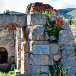
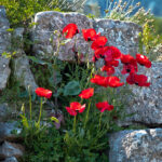
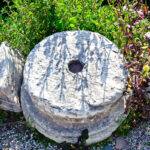
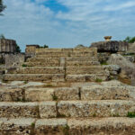
There are so many amazing sites to see in Greece, here are a few sites visited on a recent trip.
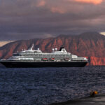
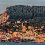
Sunset at Katakolon, Ancient Olympia, and Ancient Corinth;
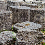
Katakolon is a seaside town in western Ilia in the municipality of Pyrgos. The town center is within a gulf overlooking the Ionian Sea. Katakolon is the gateway to Olympia (Greek: Ολυμπία Olympía), a sanctuary of ancient Greece in Elis, known for having been the site of the Olympic Games in classical times, the most famous games in history. The Olympic Games were held every four years, dating back to 776 BC. In 394 AD, emperor Theodosius I abolished them as they were then considered reminiscent of paganism. The first Olympic Games were in honor of Zeus. If one visits the large area that was Ancient Olympia, in the Spring, the trees are in bloom, if one visits in the Fall small pink flowers are sprinkled around the grounds.
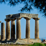
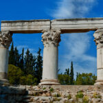
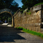
Corinth, or Korinth (Greek: Κόρινθος, Kórinthos) was a city-state (polis) on the Isthmus of Corinth, the narrow stretch of land that joins the Peloponnesus to the mainland of Greece, roughly halfway between Athens and Sparta. Neolithic pottery suggests that the site of Corinth was occupied from at least as early as 6500BC, and continually occupied into the Early Bronze Age, and it has been suggested, the settlement acted as a center of trade. Skip ahead to the Romans in Corinth; Under the Romans, Corinth was rebuilt as a major city in Southern Greece or Achaia. It had a large mixed population of Romans, Greeks, and Jews.
Corinth is mentioned many times in the New Testament, largely in connection with Paul the apostle’s mission there. When the apostle Paul first visited the city (AD 51 or 52), Gallio, the brother of Seneca, was proconsul. Paul resided here for eighteen months


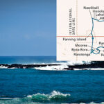
More fun with Google maps showing the sites we visited on a recent trip around South America, including the Antarctic, the Falklands, and a trip up the Amazon. I hope to share this wonderful journey with you on my website with pictures and storys. Our ship was the Princendam of the Holland America Cruise Line.
The new Adobe Lightroom 4 will automatically place all my GPS labeled photos on a map including how many pictures were taken at each Geo-location! Check out the NAPP website, or Adobe to learn about this great update to Lightroom.
This map was made with Lightroom 3 showing additions since the original map I posted on December 3, 2011. I plan to add at least one photo to so you could see what we saw at each pin.
View South America 2012 in a larger map
There is an article reviewing the Top HDR Software in the April issue of Outdoor Photographer.
But the latest HDR news!
HDR is the latest craze in Photography and now it will even be on the ipad!
The newest how-to app for the iPad is now available: Rick Sammon’s HDR Portfolio (soon to be renamed – Rick Sammpn’s iHDR). This app is packed with HDR photos (his latest), info and movies. A great way to learn and experience HDR. Same great content, but when the new version is release, it will feature a Favorites section, which is very cool.
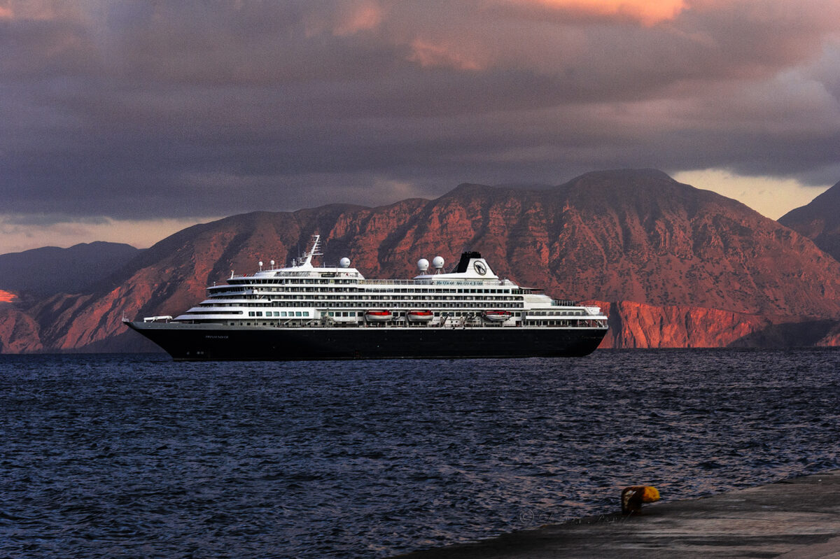
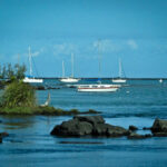
 When one takes photos to be used for HDR a tripod in a necessary item. What about a tripod on a moving ship? That is how I took this picture, on a sail-away from the Island of Moorea on a cruise in the South Pacific, but I thought it turned out to be an interesting picture! What do you think?
Click on the picture to enlarge.
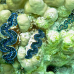
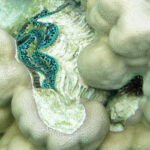
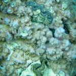
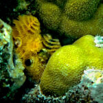
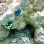
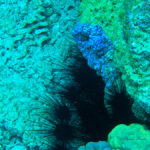
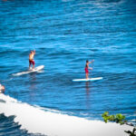
Colorful Crocea Clams plus other beauties of Pacific Ocean
One of my favorite things to do is Scuba Dive. This trip I was unable to dive, so snorkeled instead. Here are some pictures from underwater Bora Bora in a beautiful area called The Coral Garden.
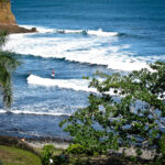
Its ancient name of Vava’u suggests that the original inhabitants of this seven-million-year-old island arrived from Tonga.
And interestingly, in the local Tahitian language there is no “B,” so its actual name is then Pora Pora, meaning “first born.”
Bora Bora’s fabled blue lagoon is, according to novelist James A. Michener, “so stunning, that there are really no adequate words to describe it.”
Volcanic in origin, Bora Bora’s rugged main island, and a few smaller islands, are completely surrounded by coral reefs.
Made famous by books, movies, and its stunning beauty, the island is now besieged by tourism and overcrowding. Regardless, if you must visit a South Pacific island (and you should), Bora Bora would be an excellent choice.
Rotterdam ship bell–Each HAL ship seems to have a bell, some times it is just hard to find it!

One doesn’t see phone booths very often anymore,
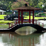
These caught my attention in Hilo,
and they are also “prettier” than most!

On a recent Cruise on Holland America Line we traveled from San Diego to Hilo Hawaii– our first siting of land! The trip map is featured on the first picture in the gallery
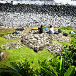
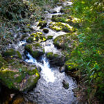
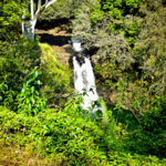
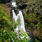
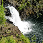
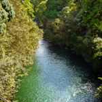
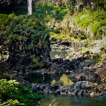
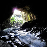
The Wailuku River rushes through old lava rocks and lava tubes creating a “boiling” effect. The Kaumana Caves are reached by climbing down an almost vertical staircase. These caves were formed by the 1881 eruption of Mauna Loa.
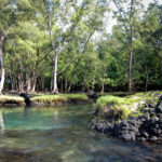
A trek through white sand lagoons filled with a mixture of salt water and artesian well water from below the surface and surrounded by unique lava formations, leads one to a beautiful sheltered lagoon in which to swim.