Related Images:


Just a few photos to make you smile! I relive my travels when I look at my photos, and many make me smile. Enjoy
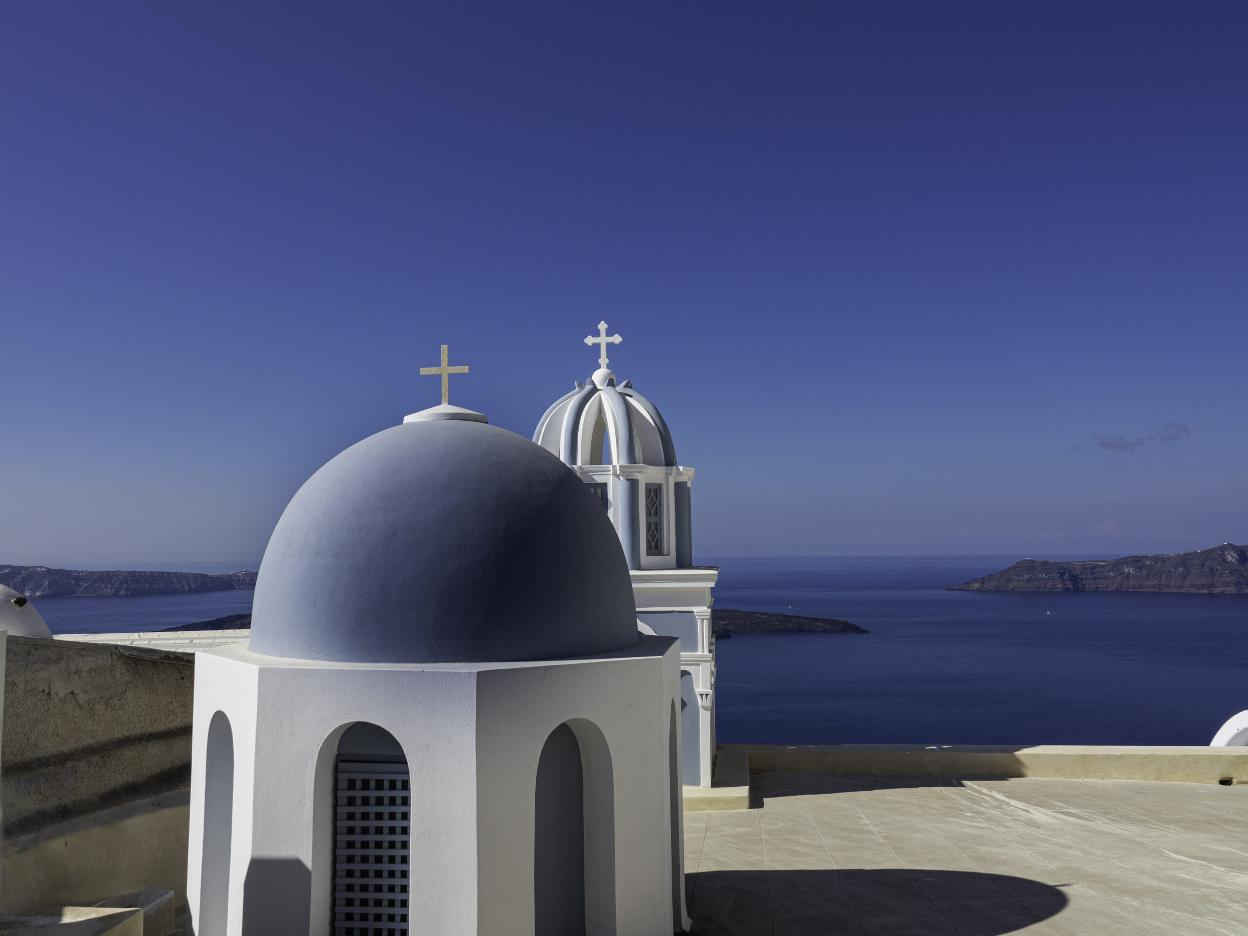
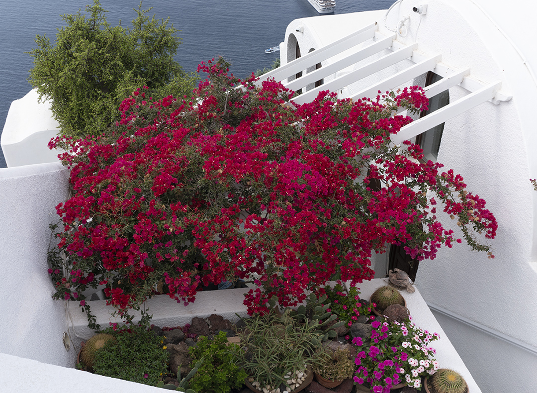
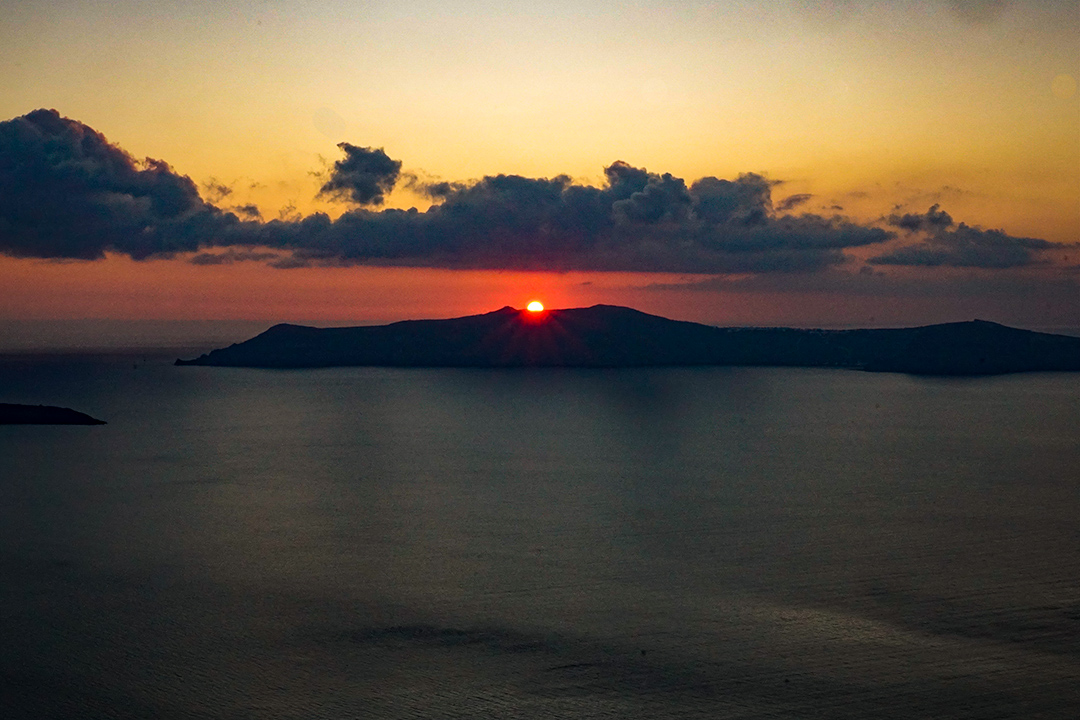
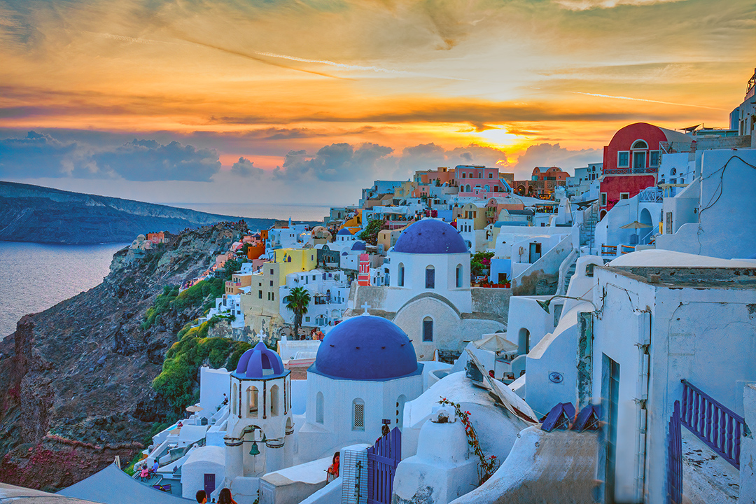
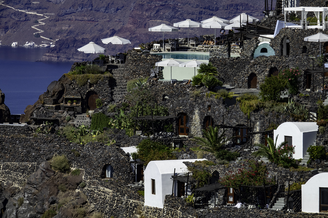
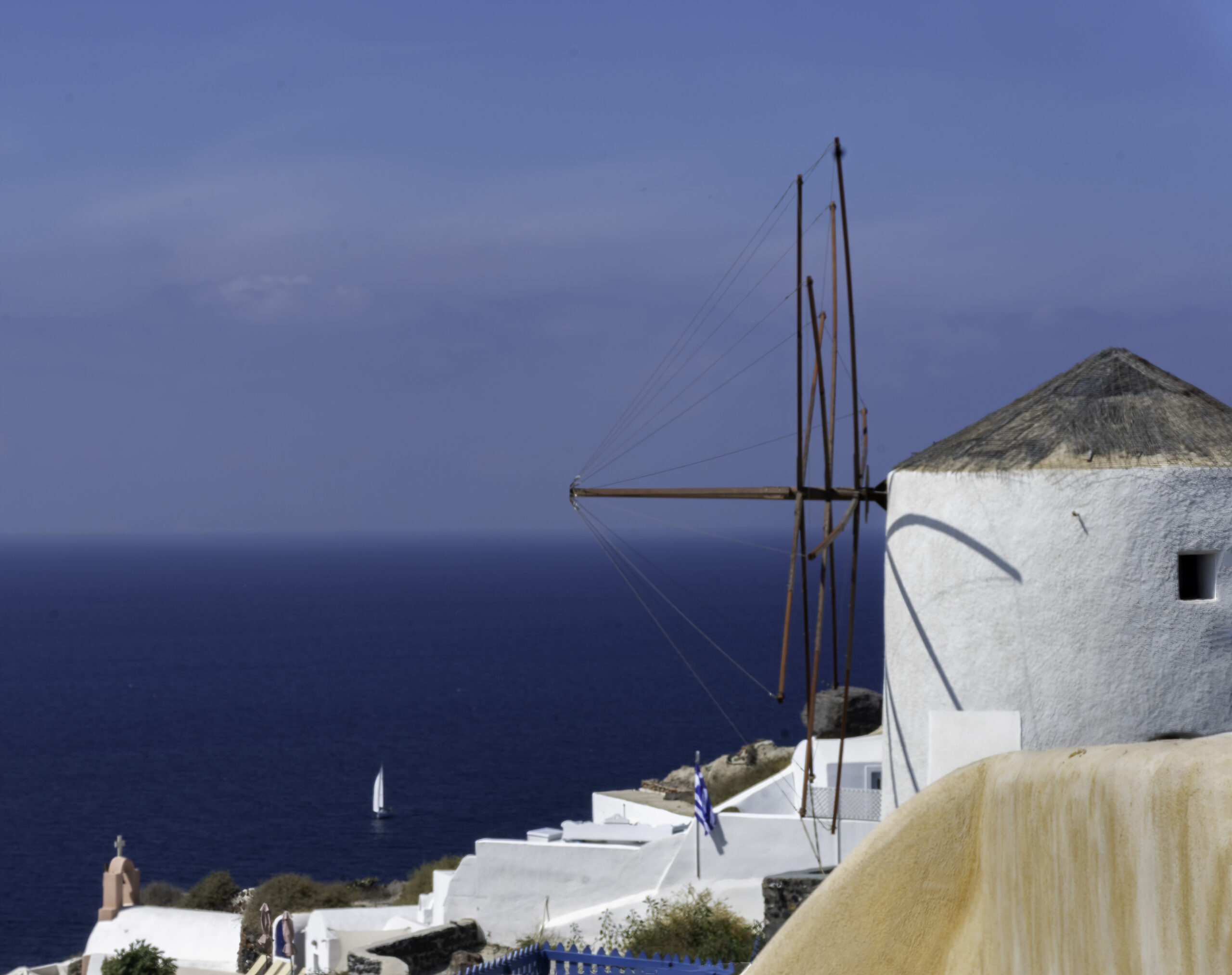
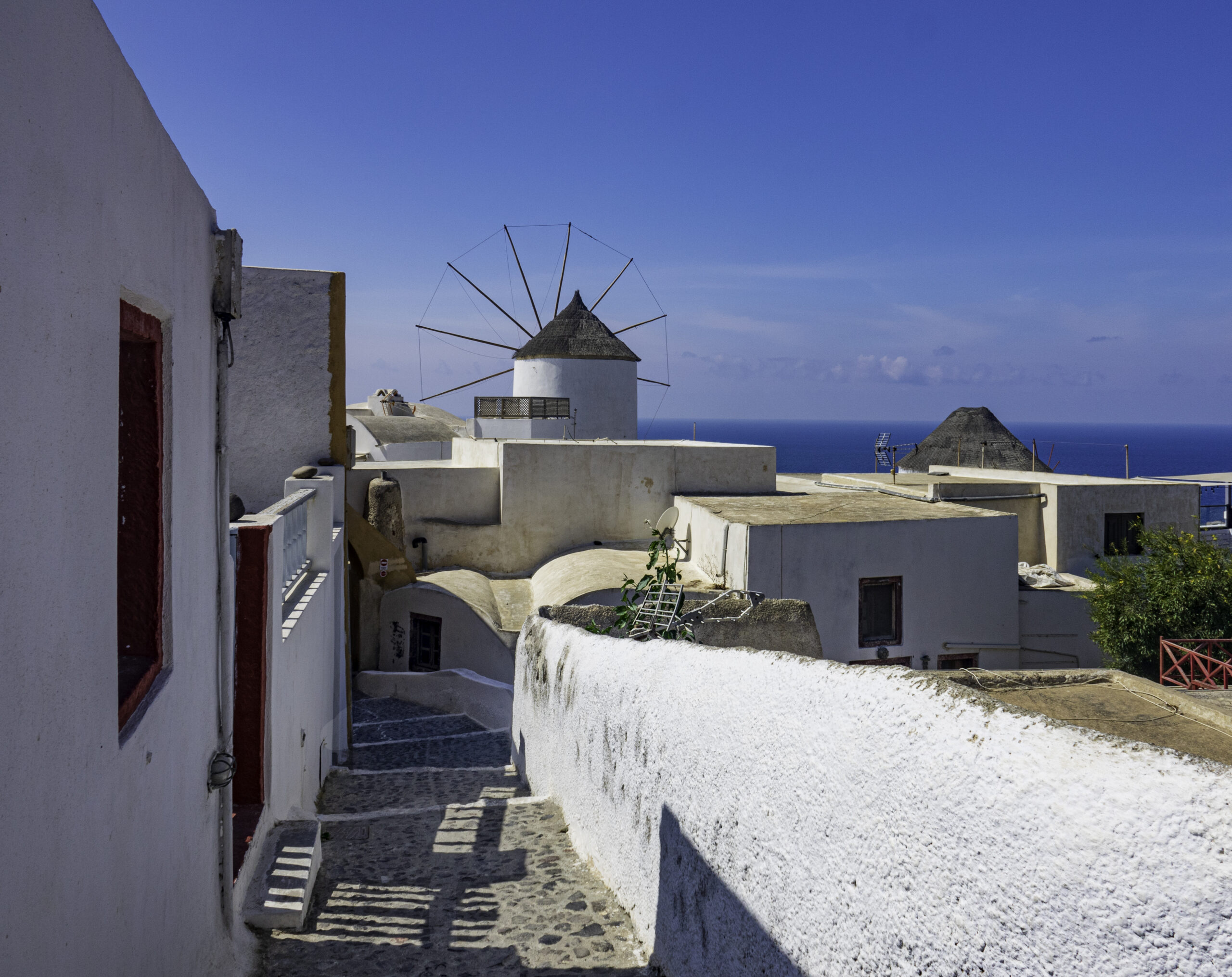
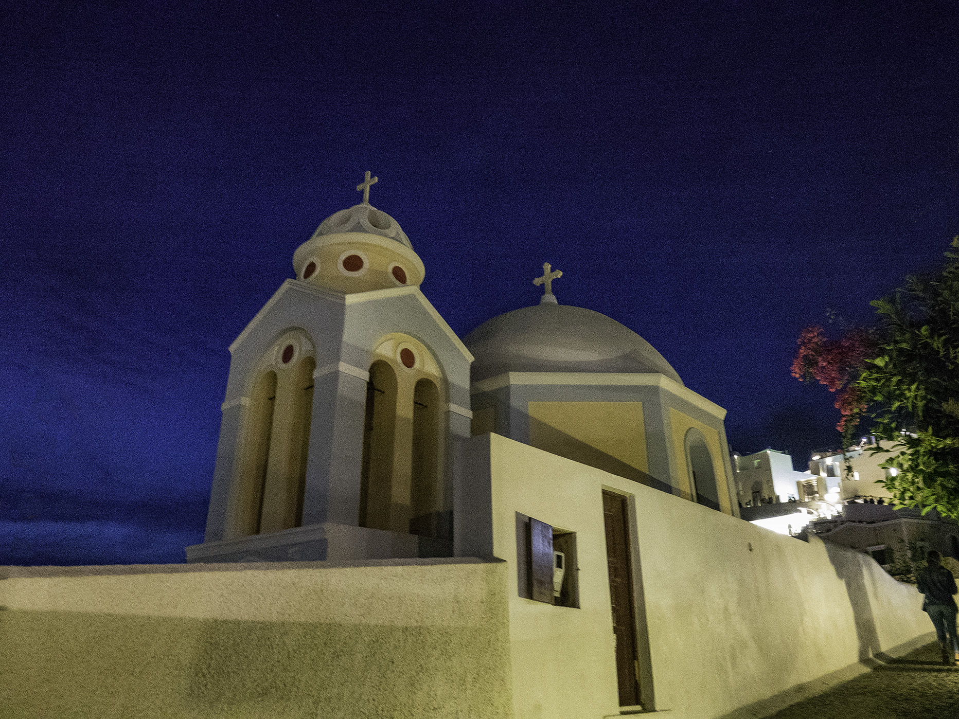
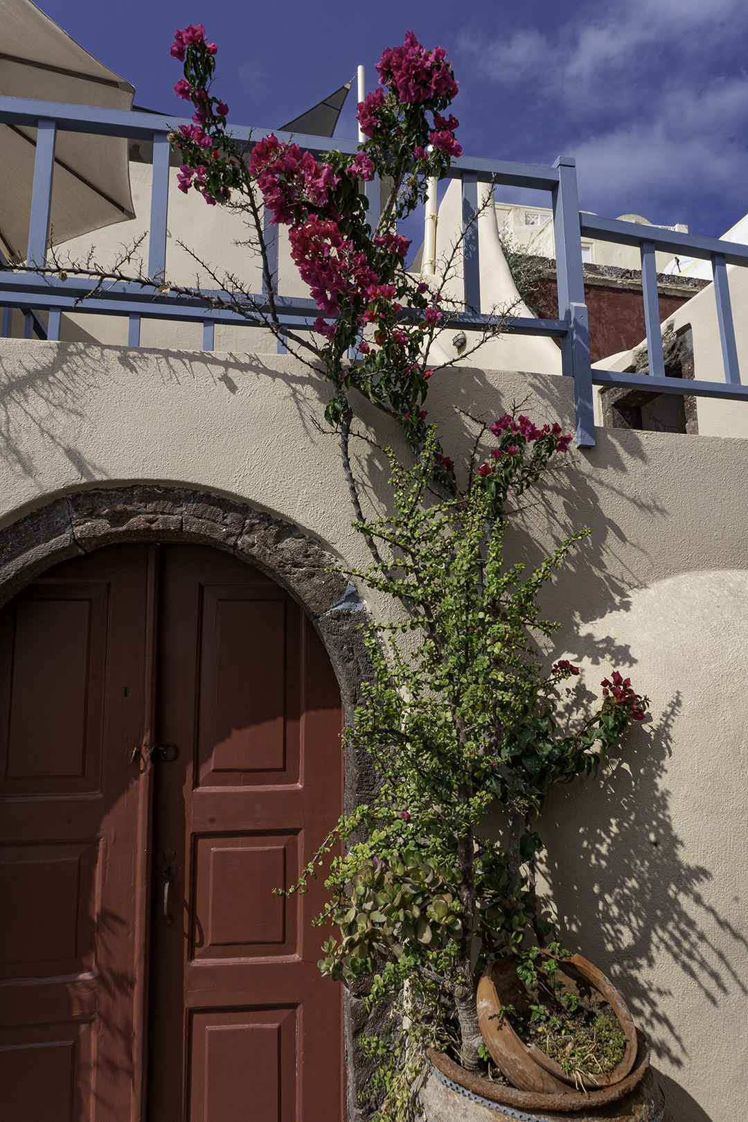
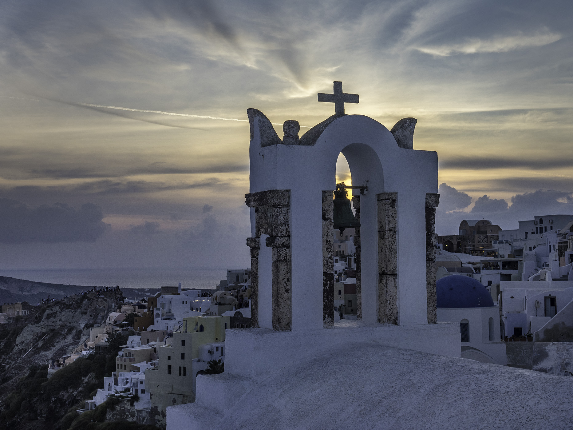
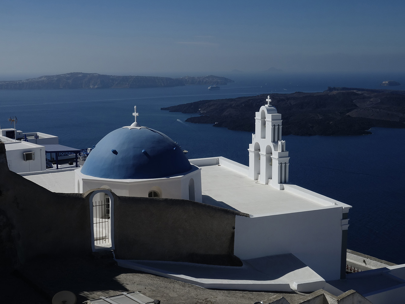
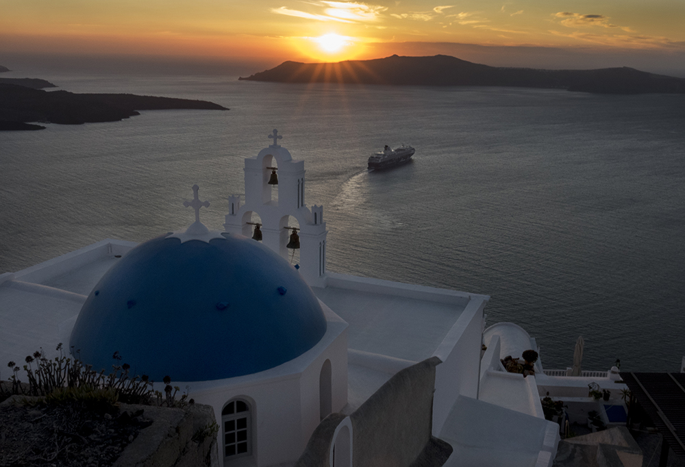
One of my favorite areas of Greece to visit. The bright blue sky, white wash houses, narrow walkways and steep cliffs and beautiful sunsets most every night!


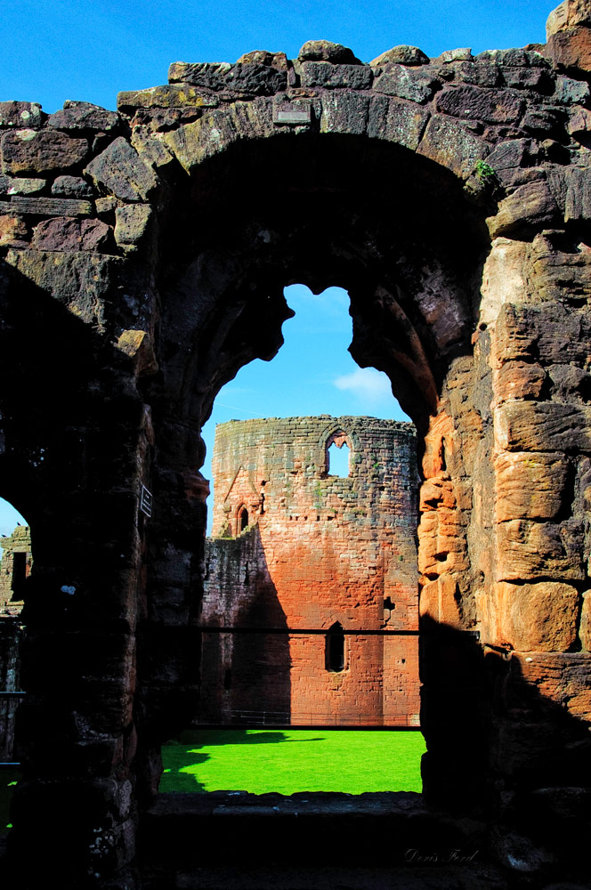
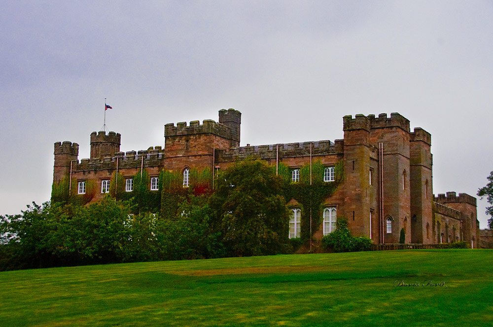
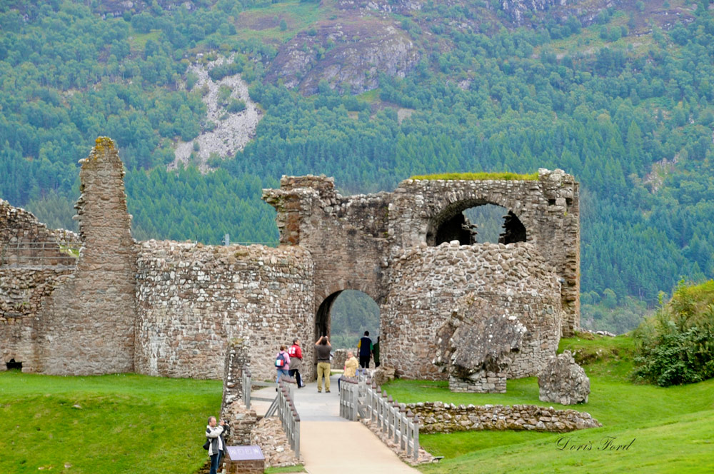
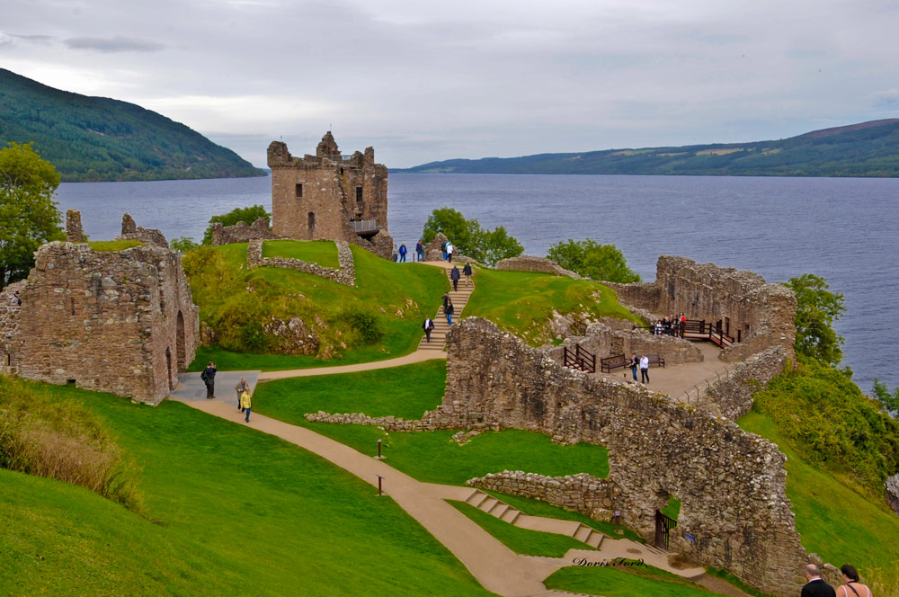
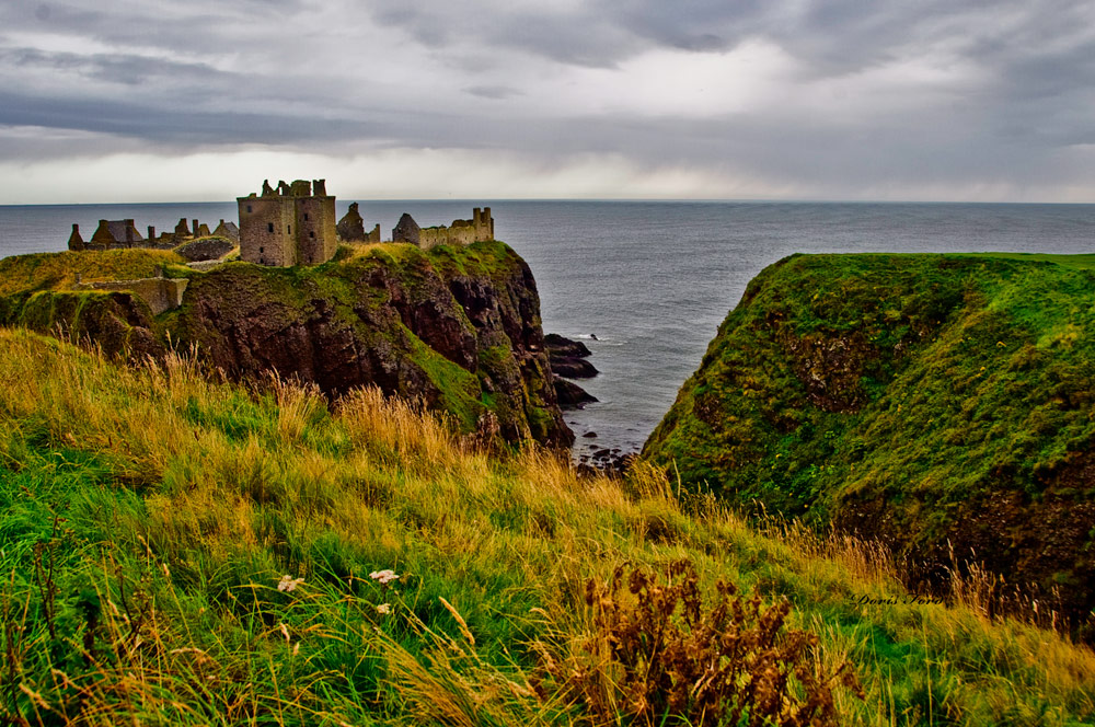
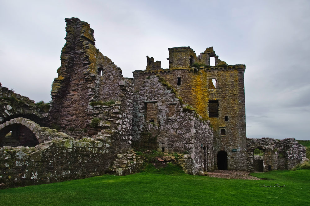
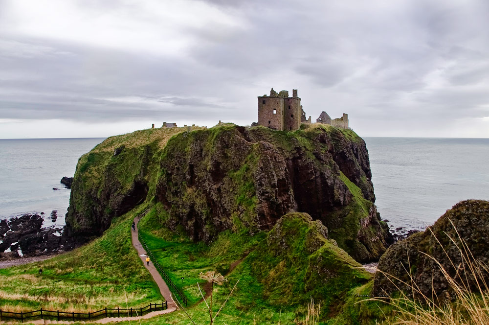
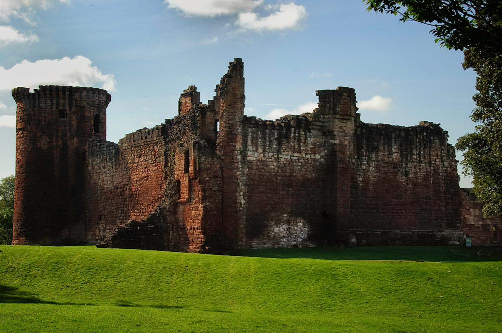
There is history that comes alive as we wonder through the ruins. Urquhart is known because of its location on Loch Ness, and the Loch Ness monster. Scone Palace is well preserved and the world famous crowning place of the King of Scots. It is one of the finest examples of late Georgian Gothic style in the UK. It is an interesting hike to the Dunnottar Castle, a ruined medieval fortress possibly fortified in the Early Middle Ages.
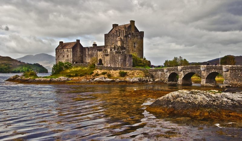
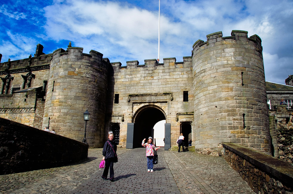
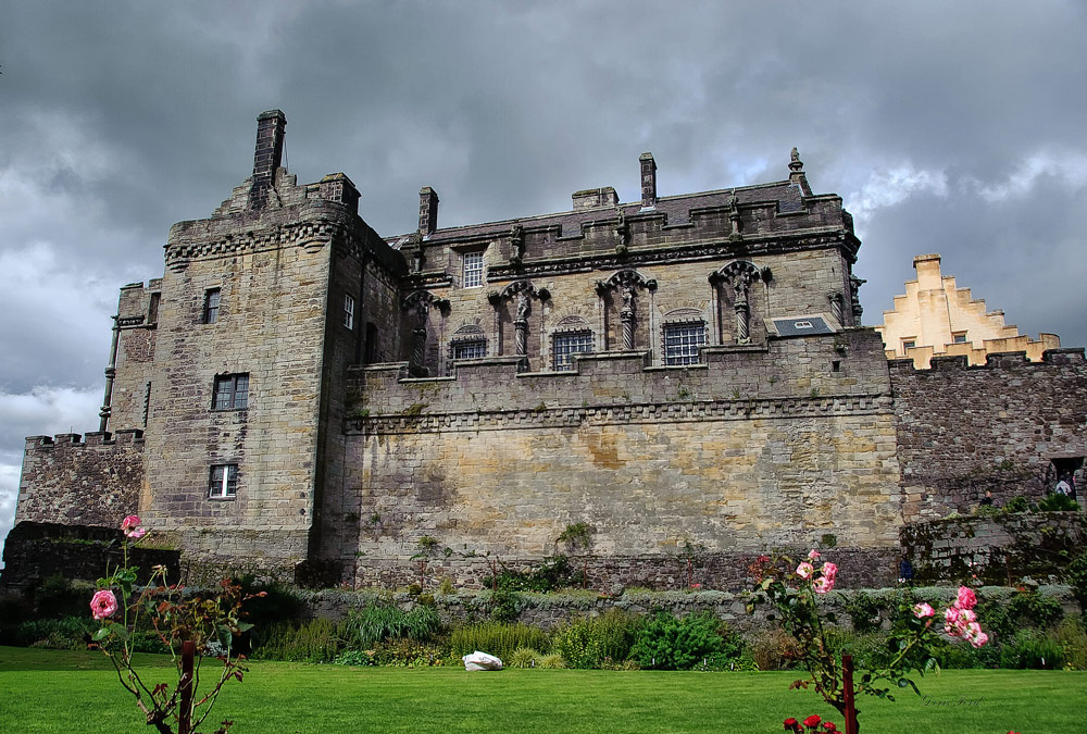
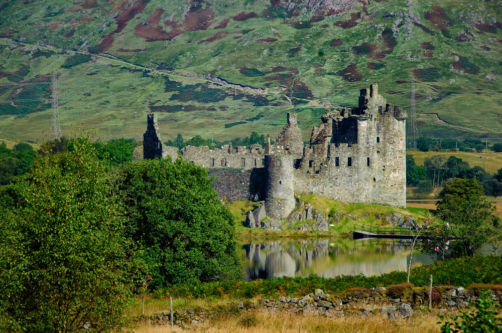
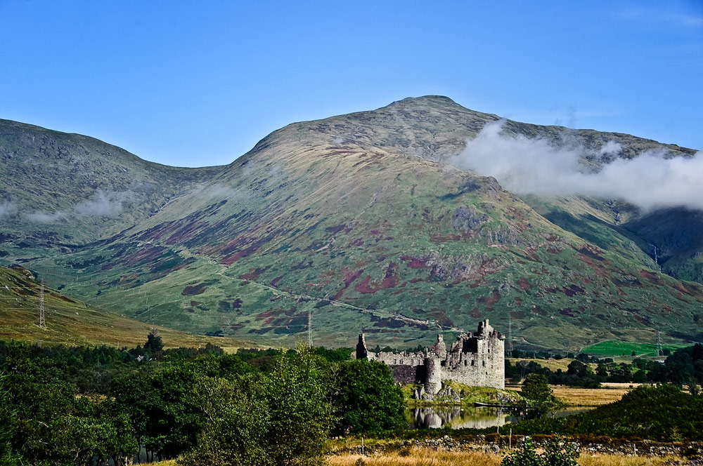
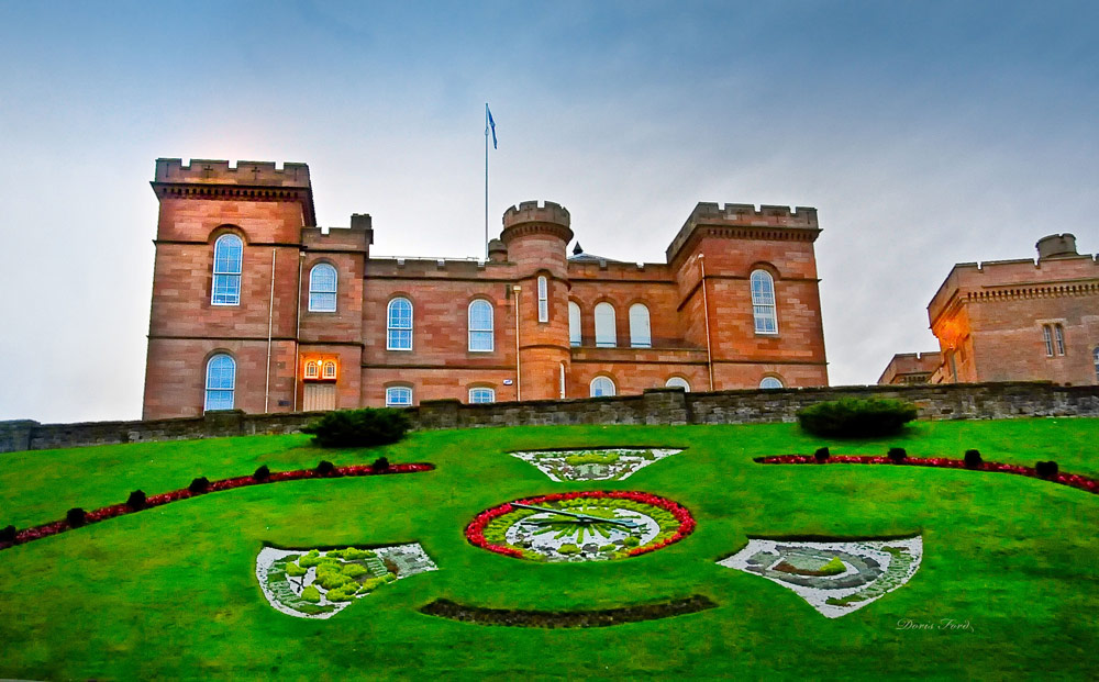
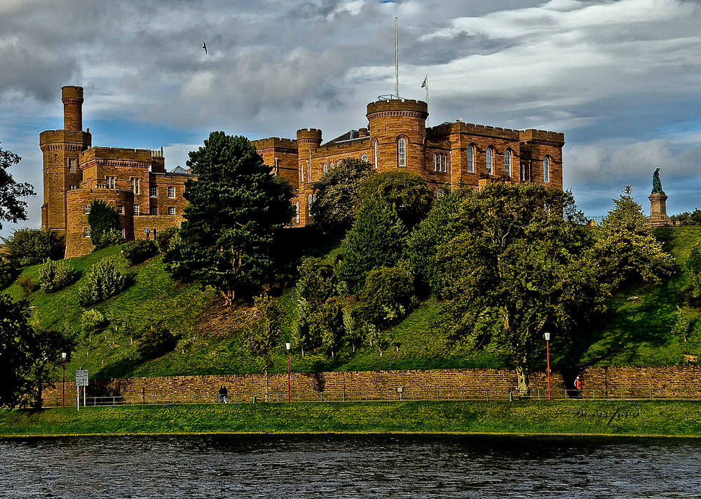
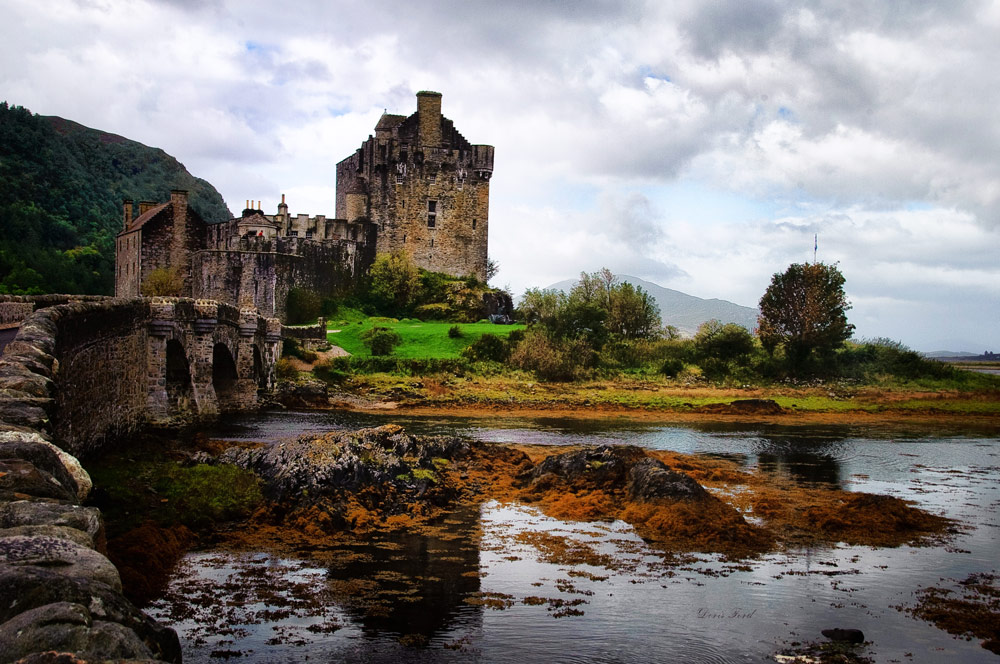
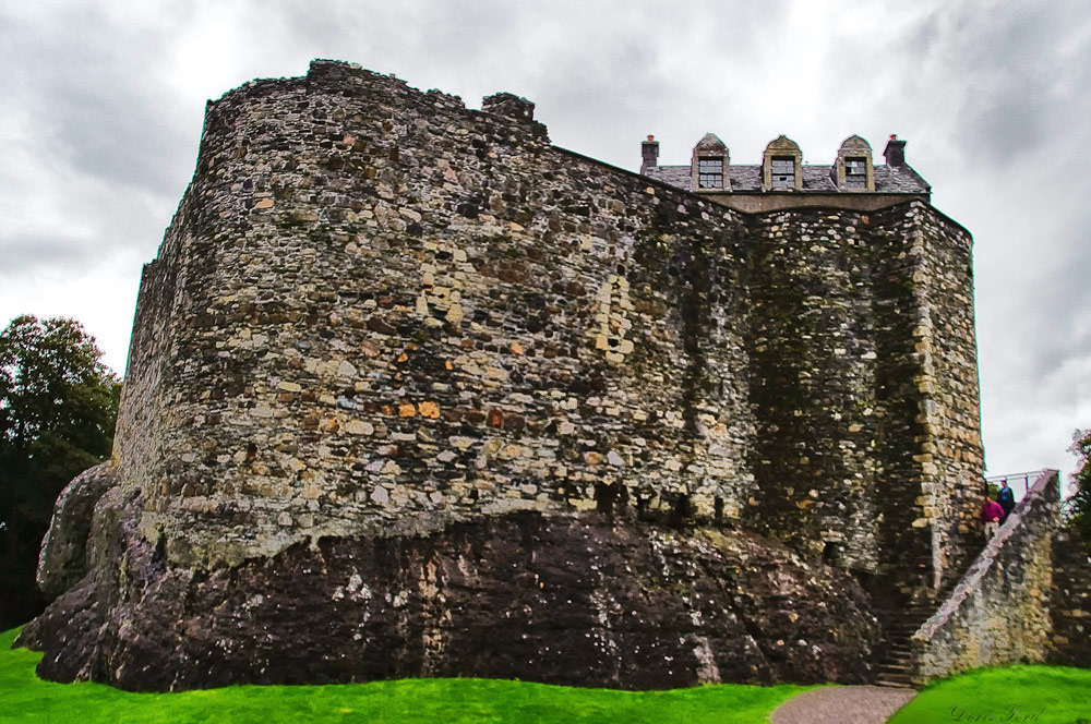
Sterling Castle, sitting atop Castle Hill is one of the largest and most important castles in Scotland, both historically and architecturally. Traquair House, the oldest continually inhabited house in Scotland. It was visited by 27 Scottish Kings and Queens and has been lived in by the Stuart family since 1491. Mount Stuart Castle is a sumptuous 19th-century mansion, with extravagant interiors and expansive landscaping and wild gardens. Kilchurn Castle was built in the mid 1400s on the northeastern end of Loch Awe. The ruins can be visited and the reflection on the Loch is beautiful. Explore Eilean Donan, a 13th Century Castle in the Highlands of Scotland and one of the most iconic images of Scotland. Inverness Castle sits on a cliff overlooking the River Ness in Inverness. A fortification has existed here since at least the sixth century, and rebuilt, added on to, finally rebuilt to house the Sheriff Courthouse and Country Hall. It remains in use as a court and therefore, at this time, access is limited to the exterior.


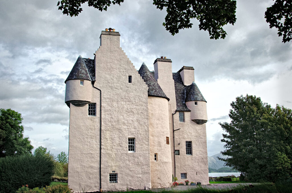
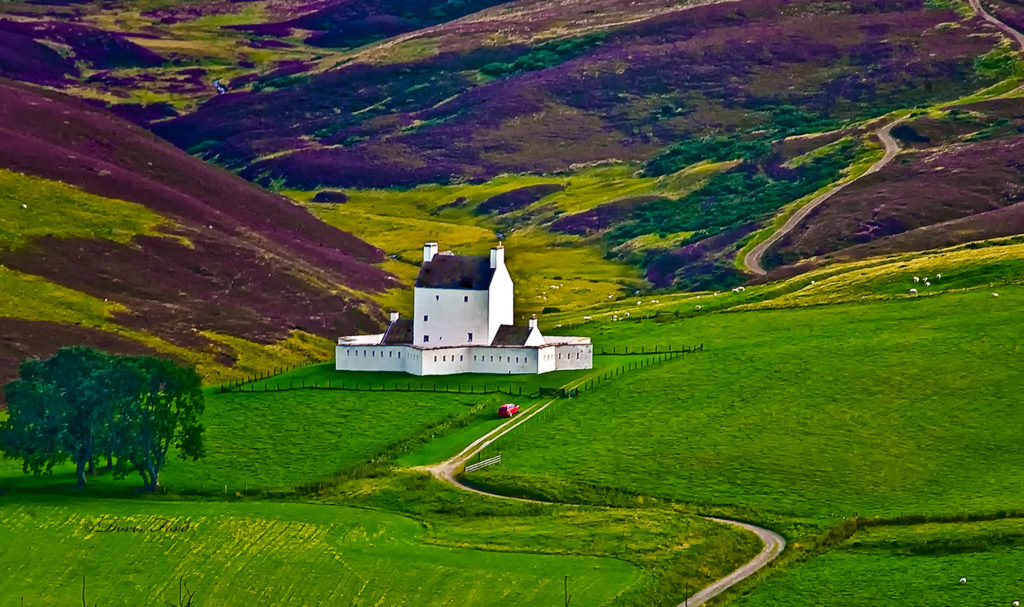
Barcaldine Castle is a 17th century tower house and is now a luxury Bed and Breakfast Guest House. Corgarff Castle was built in 1550 then converted to a barracks for government troops in 1748. It is still complete with its 18th star-shaped fortification and sits surrounded by heather covered hills.
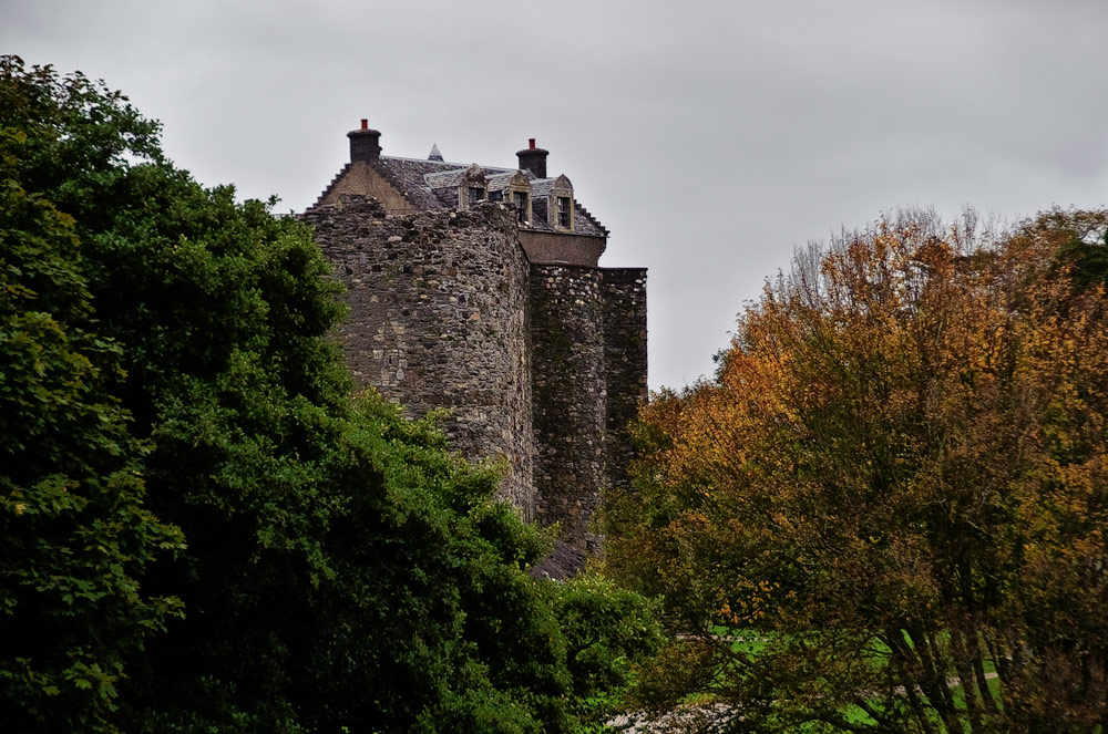
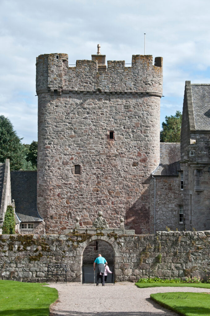
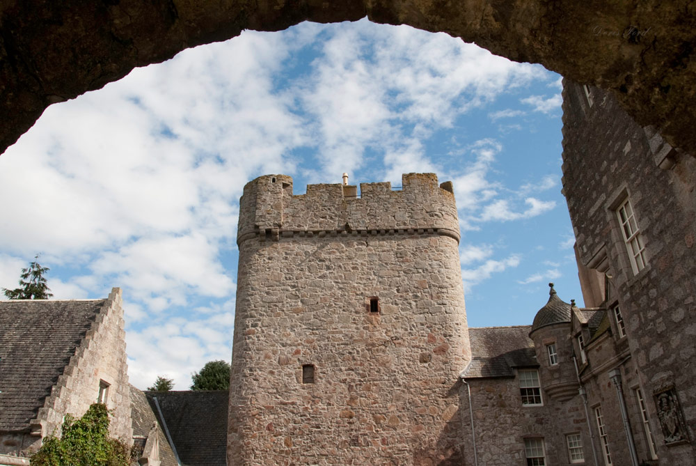
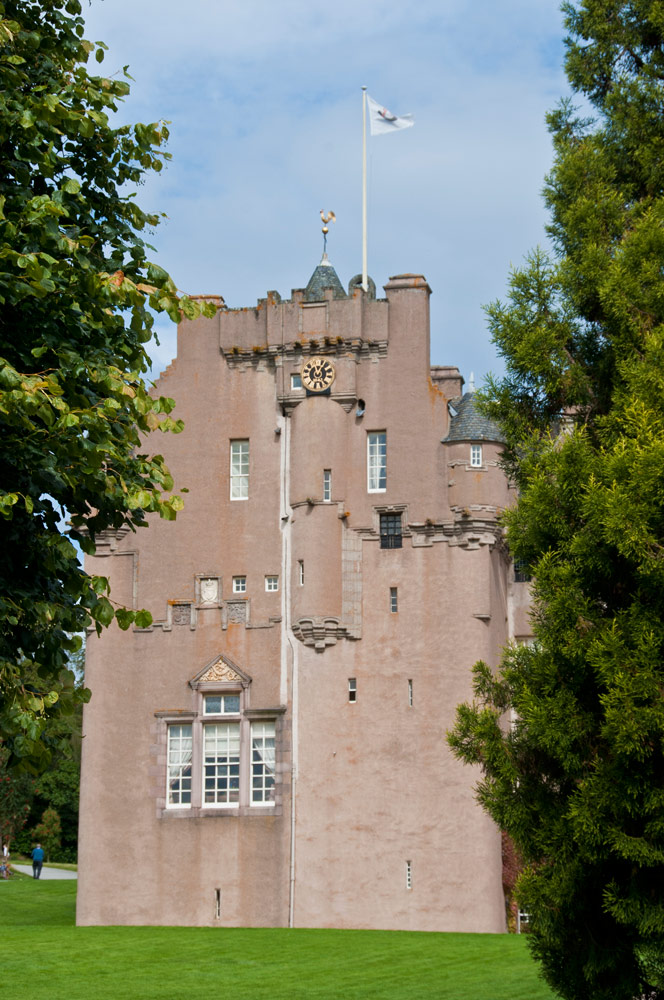
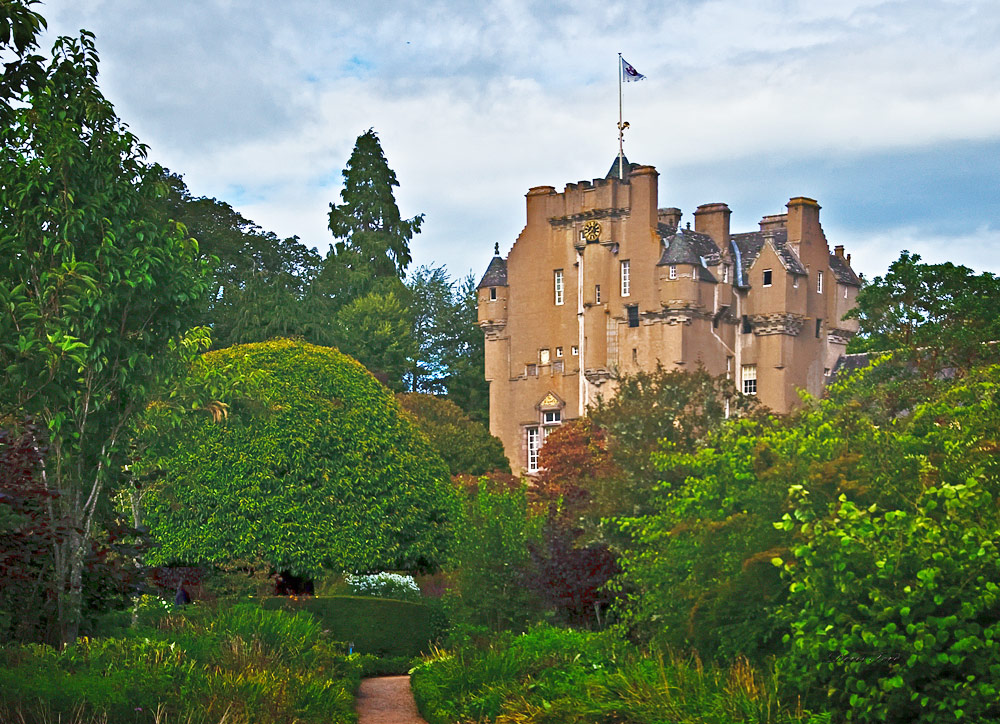
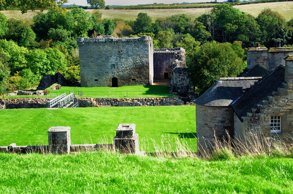
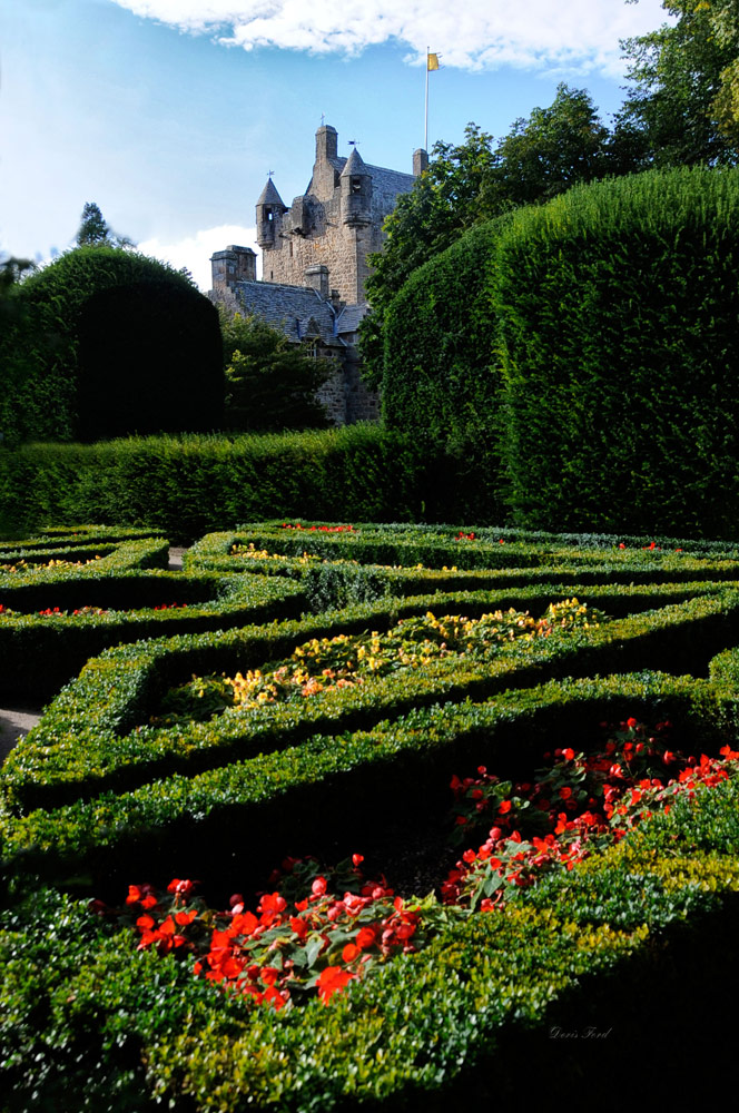
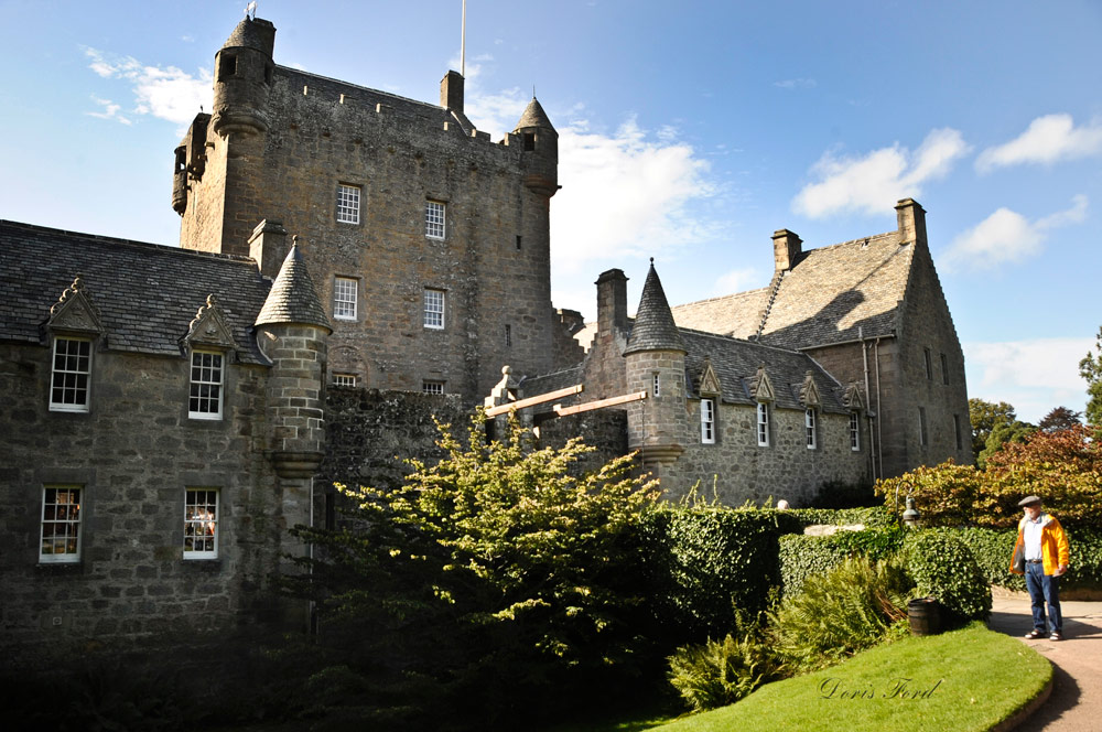
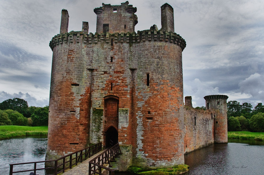
Caerlaverock Castle is a moated triangular castle first built in the 13th Century. It was once caught up in bloody border conflicts but now a popular filming location. Dunollie Castle is a small ruined castle now covered by greenery, but open to the public for tours. Dunstaffnage Castle built in 1220s is a partially ruined castle near Oban, and is surrounded on three sides by the sea. Crathes Castle cared for the National Trust for Scotland is a classic Tower house whose interior and gardens can be toured and enjoyed. Nearby Drum Castle is one of Scotland’s oldest tower houses also cared for by the National Trust while touring one can explore 700 years of history. Craignethan Castle is another ruined castle with a tower built in the 16th century. The last medieval castle to be built in Scotland. Cawdor Castle, a romantic Highland Castle is set amid beautiful formal gardens originally built around a 15th century tower house.
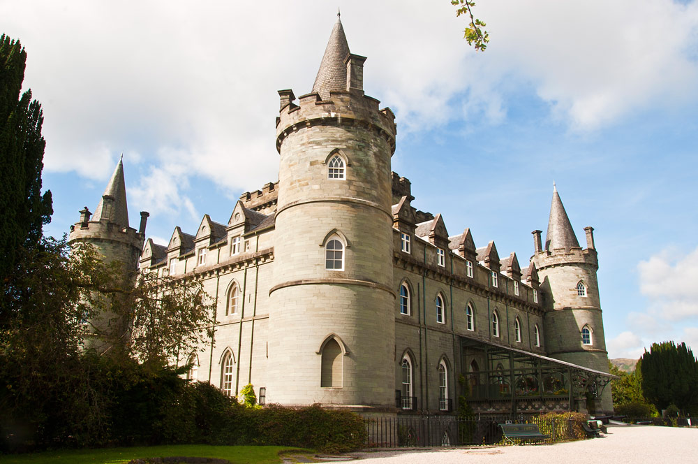
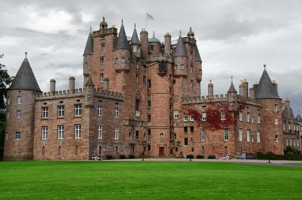
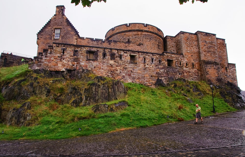
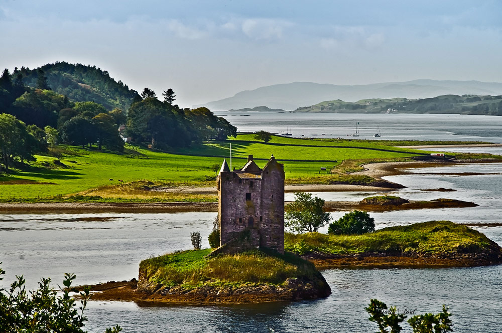
Castle Stalker is a privately owned 14th century four-story tower house located on a small patch of land on Loch Laich. It is very picturesque when viewed from the road, and one can kayak to get closer to walk around the tower, and request a guided tour. Bothwell Castle, the largest and finest 13th century stone castle much fought over during the Wars of Independence with England. even though it sustained much damage it still continues to be one of the most spectacular pieces of medieval architecture across the whole of Scotland. 13th Century Duart Castle is located on the Isle of Mull, restored and open for tours, beautiful tea room and spectacular location for weddings. Glamis Castle is beautiful, a living, breathing monument to Scottish heritage, hospitality and enjoyment for all. It was the inspiration for Shakespeare’s Macbeth, the childhood home of HM Queen Elizabeth the Queen Mother and birthplace of HRH Princess Margaret. Inveraray Castle is a beautiful stately home and an early example of Gothic Revival architecture. Accommodation is available, and an episode of Downton Abby was partly filmed there. Edinburgh Castle is an historic fortress which dominates the skyline of Edinburgh was once the residence of Scottish monarch and now serves mostly as a museum. The Royal Military Tattoo is an annual series of military tattoos performed by British Armed Forces, Commonwealth and international military bands and artistic performance teams on the esplanade of Edinburgh Castle.
www.visitscotland.com
https://www.historic-uk.com/HistoryMagazine/DestinationsUK/CastlesinScotland/
https://www.visitscotland.com/see-do/attractions/castles/great-scottish-castles/


https://en.wikipedia.org/wiki/Prince_Christian_Sound
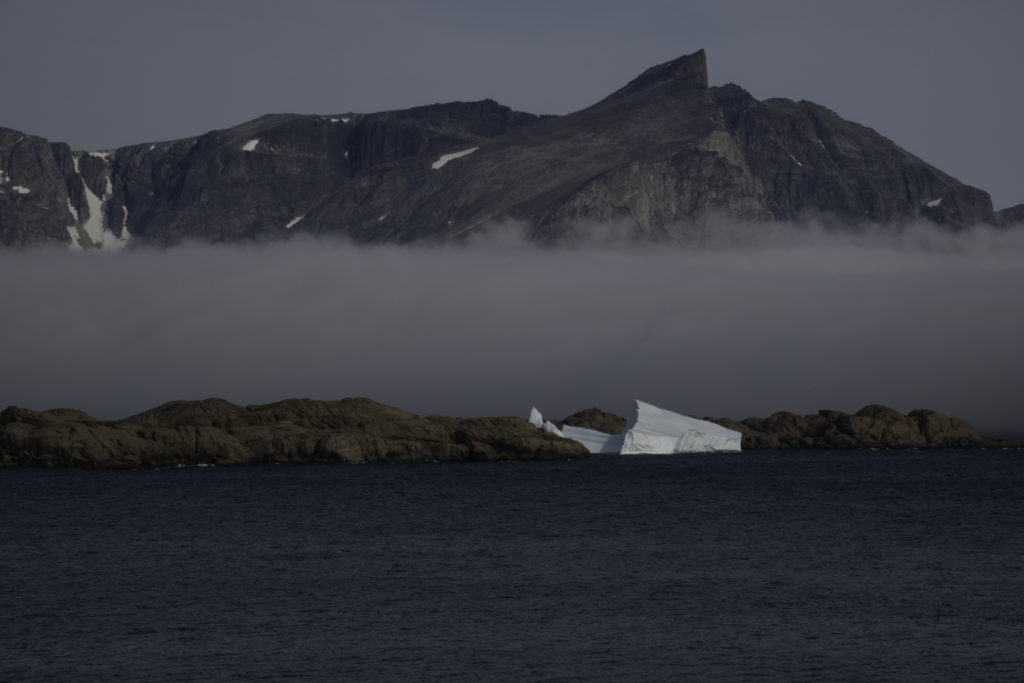
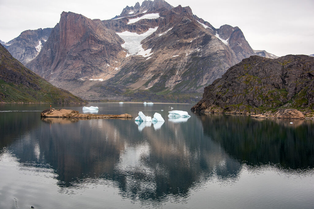
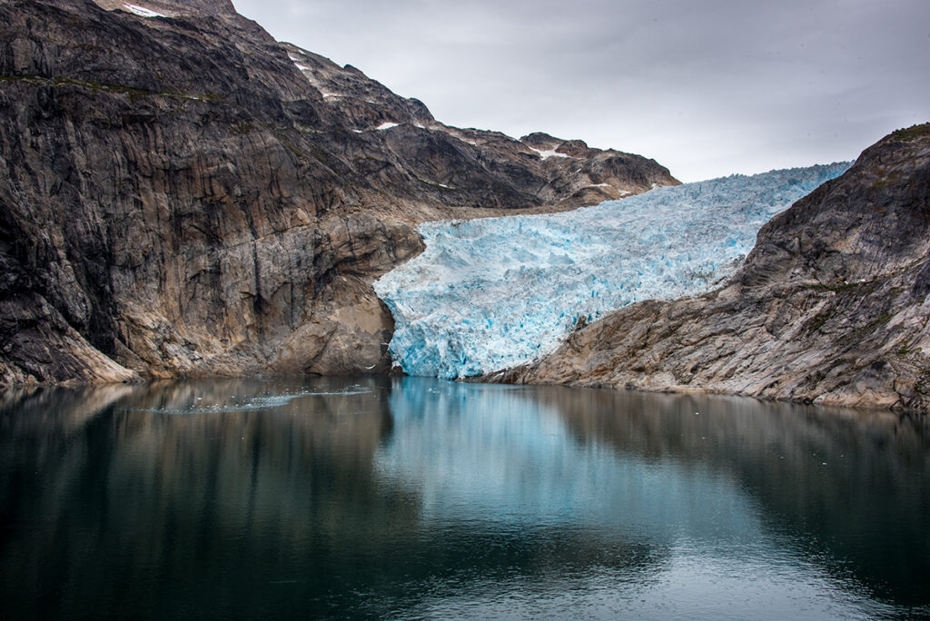
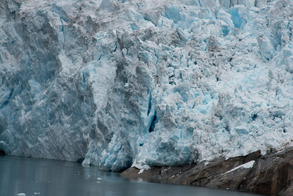
The Prince Christian Sound (Greenlandic: Ikerasassuaq;[1] Danish:Prins Christians Sund) is a waterway in Southern Greenland. It separates the mainland from Sammisoq (Christian IV Island) and other islands of the Cape Farewell Archipelago near the southernmost tip of Greenland. The name was given in honour of the prince, later king Christian VIII of Denmark.[2]
The Prince Christian Sound connects the Labrador Sea with the Irminger Sea. It is around 100 km (60 miles) long and it is narrow, sometimes only 500 metres (1,600 ft) wide. There is only one settlement along this sound, Aappilattoq. Few from the outside world have visited this village but several years ago I was able to I will publish pictures from this visit at a later time.
The long fjord system is mostly surrounded by steep mountains in general reaching over 1,200 metres (3,900 ft), one of them 2,220 metres (7,280 ft) high[3][4] Many glaciers go straight into its waters where they calve icebergs. There are often strong tidal currents limiting the formation of ice. It has many offshoots, such as Kangerluk to the north midway through the fjord, Ikeq Fjord in the south, and in the west Ilua Fjord, Ikerasaq Fjord (Akuliarutsip Imaa), Utoqqarmiut Fjord (Pamialluup Kujatinngua) and the Torsukattak Fjord.[5]


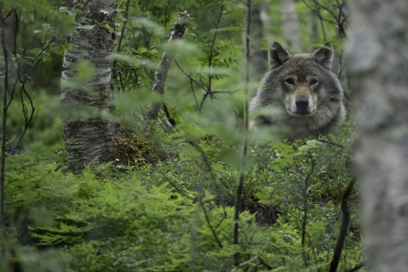
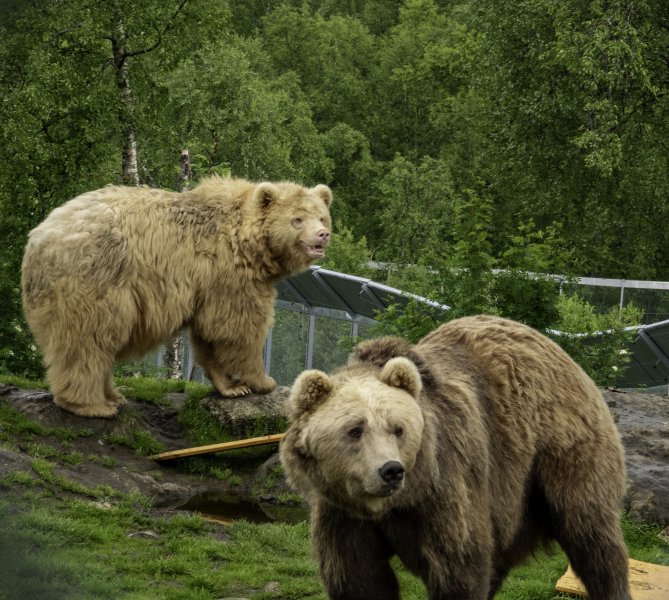
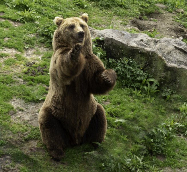
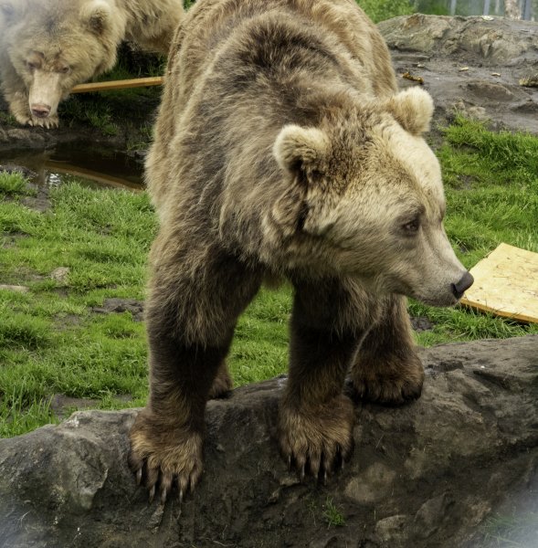
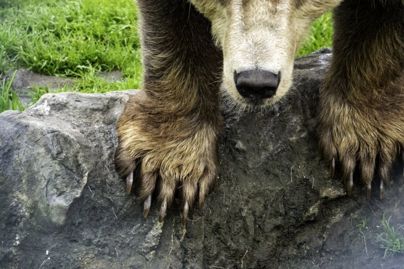
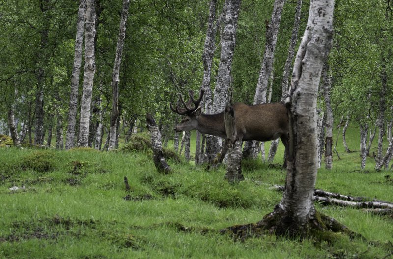
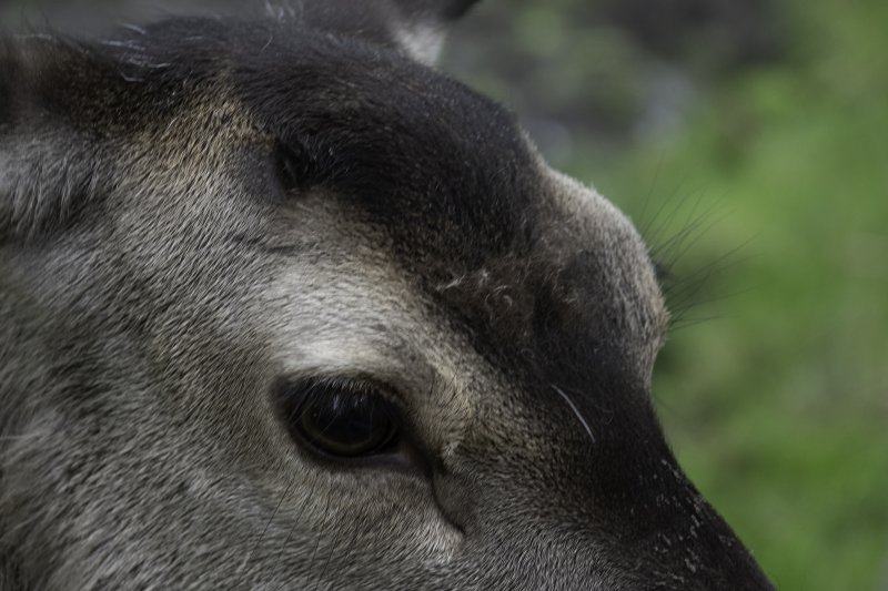
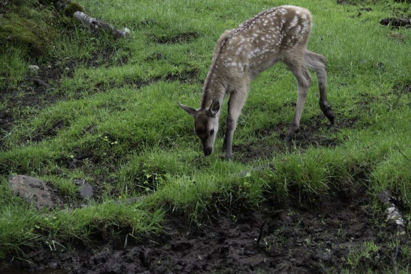
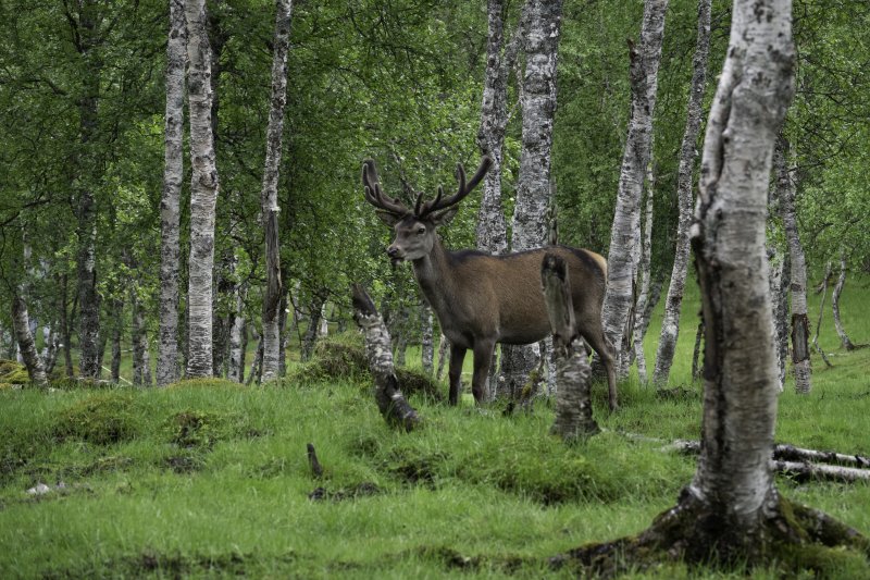
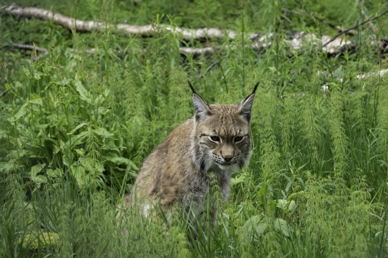
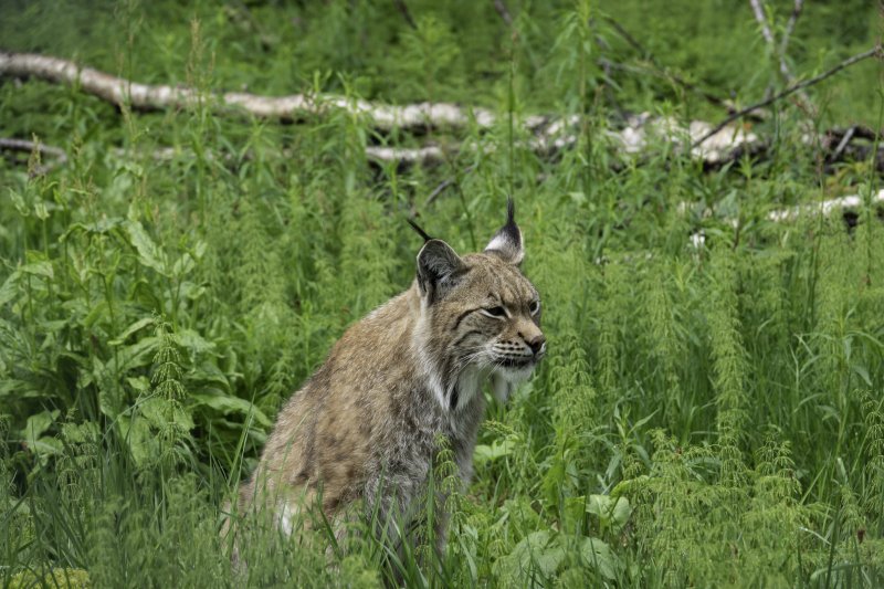
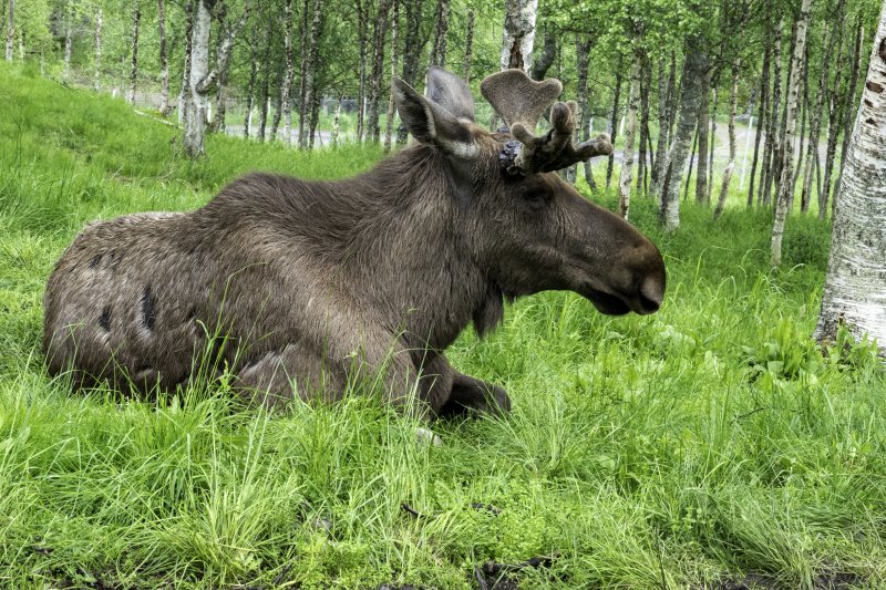
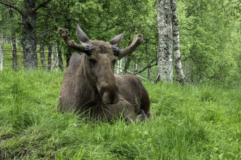
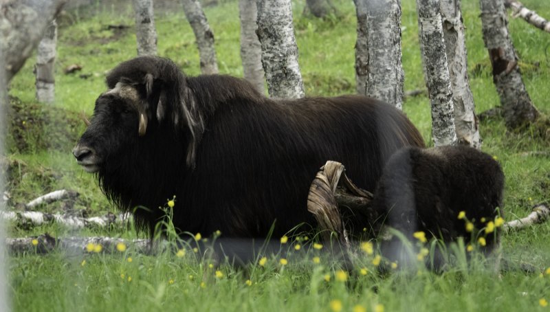
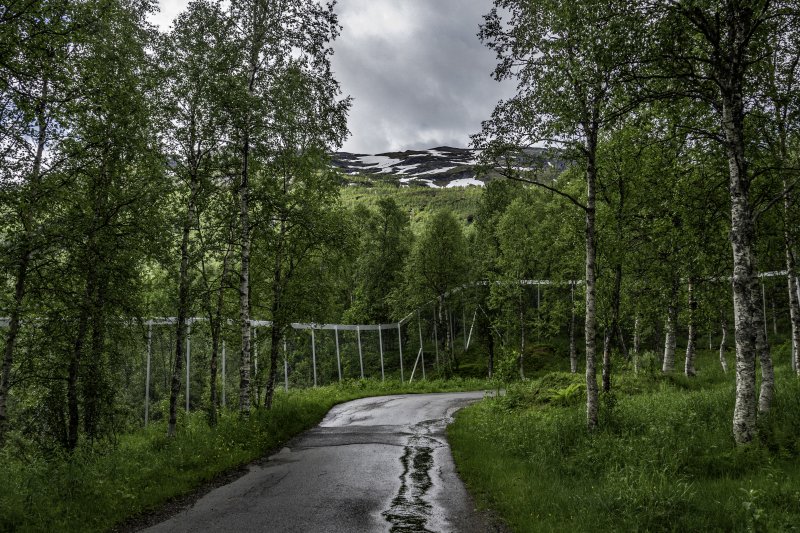
Polar Park Arctic Wildlife Center – The world’s northernmost animal park and home to Norway’s large predators such as bears, wolves, and lynx as well as deer, moose, reindeer and muskox.
Polar Park is an animal park in Bardu municipality in the county of Troms.
Opened in 1994, the park is based on exhibiting animals in their natural surroundings which means that each species also gets a lot of room to romp around.
With 1100 dekar (1 dekar = 1000 square meters) in only 12 enclosures, the Polar Park is one of the animal parks in the world with the most area per animal.
Polar Park is more than a traditional zoo. They place great emphasis on animal welfare and give animals large areas to create a habitat as natural as possible for the animals.
https://www.tripadvisor.com/Attraction_Review-g2416521-d2622319-Reviews-Polar_Park-Bardu_Municipality_Troms_Northern_Norway.html
About Polar Park
Stavangar Norway


Lets take a Walk through an Historic city in Norway
Lets take a walk in Historic Stavanger, Norway’s fourth biggest city, behind Oslo, Bergen and Trondheim. Situated in Rogaland county on Norway’s west coast, there is something unique that sets Stavanger apart from the country’s other larger cities. It is a walk-able city and most attractions are easily reached.
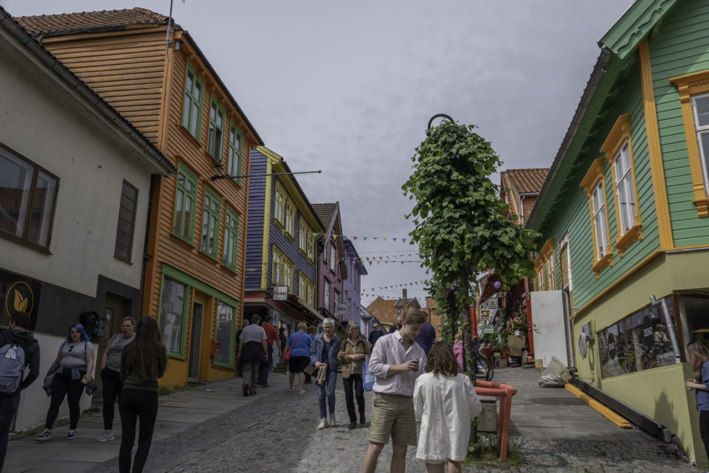
A large part of Stavanger is made up of timber structures. Lets take a walk to view some of the 8,000 wooden houses, and the largest wooden city in northern Europe. Walk up the narrow streets and enjoy the unique beauty of the old town.
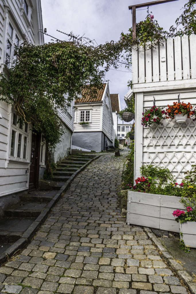
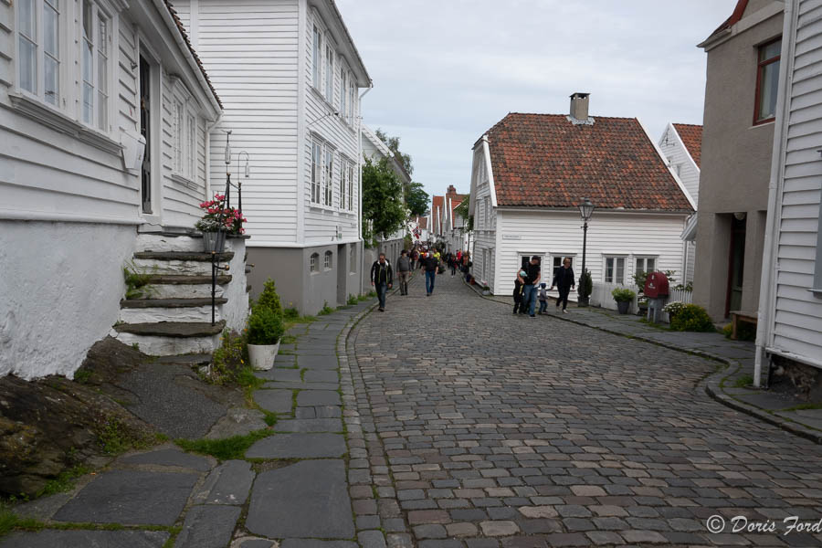
A large proportion of the city’s wooden houses were built in the eighteenth or nineteenth century. The oldest of them are perfectly preserved in the city’s historic Gamle Stavanger or Old Town.
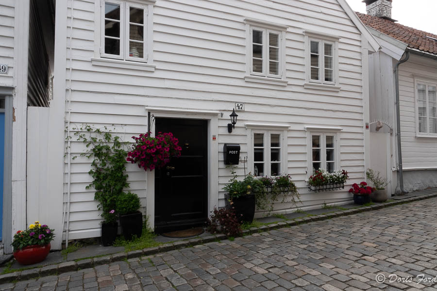
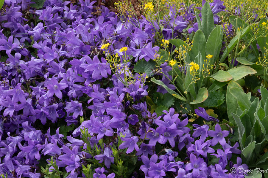
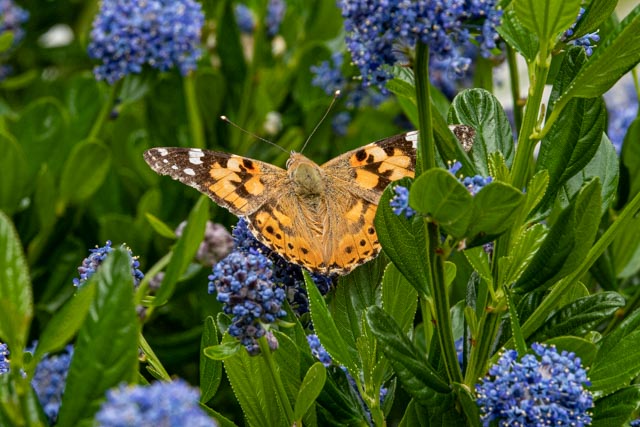
Many homes feature beautiful flowers in pots and baskets. Near these historic wooden houses, are colorful flowers and gardens, favorite places for bees and butterflies!
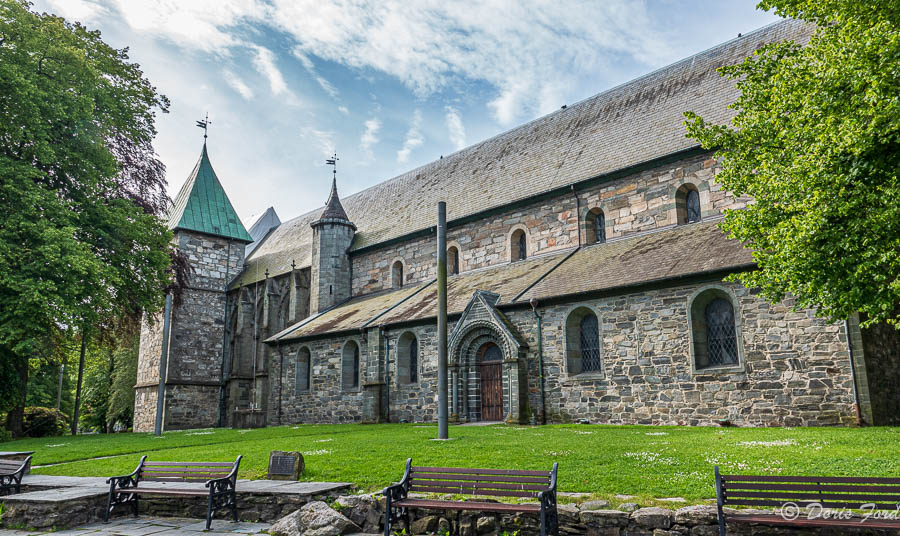
Stavangar has a beautiful Cathedral, the only Cathedral from the Middle Ages that has kept its original architecture, and the only Norwegian Cathedral in continuous use since the 1300s. Norway’s best-kept Cathedral is located within walking distance from the Stavanger harbor. According to tradition Stavanger Cathedral was built in 1125 after Sigurd Jorsalfarer named Stavanger a Cathedral city.
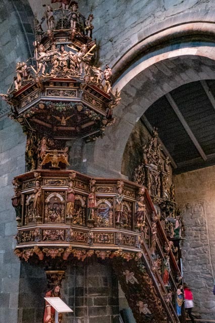
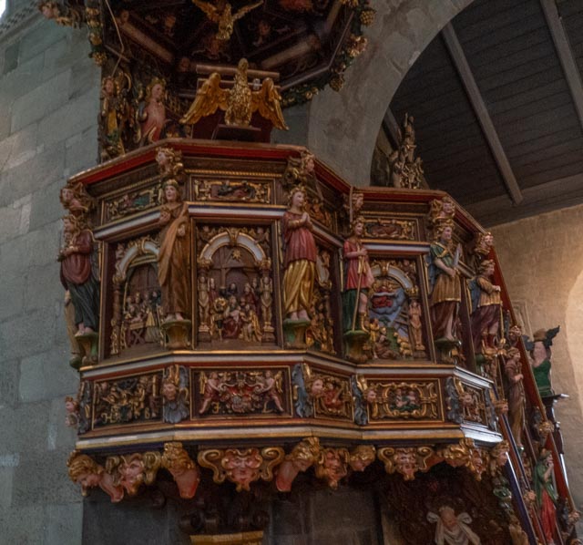
The most notable feature of the interior is the Pulpit that is post Reformation and dates back to the 1650s, Pulpit carvings cover the history of the Bible from Adam and Eve to the crowning of Christ, all carved on the Pulpit by a Scotsman, Andrew Smith,


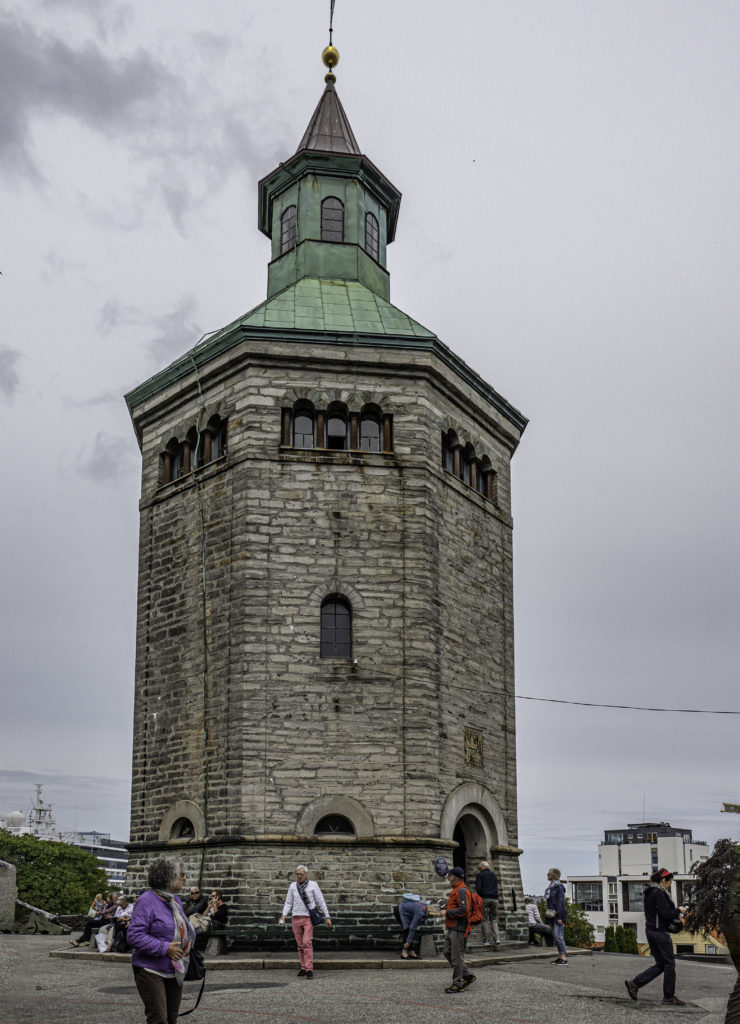
The Valberg tower (Valbergtårnet) was constructed from 1850 to 1853 and was the former observation tower of Stavanger. The tower was the permanent lodging of the watchmen in Stavanger. Among their duties was to alert the people in town when there was a fire. Tobias Sandstol was the last watchman and worked 18 years until 1922.
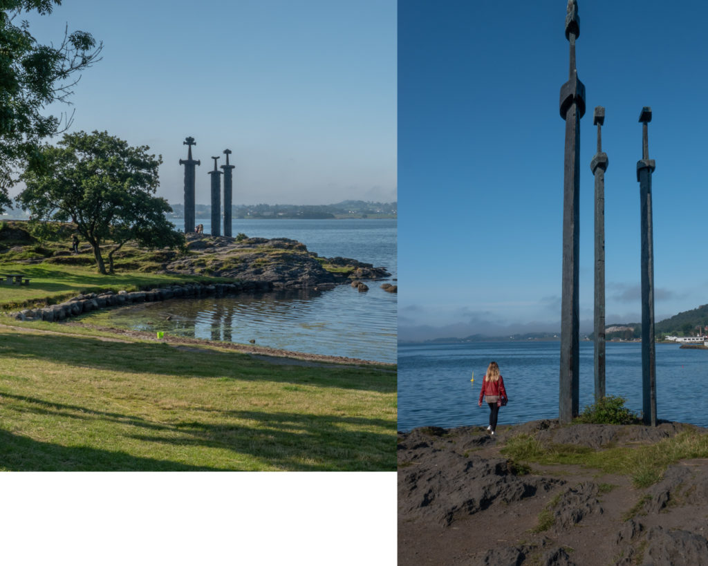
Outside of town are the famous buried swords of Hafrsfjord. This historic site commemorates the battle of 872 AD. and where Harald Fairhair gathered Norway into one kingdom in the same year. The swords symbolize peace, unity and freedom, and buried in stone not to be used anymore, to encourage people to live in Peace.


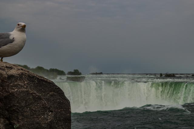
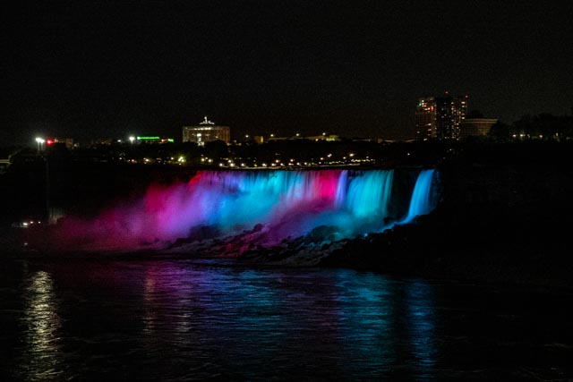
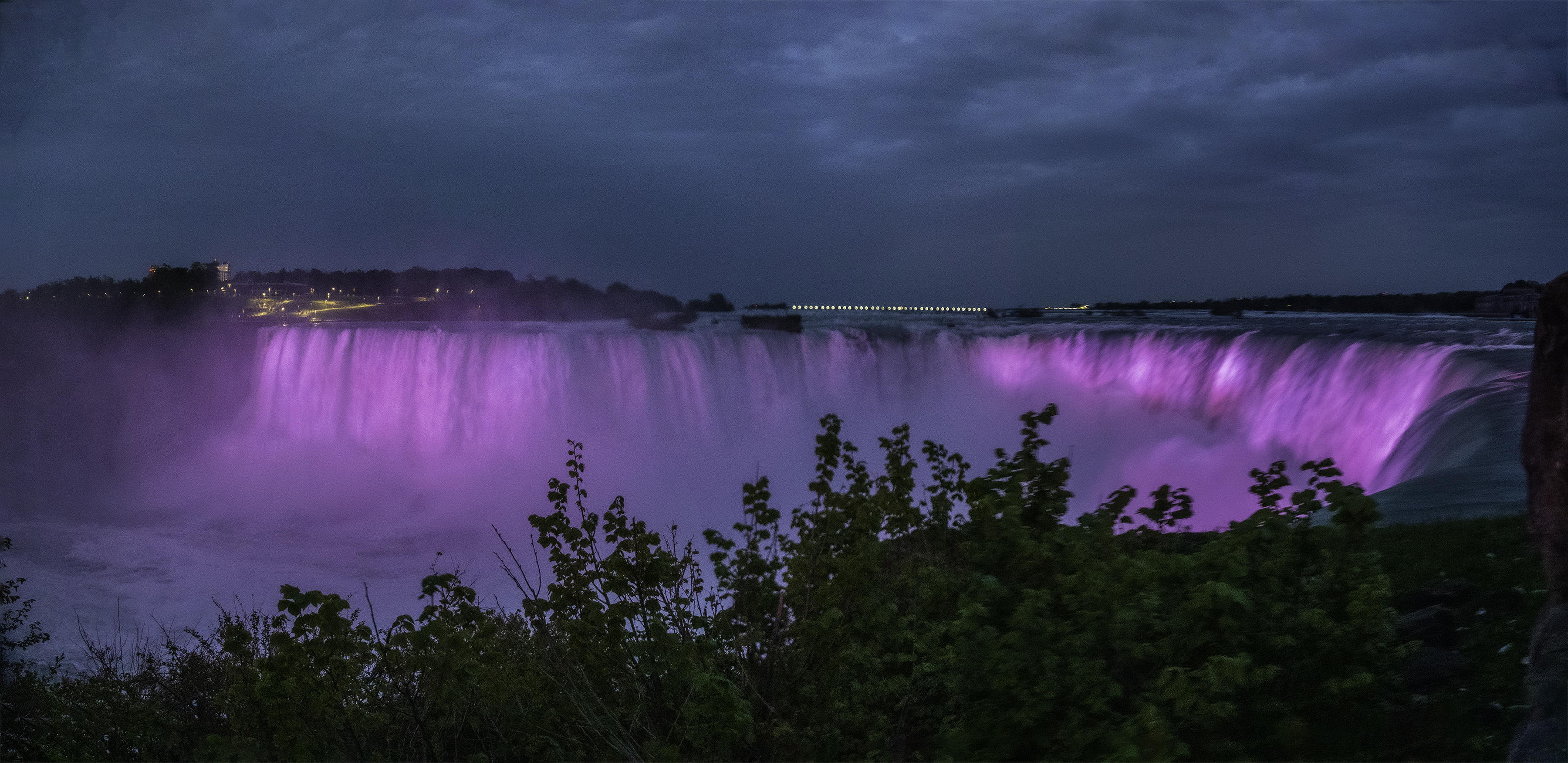
A visit to Niagara Falls
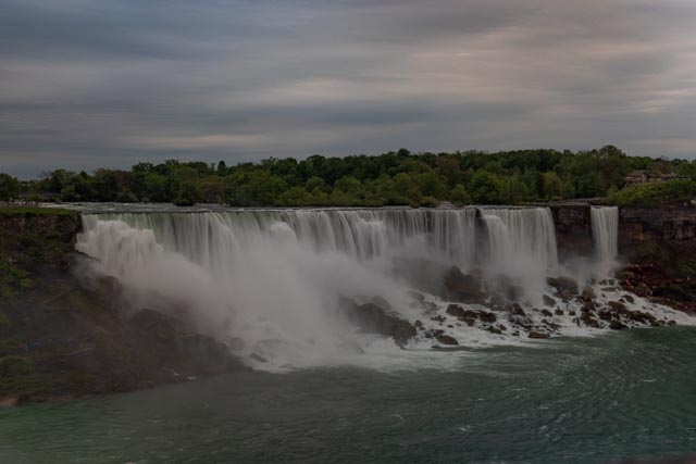
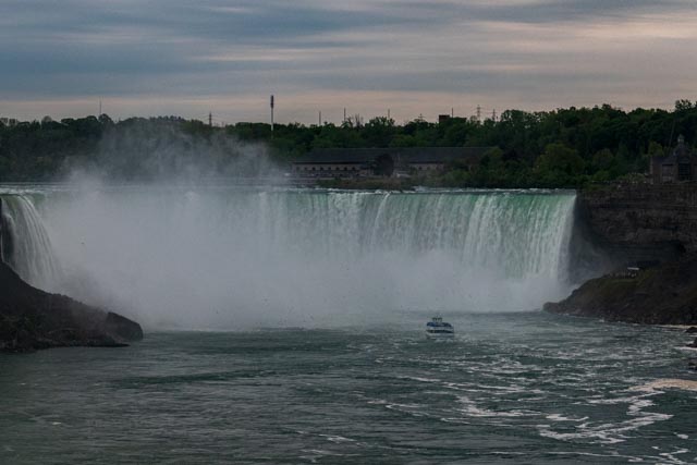
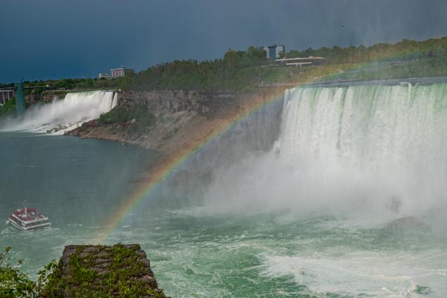
Niagara Falls is a group of three waterfalls at the southern end of Niagara Gorge, between the Canadian province of Ontario and the US state of New York. The largest is Horseshoe Falls, also known as Canadian Falls, which straddles the international border between Canada and the United States. The smaller American Falls and Bridal Veil Falls lie entirely within the United States. Bridal Veil Falls are separated from Horseshoe Falls by Goat Island and from American Falls by Luna Island.
Located on the Niagara River, which drains Lake Erie into Lake Ontario, the combined falls have the highest flow rate of any waterfall in North America that has a vertical drop of more than 50 metres (160 ft). During peak daytime tourist hours, more than 168,000 m3 (six million cubic feet) of water goes over the crest of the falls every minute Horseshoe Falls is the most powerful waterfall in North America, as measured by flow rate.
https://en.wikipedia.org/wiki/Niagara_Falls
American Falls and Bridal Falls
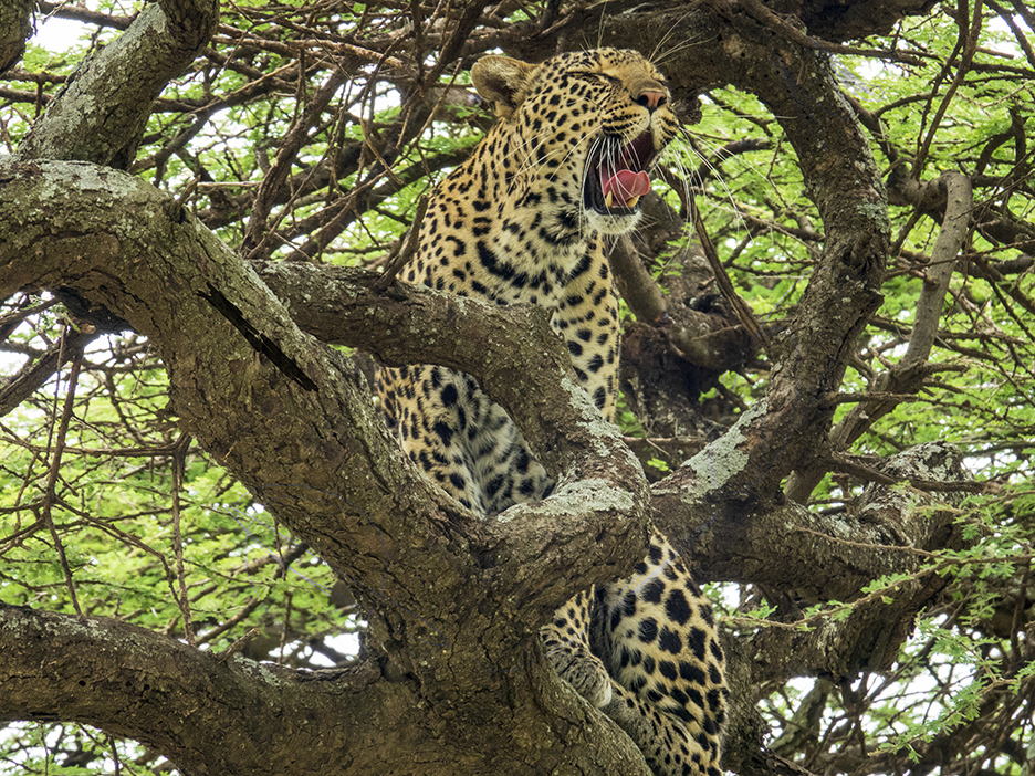
African Safari in Serengeti and Sabi Sand South Africa, also visits to Arusha National Park, and Nogoronogoro Caldera;
An African Safari is an wonderful experience, and time in Africa involving several safaris is even more amazing. Up at 5:30 every morning and in the trucks for the Game Drive by 6:00 takes some getting used to, but the anticipation of what we will see each day makes the early rising well worth it.
The photos on this page were taken in multiple places; Arusha National Park, Nogoronogoro Caldera and Serengeti National Park all in Tanzania, and Sabi Sands near Kruger National Park in South Africa. The land areas and habitats of the Parks and Caldera are different and there are some differences in the animals one will see, but the wonder at the massive herds, variation in individual species is God’s plan and we can only view in awe.
We easily saw “the Big Five” and I display pictures of them.
“In Africa, the big five game animals are the lion, leopard, rhinoceros (both black and white species), elephant, and Cape buffalo. The term “big five game” (usually capitalized or quoted as “Big Five”) was coined by big-game hunters and refers to the five most difficult animals in Africa to hunt on foot.” https://en.wikipedia.org/wiki/Big_five_game
Serengeti National Park has UNESCO designation.
The photos are all for sale in the size of your choice.


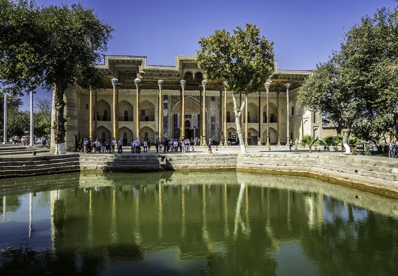
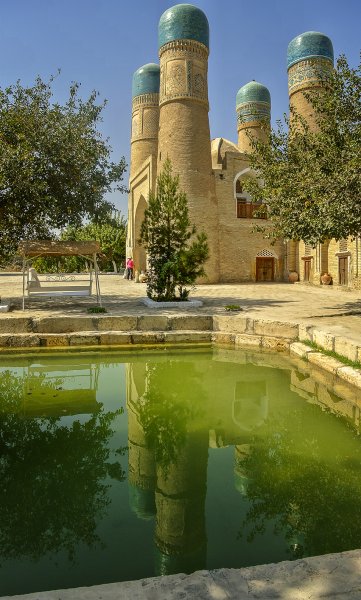
A visit to Bukhara
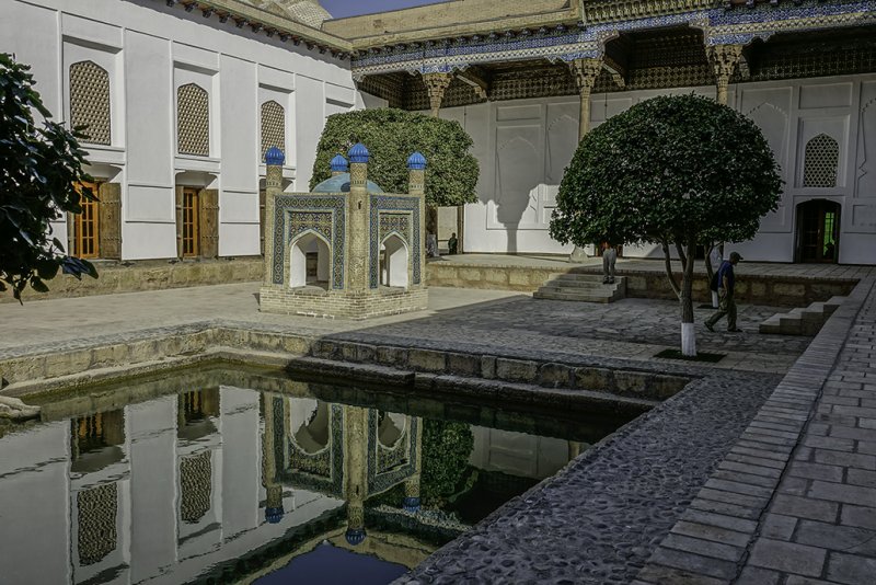
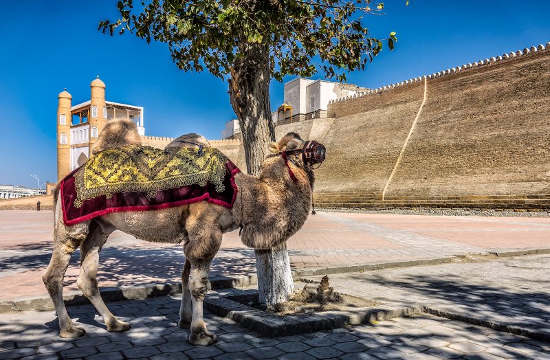
Bukhara Uzbekistan (Uzbek Latin: Buxoro; Uzbek Cyrillic and Tajik: Бухоро) Bukhara as an ancient city is a city-museum, with about 140 architectural monuments dating from the 9th to the 17th centuries. People have inhabited the region around Bukhara for at least five millennia, and the city has existed for half that time. Located on the Silk Road, the city has long served as a center of trade, scholarship, culture, and religion. UNESCO has listed the historic center of Bukhara (which contains numerous mosques and madrassas) as a World Heritage Site.
I recently traveled the Stans with Road Scholar. If you would like to go to the Stans and travel that part of the the Silk Road I highly recommend them. Bukhara is an interesting city with a “Surprise Behind Every Corner”. We stayed near a bazaar in a caravanserai, and had great fun shopping and sightseeing. I will show pictures from our trip, and hopefully infect you with the desire to visit this amazing area.
Beautiful monuments,
Beautiful monuments, One of the Oldest is;
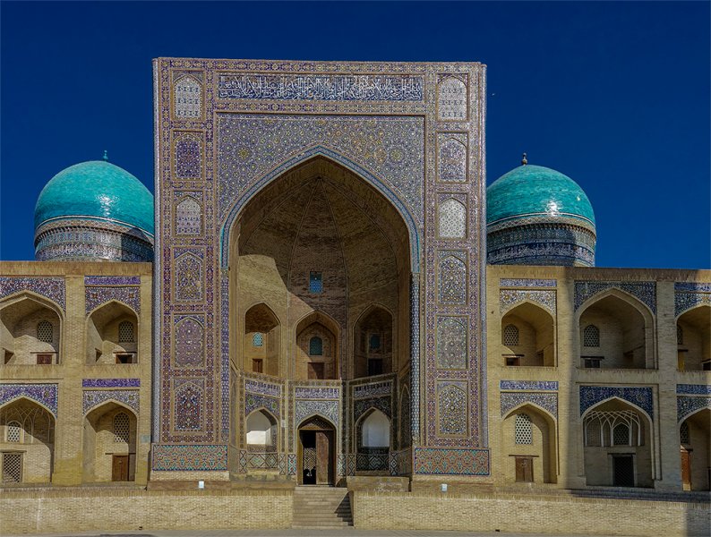
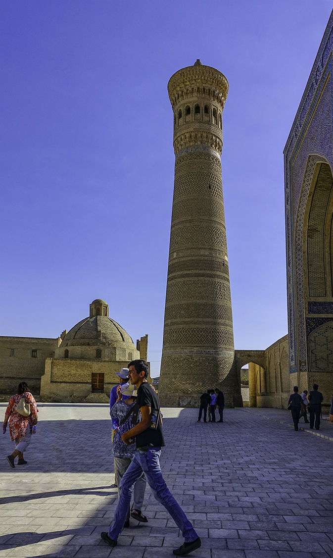
Kalyan minaret. More properly, Minâra-i Kalân, (Persian/Tajik for the “Grand Minaret”). Also known as the Tower of Death, as according to legend it is the site where criminals were executed by being thrown off the top for centuries. The minaret is most famed part of the ensemble, and dominates over historical center of the city. The role of the minaret is largely for traditional and decorative purposes—its dimension exceeds the bounds of the main function of the minaret, which is to provide a vantage point from which the muezzin can call out people to prayer. For this purpose it was enough to ascend to a roof of mosque. This practice was common in initial years of Islam. The word “minaret” derives from the Arabic word “minara” (“lighthouse”, or more literally “a place where something burn”). The architect, whose name was simply Bako, designed the minaret in the form of a circular-pillar brick tower, narrowing upwards. The diameter of the base is 9 meters (30 feet), while at the top it is 6 m (20 ft). The tower is 45.6 m (150 ft) high, and can be seen from vast distances over the flat plains of Central Asia. There is a brick spiral staircase that twists up inside around the pillar, leading to the landing in sixteen-arched rotunda and skylight, upon which is based a magnificently designed stalactite cornice (or “sharif”).
About a hundred years after its construction, the tower so impressed Genghis Khan that he ordered it to be spared when all around was destroyed by his men. It is also known as the Tower of Death, because until as recently as the early twentieth century criminals were executed by being thrown from the top. Fitzroy Maclean, who made a surreptitious visit to the city in 1938, says in his memoir Eastern Approaches, “For centuries before 1870, and again in the troubled years between 1917 and 1920, men were cast down to their death from the delicately ornamented gallery which crowns it.
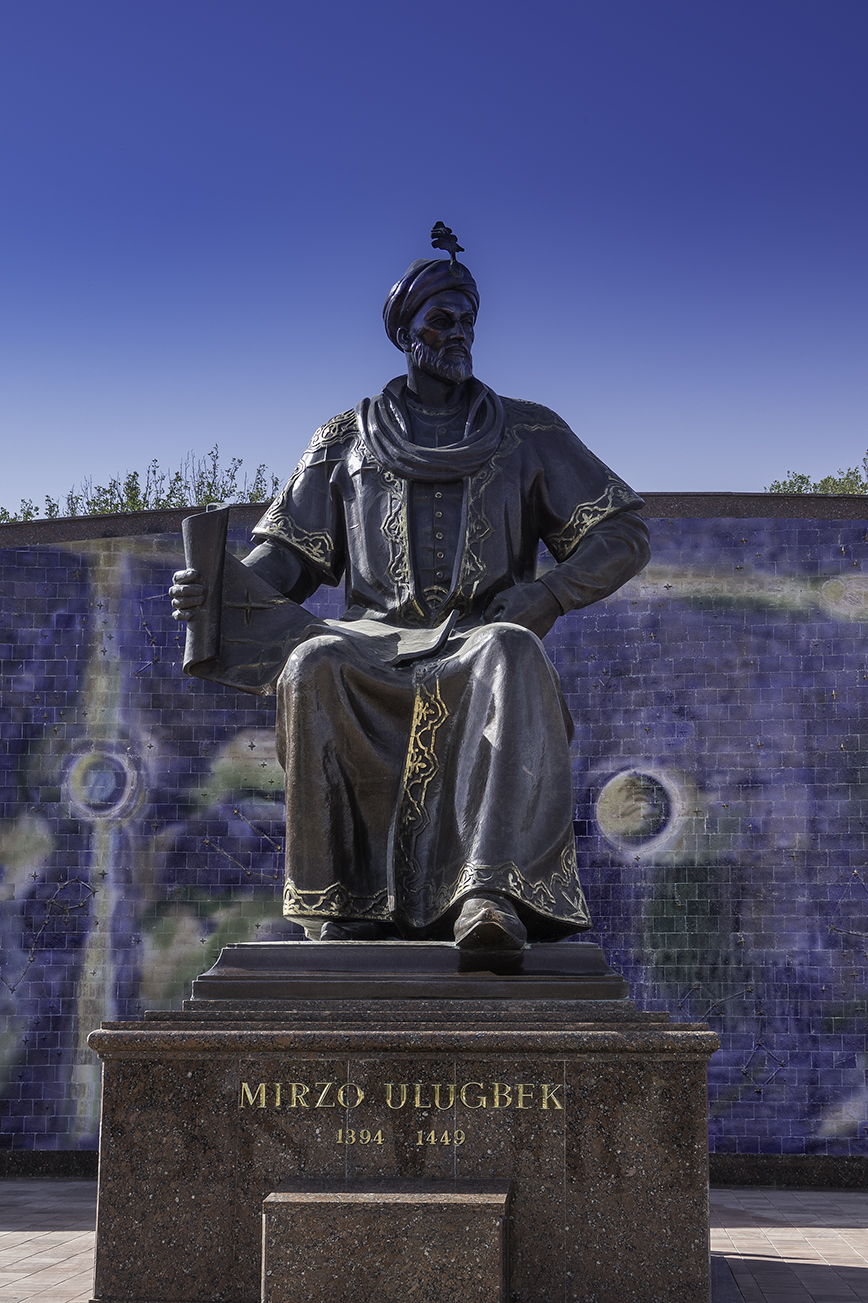
Ulugh Beg
Mīrzā Muhammad Tāraghay bin Shāhrukh better known as Ulugh Beg (الغ بیگ ) was a Timurid ruler as well as an astronomer, mathematician and sultan. His commonly known name is not truly a personal name, but rather a moniker, which can be loosely translated as “Great Ruler”

These are a few sample pictures from our travels in 2017. These are a selection of pictures taken in Greenland, Iceland, Italy, Greece, Wales, Scotland and England. Please check back for Photographic additions in one or all of the visited Countries.
Greenland is an interesting country ans has just recently started receiving the tourist trade. I bought a fun t-shirt in Greenland on our first visit that says “Lost in Greenland” such fun!
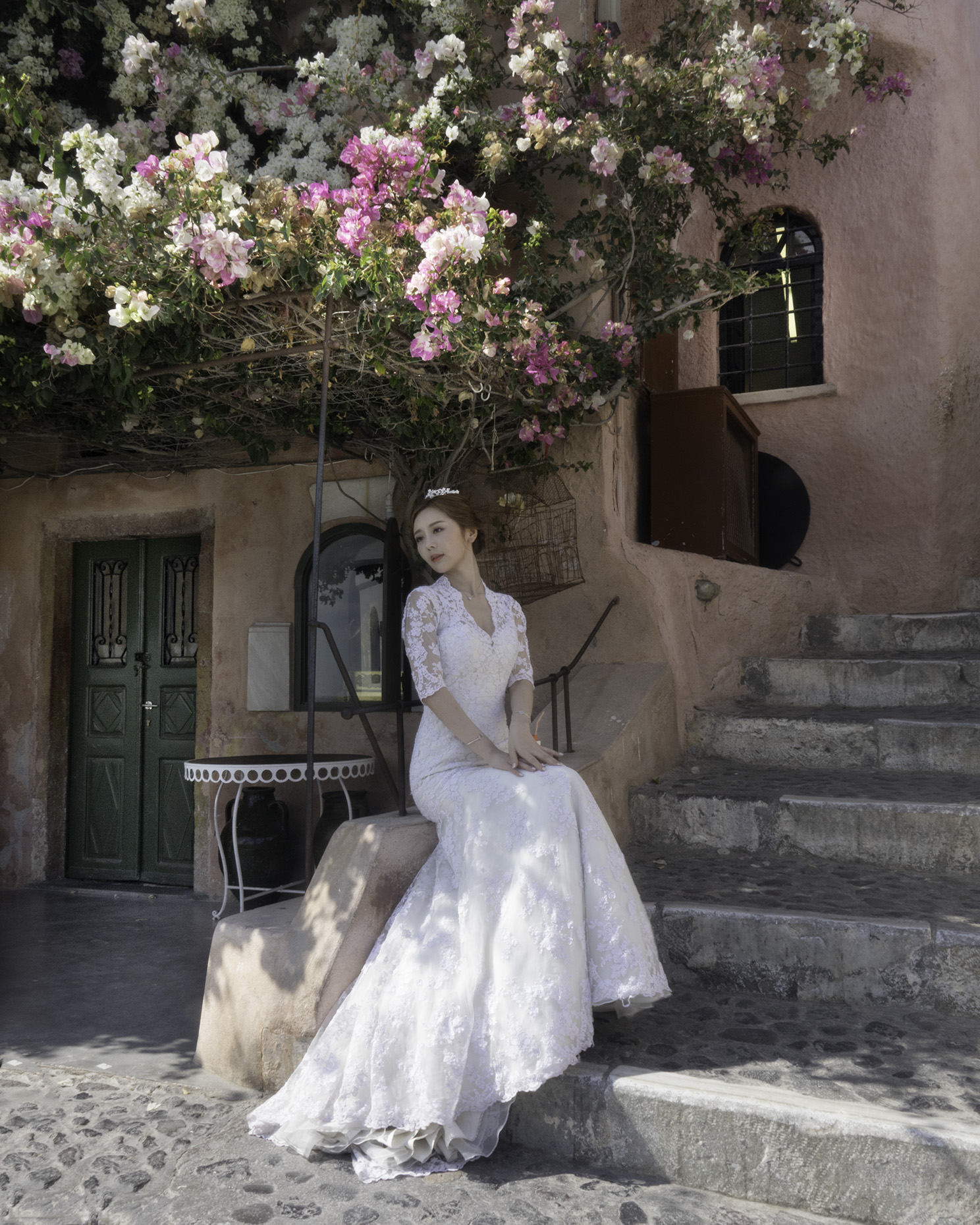
Venice is great for photography; the Gondolas, the canals, Rialto Bridge and the historic Buildings. Burano Italy is just a water taxi away from Venice famous for its colorful houses, and beautiful lace work. Santorini and Mykonis are beautiful Greek Islands, and very popular with the tourist crowd. Many Chinese women come to Santorini to pose in their wedding gowns.
Wales, Ireland and the Islands off Scotland have many interesting Neolithic sites such as Skara Brae and several Henge sites, Standing Stones of Stennes, and Ring of Bodgar near Kirkwell Orkney.


 Classic Cars of Cuba


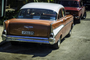

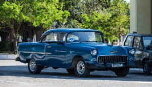
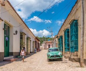
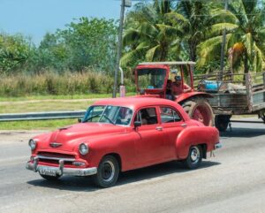
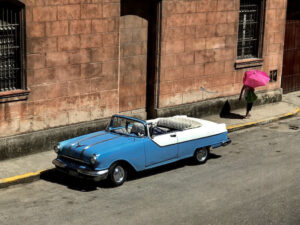
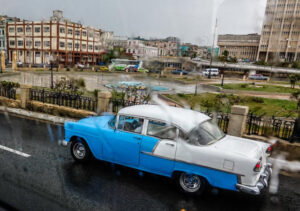
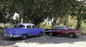
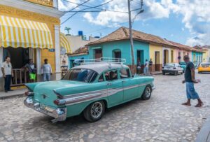
Just a few of the beautifully restored Classic Cars seen in Cuba. These cars are lovingly preserved and maintained. Most seem to have been converted to diesel and many are used as Taxis. I think using the cars as taxis is one way they are able to afford keeping the cars is such good looking condition and so well maintained. The colors of the cars used are not usually indicative of what they were when they were first purchased. It was great fun to take a ride in the cars, bringing back memories. The roll up windows, the radio the steering wheel etc. More pictures of these Classic Cars to follow.
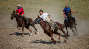
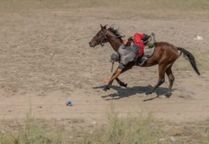
A visit to Kyrgyzstan Featuring Horse Games,Crafts and Monuments
The Kyrgyz people are descended from nomads and are proud of their horsemanship. While we were there we got to experience display of traditional Kyrgyz horse games, including Oodarysh, a kind of wresting match on horseback and Ulak Tartysh a sort of polo played with a goat carcass. Photos of each are featured.
Arts and Crafts
Arts and crafts of Kyrgyz people has evolved over the centuries. It was formed based on the needs of people’s everyday life, and the nomadic way of life influenced their Customns. Among the major forms of arts and crafts felt art, weaving, patterned embroidery, making of mat, leather products, jewelry, and wood carving.
The art of making felt products is closely related to the dwelling of the nomads, the yurt. Carpets of felt, decorated with ornaments, are called “shyrdaks”. Shyrdak is a very important element in the decoration of a yurt. It is usually located on the floor. Felts for shyrdaks are made from sheep wool, which is tightly rolled and painted in bright colors. Felt is made from pieces of ornament, then they are sewn together to form a beautiful carpet. Shyrdak’s length is usually four meters. width is about two meters. The great meaning in the applied arts has the carpet “ala kiyiz” (kyrg. “motley felt”). It differs from shyrdak that felt pieces are not sewn, but they are rolled to each other.
We purchased a traditional men’s hats, or kalpak in a typical felt design.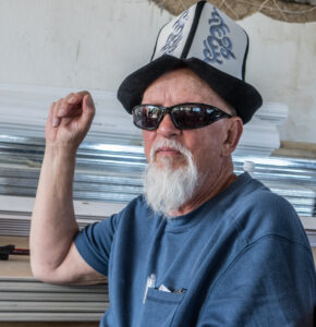
Embroidery also can be noted as significant craft of Kyrgyz people. Often only women involved in it. They skillfully embroider patterns and ornaments on fabrics, leather and felt. Kyrgyz masters magnificently embroider wall pictures “tush-kiyiz”. Such pictures’ center is usually plain, without patterns, while the sides are framed by the wonderful color ornaments. Pattern embroidery is also common for traditional bags “ayak-kap” and hanging shelves “tekche”.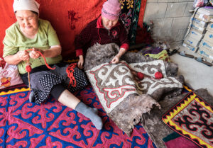
Burana Tower and Balbals
The minaret of the archeological site dates to the 10-11th centuries. It is among the oldest constructions of this type in the whole of Central Asia. Its original height was about 45 miters, the upper part of it was adorned with a lantern dome with four doorways looking out the four cardinal points. The present height of the tower is 24,6 m; the upper part of it collapsed during an earthquake that took place about the 15th or 16th centuries.
There were major archaeological surveys of the site in the 1920s, 1950s and 1970s. The archaeologists discovered that the town had a complicated layout covering some 25-30 square kilometers. There were ruins of a central fortress, some handicraft shops, bazaars, four religious buildings, domestic dwellings, a bathhouse, a plot of arable land and a water main (pipes delivering water from a nearby canyon). Two rings of walls surrounded the town. The town was located on the Silk Road.
Now the Burana archeological site has become an open-air historical and architectural museum.
The collection of the museum includes real sculptural masterpieces of the medieval fine arts dating from the 6-10th centuries. Many Petroglyphs from the area are also featured
An interesting highlight of the Open-air Museum are the Balbals (grave markers used by nomadic Turkic peoples who used to roam Central Asia) and Petroglyphs (paintings on stones) which have been collected and placed here from all around the Chu valley.;
Balbals – ancient stone sculptures of Kyrgyzstan. With settling of Turkic tribes on the territory of Kyrgyzstan, appear a new ceremony of burring; in which wildly spread the custom of installation the stone sculptures on the graves. Mostly they made of granite, sometimes from limestone. Also the only flagstones were selected for statues. Sometimes the surfaces were meticulously trimmed, sometimes not.
In its mass the stone sculptures are not the same, scientists distinguish 2 main groups: the 1st group are valued, round sculptures on which clearly traced the proportions of the figures and details: clothes, jewelry, weapon. The 2nd group are flat sculptures, when on the stone the contour line image just a head with the face features, or even rarely the whole figure. The last group is dominated and probably older then the 1st group. Usually the statues represent the Male-stern fighters, rarely female, the faces are mongoloid. In the right hand there is a vessel, on the waist there is a knife or sabre.
Stone sculptures date to 6-10th century and a very few of them to 10-12th centuries. One of the main causes of disappearance was the spread of Islam, as it is known Islam forbid imaginations of alive people, animals, birds.
The stone sculptures were created by skillful sculptors-masons who were the great artists of the time. They could correctly reproduce the proportions of the figure, face features, jewelry. There are also 2 hypothesizes of the purposes these sculptures: the 1st one is what the stone statues represent dead Turks by themselves and the 2nd is what the stone statue is an imagination of an outstanding adversary killed by Turk in the real life, and who has to serve the winner in his next-after death life. Also, in most of the burial places main sculptures were surrounded by a number of smaller rocks that were supposed to represent the number of enemies that person killed during his life so they became his servants in the afterlife.
http://www.kyrgyzstantravel.info/culture/balbals.htm
More Information on the Balbals;Balbals have two clearly distinct forms: conic and flat, with shaved top. Considering the evidence of Orkhon inscriptions that every balbal represented a certain person, such distinction cannot be by chance. Likely here is marked an important ethnographic attribute, a headdress. The steppe-dwellers up until present wear a conic ‘malahai’, and the Altaians wear flat round hats. The same forms of headdresses are recorded for the 8th century.
The Petroglyphs represent animals such as deer, mountain sheep and wolves as well as sun and person shapes.
“Two thousand years ago, caravans of pack animals and traders followed a route west from their home in China over the Steppe of Central Asia and into the fertile valleys of Europe, bringing with them silk, porcelain and spices. When adventurous Europeans traveled the Silk Road in the opposite direction, they came back with knowledge that changed the destiny of Western Civilization. Experience the history, culture and people that link the living cities and ancient ruins lining the Silk Road.”
The above is the introduction to the Program Summary by Road Scholar about a wonderful educational trip to the five “Stans”. Kyrgystan, Kazakhstan, Uzbekistan, Tajikistan, and Turkmenistan.
“In the heart of the Asian continent, where mighty conquerors and trading caravans once strode the Silk Road, the “seven Stans” weave a carpet of many colors. Prior to 1991 maps showed only Afghanistan and Pakistan. Then came the Soviet Union breakup and the birth of five new nations: Kazakhstan, Kyrgyzstan, Tajikistan, Turkmenistan, and Uzbekistan. Today, these independent states continue to forge identities amid continuing conflicts.”
http://travel.nationalgeographic.com/travel/countries/seven-stans-photos
The Stans got their Independence from USSR two Decades ago and the path the countries have taken since the independence is somewhat different. For more reading check your local library.
Kyrgyzstan was the first Stan that we visited. A sign that I photographed in Bishkek impressed me–I have included it in this Introduction to the Silk Road series on my site.


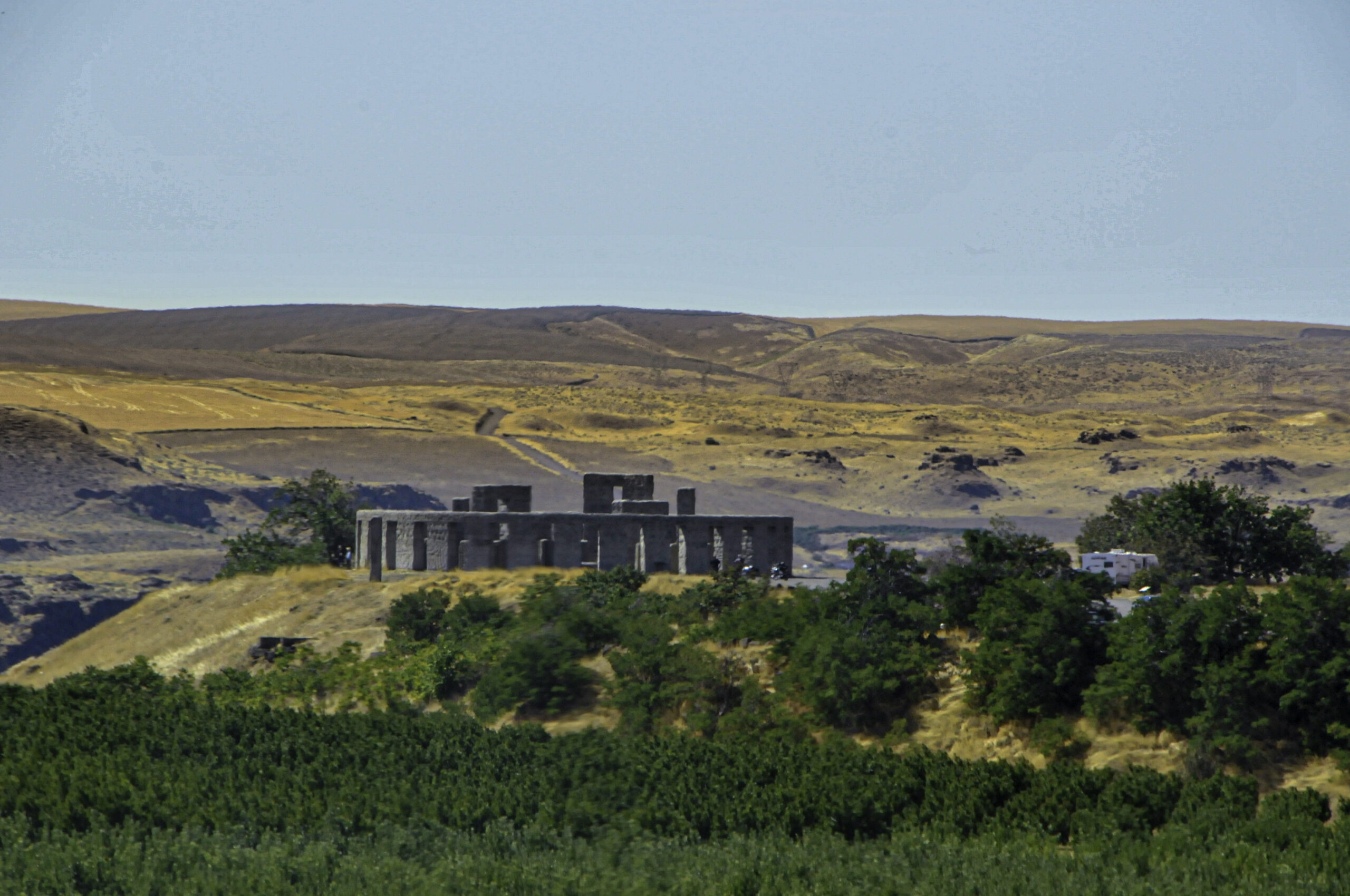
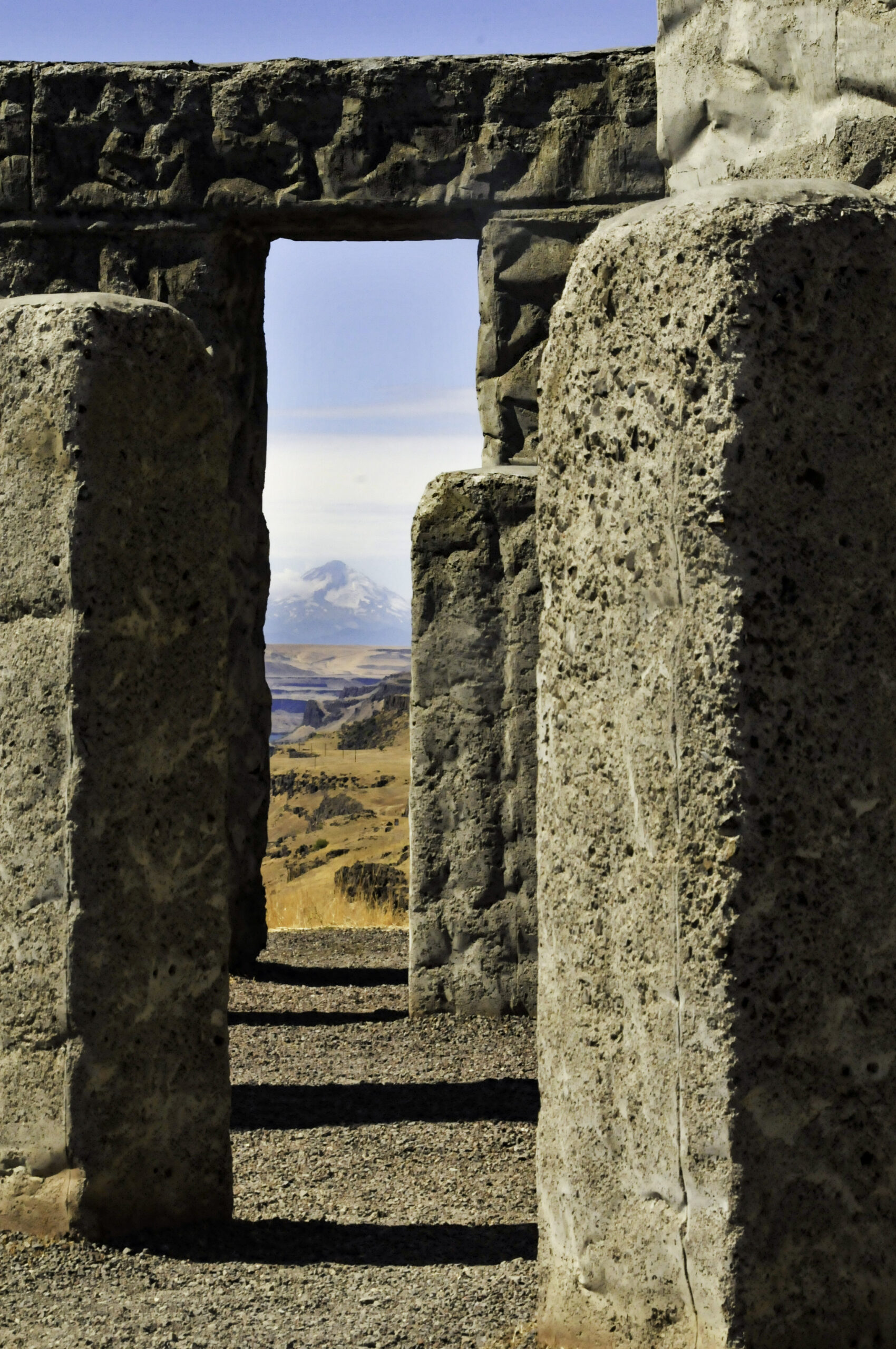
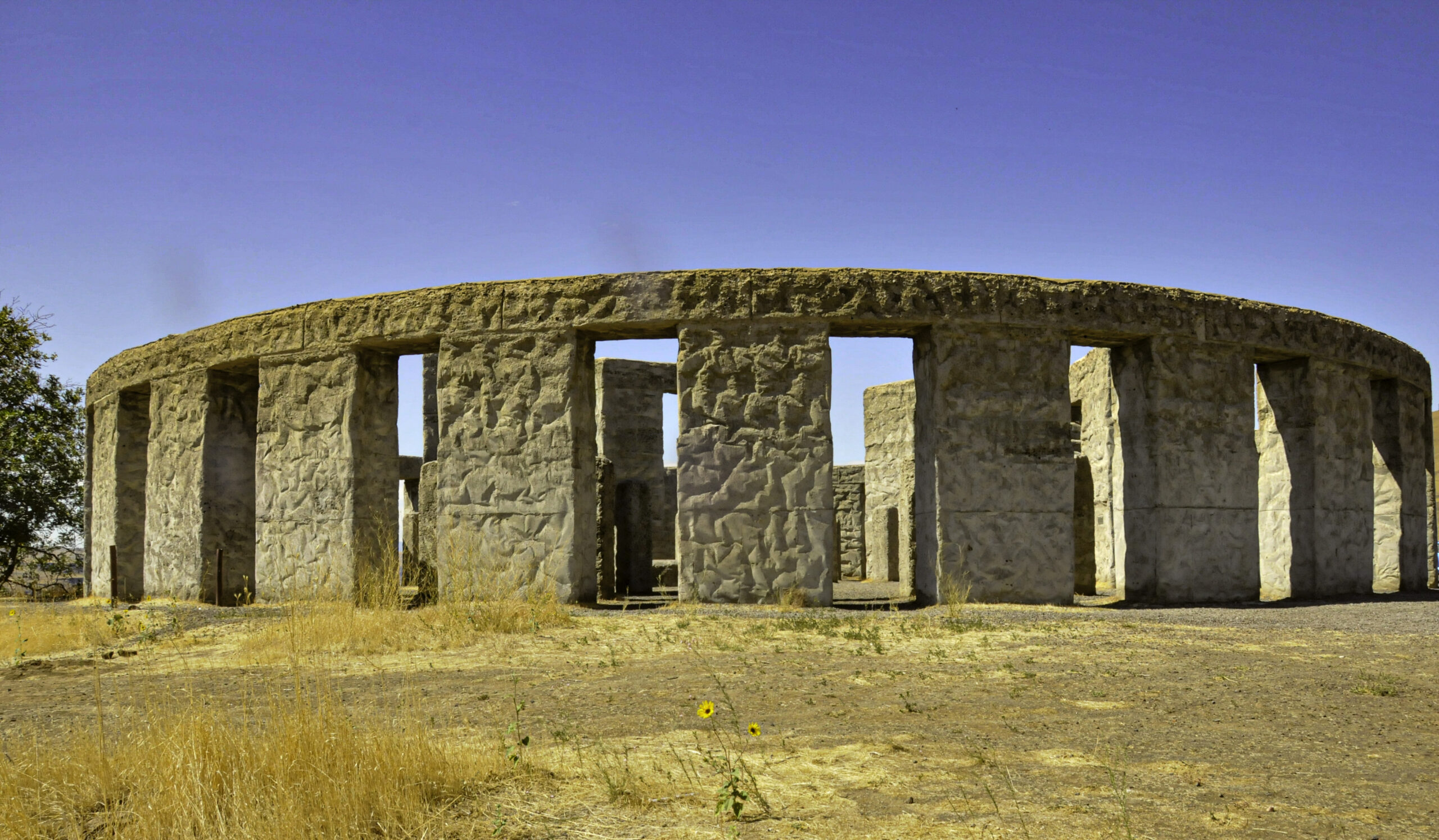
Did you know that there are several Stonehenge replicas! I have visited one in Washington State, and one in Western Australia. I visited the original in England, years ago, and by viewing these replicas it is nice to see what the original probably looked like.
On a lonely bluff overlooking the Columbia River and the town of Maryhill, Washington, is a full-size replica Stonehenge. An almost identical copy of the more famous English Stonehenge, it was built by Sam Hill, a road builder, as a memorial to those who died in World War I. Dedicated in 1918, the memorial wasn’t completed until 1930. Hill passed away soon after he finally saw his masterpiece completed. He was buried at the base of the bluff; but, because he wished to be left alone, there is no easy path to his resting place. Pictures of this Stonehenge will follow;
The project began when Hill was mistakenly informed that the original Stonehenge had been used as a sacrificial site. He thus constructed his replica as a reminder that “humanity is still being sacrificed to the god of war.
The dedication plaque on this American Stonehenge reads:
“In memory of the soldiers of Klickitat County who gave their lives in defense of their country. This monument is erected in the hope that others inspired by the example of their valor and their heroism may share in that love of liberty and burn with that fire of patriotism which death can alone quench.”
http://www.legendsofamerica.com/wa-stonehenge.html
Stonehenge Replica in Australia
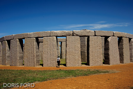
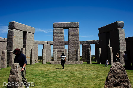
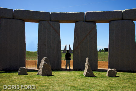
Esperance Stonehenge has been constructed on the South Coast of Western Australia.
There are thought to be 66 large, permanent replicas of Stonehenge throughout the world.
It is a full size replica of the original “Stonehenge” in the UK, as it would have looked around 1950BC.
137 Stones of Esperance Pink Granite quarried adjacent to the Beale’s property, in Esperance, Western Australia.
The 10 Trilithon Stones in a horseshoe pattern weigh between 28-50 tonnes each, standing with the 18 tonne lintels to a height of 8 metres.
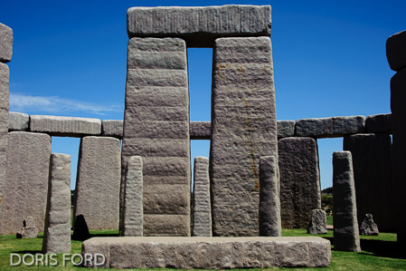
Inside the Trilithon Horseshoe stands another Horseshoe of 19 Blue Stones.
The Trilithon Stones are surrounded by a circle of 30 Sarsen Stones weighing 28 tonnes each and standing almost 5 metres high including the 7 tonne lintels on top.
Positioned between the Sarsen Circle and the Trilithon Stones is a full circle of 40 smaller stones, referred to as the Bluestone Circle.
The Altar Stone weighs 9 tonne and lies in front of the tallest Trilithon Stones.
The structure is aligned with the Summer Solstice – Sunrise – Esperance WA. The Station Stones are positioned on this line to allow the suns rays to pass through to the Altar. The Summer Solstice is the longest day of the year (22nd December). The sunset on the Winter Solstice is (June 21st – the shortest day of the year). This is the same line as the Summer Solstice Sunrise.
http://esperancestonehenge.com.au/

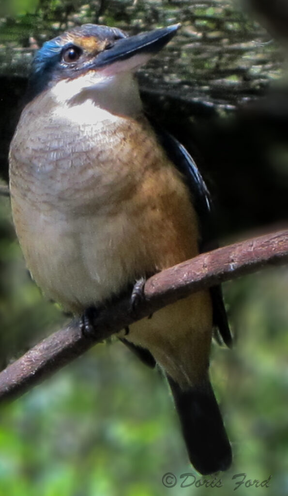
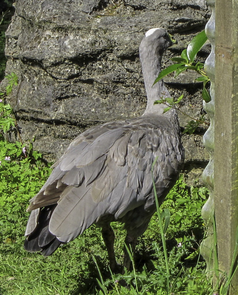
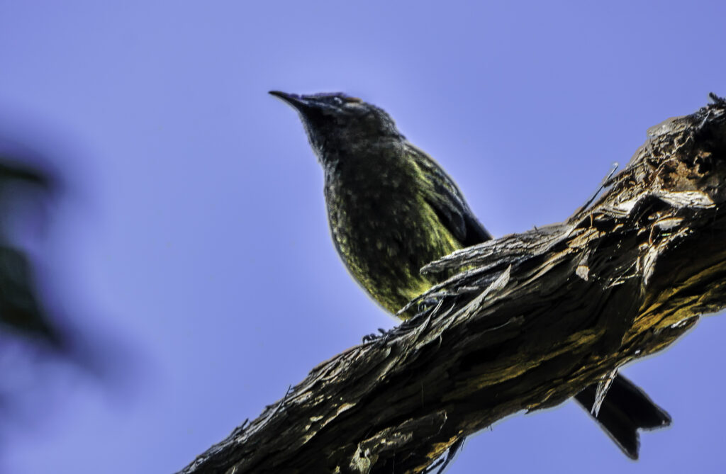
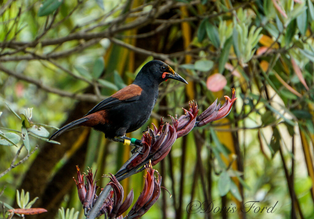
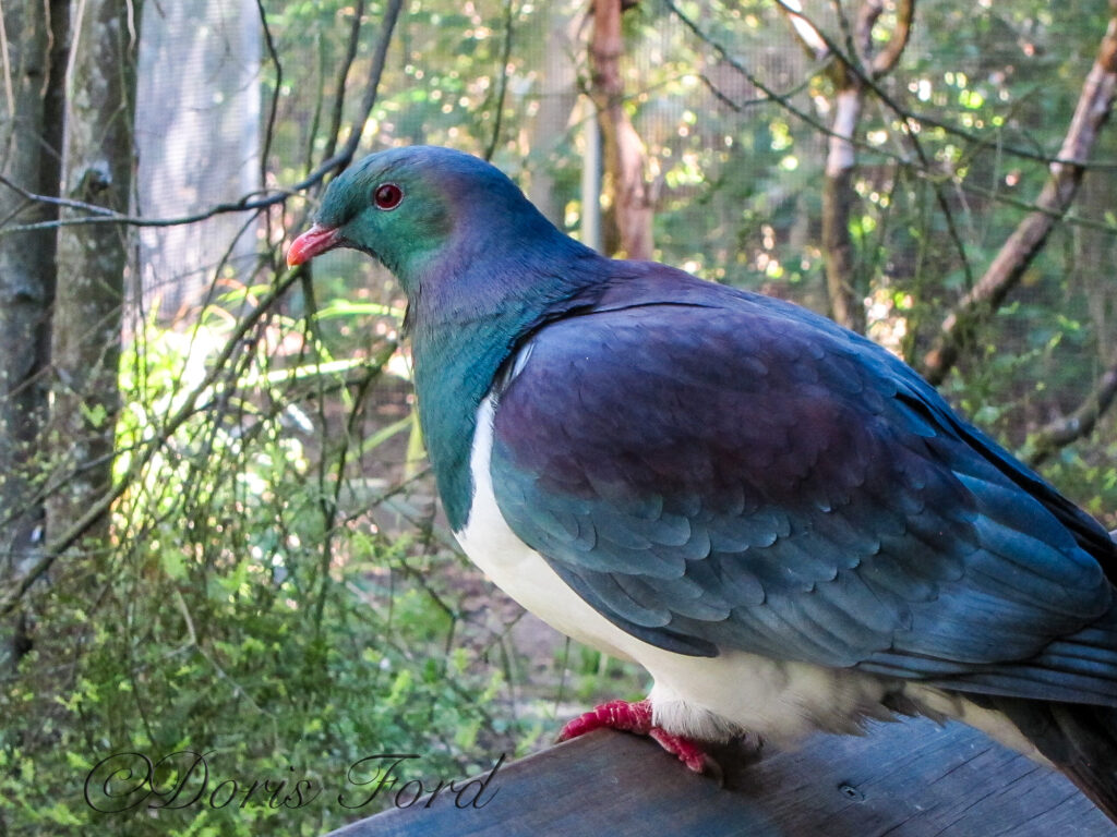
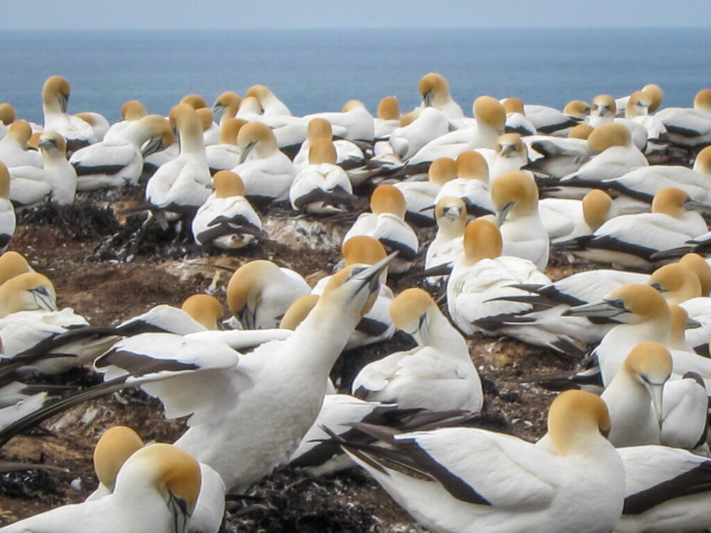
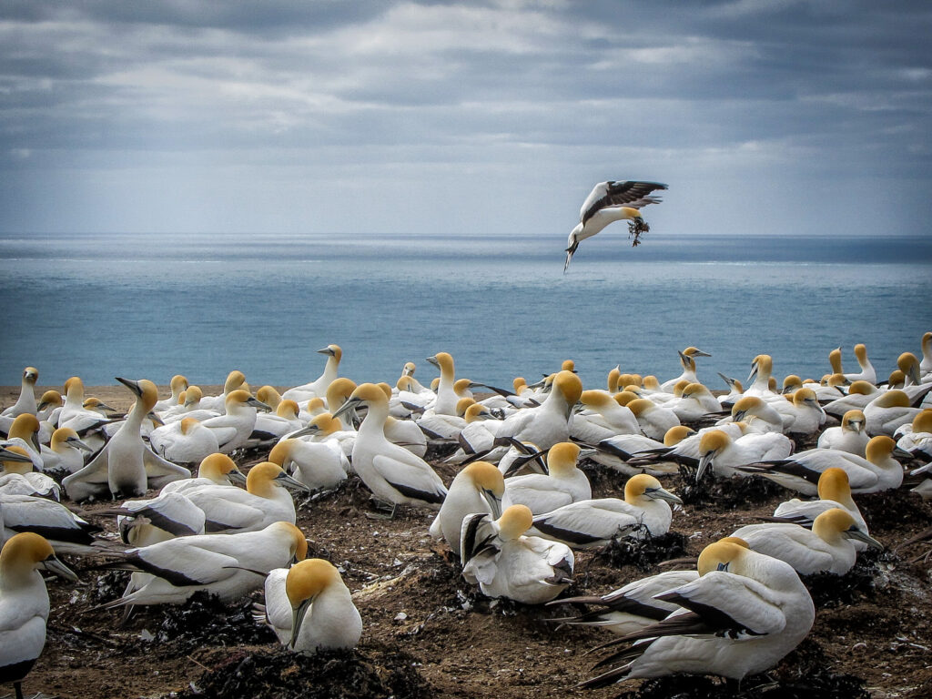
New Zealand Birds
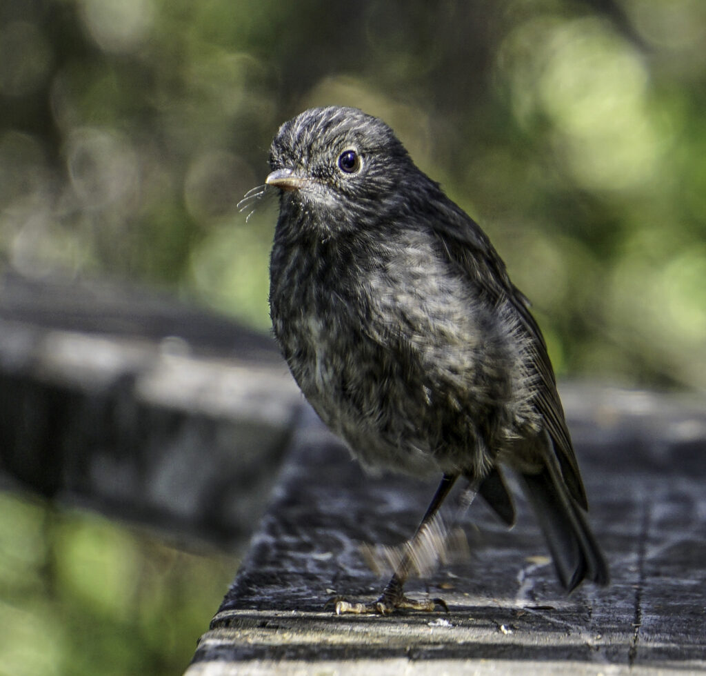


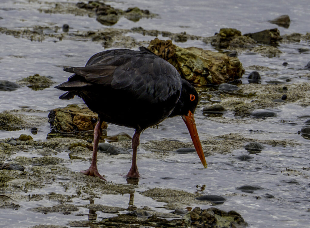
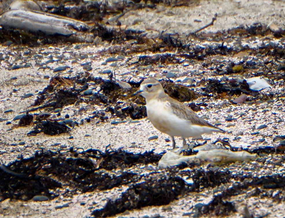
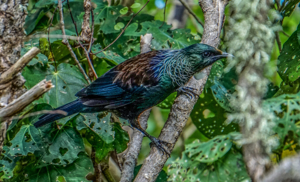
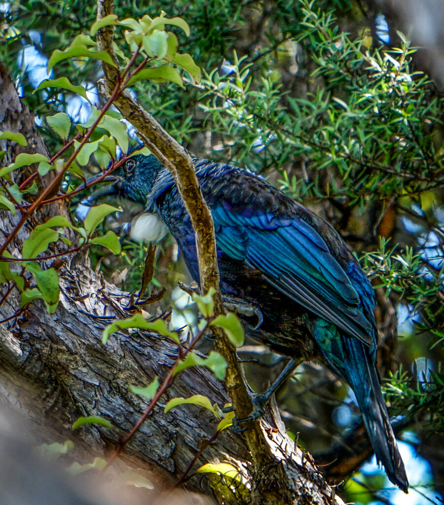
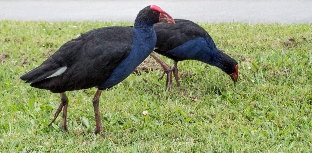
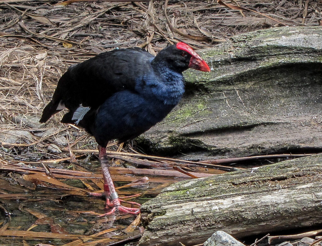
When humans arrived in New Zealand about 700 years ago the environment changed quickly. Several species were hunted to extinction, most notably the moa a giant flightless bird, (Check out http://www.bagheera.com/inthewild/ext_moas.htm) and harpagornis (https://en.wikipedia.org/wiki/Haast’s_eagle). The most damage was caused by habitat destruction and the other animals humans brought with them, particularly rats – the Polynesian rat or kiore introduced by Māori and the brown rat and black rat subsequently introduced by Europeans. Mice, dogs, cats, stoats, weasels, pigs, goats, deer, hedgehogs, and Australian possums also put pressure upon native bird species. The flightless birds were especially sensitive.
Consequently, many bird species became extinct, and others remain critically endangered. Several species are now confined only to offshore islands, or to fenced “ecological islands” from which predators have been eliminated. New Zealand is today a world leader in the techniques required to bring severely endangered species back from the brink of extinction.
During the early years of European settlement many bird species were introduced for both sport and for a connection with the settler’s homelands. New Zealand had a starkly different appearance to the countries from where the settlers came.
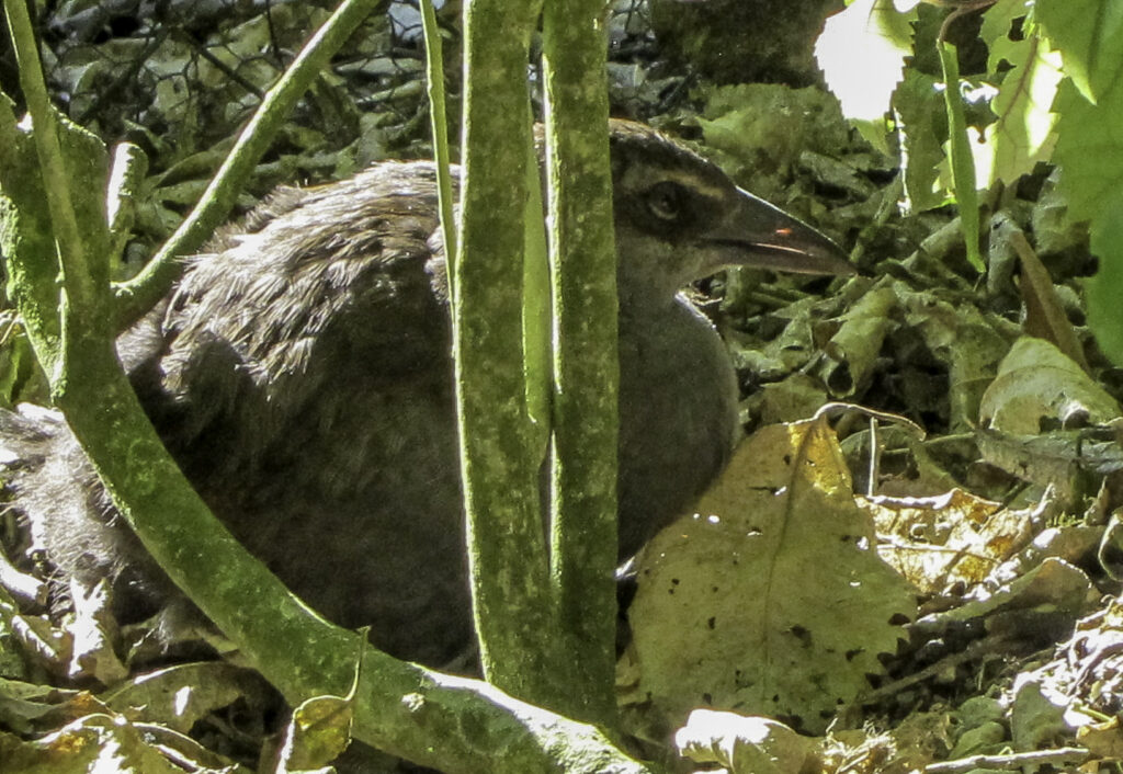
A wonderful place to visit near extinct birds is Tiritiri Matangi an Island off the NZ mainland. The following is from their website, and most of the bird pictures are also from the island.
is a wildlife sanctuary and one of New Zealand’s most important and exciting conservation projects. It is located 30km north east of central Auckland and just 4km from the end of the Whangaparaoa Peninsula. A hundred and twenty years of farming had seen this 220-hectare island stripped of 94% of its native bush but between 1984 and 1994, volunteers planted between 250,000 and 300,000 trees. The Island is now 60% forested with the remaining 40% left as grassland for species preferring open habitat.
In conjunction with this planting program, all mammalian predators were eradicated and a number of threatened and endangered bird and reptile species have been successfully introduced, including the flightless takahe, one of the world’s rarest species, and the tuatara. There are few places in New Zealand where you can readily see and walk amongst so many rare species.
The project is managed by the Department of Conservation in conjunction with the Supporters of Tiritiri Matangi Incorporated.
http://www.tiritirimatangi.org.nz/
http://www.bagheera.com/inthewild/ext_moas.htm
https://en.wikipedia.org/wiki/Haast’s_eagle
https://en.wikipedia.org/wiki/Birds_of_New_Zealand
A book on New Zealand birds–http://www.whitcoulls.co.nz/native-birds-of-new-zealand-5955027


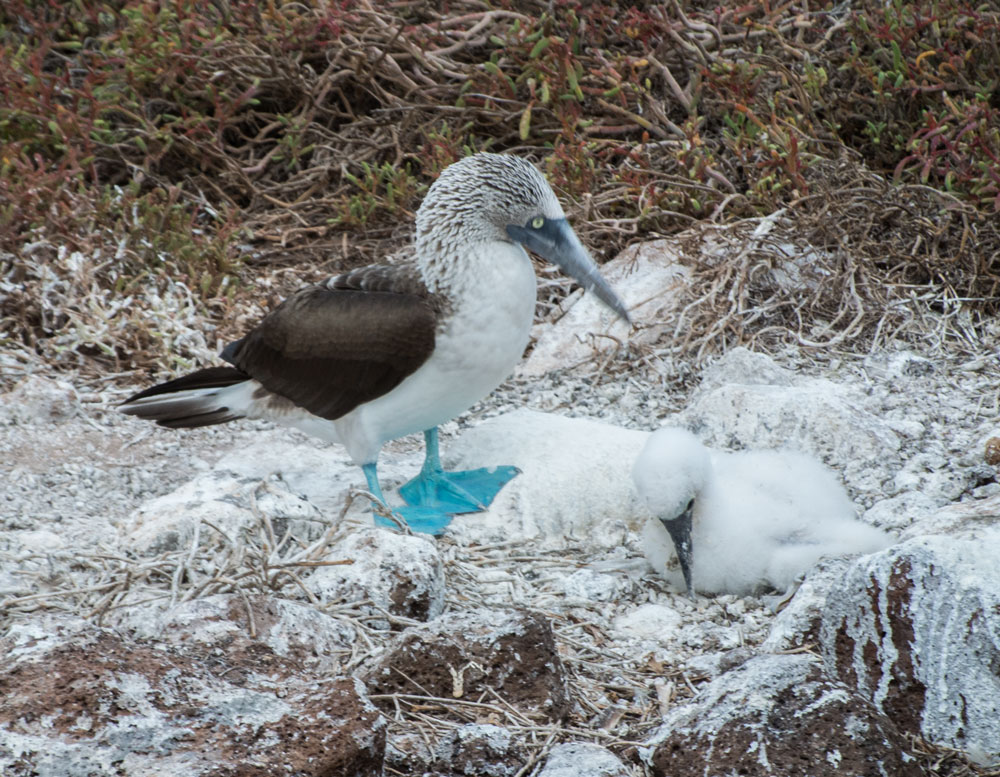
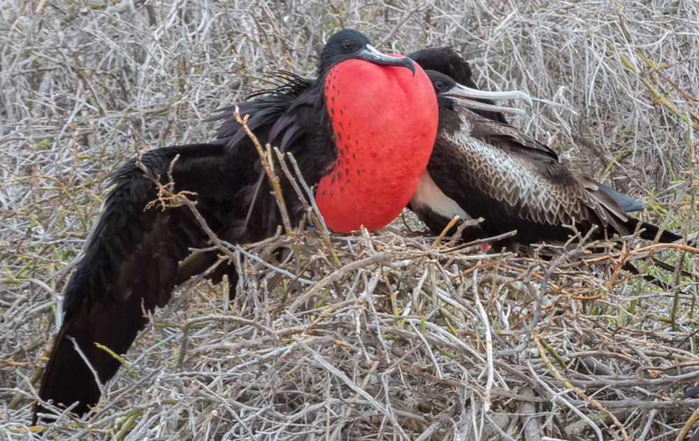
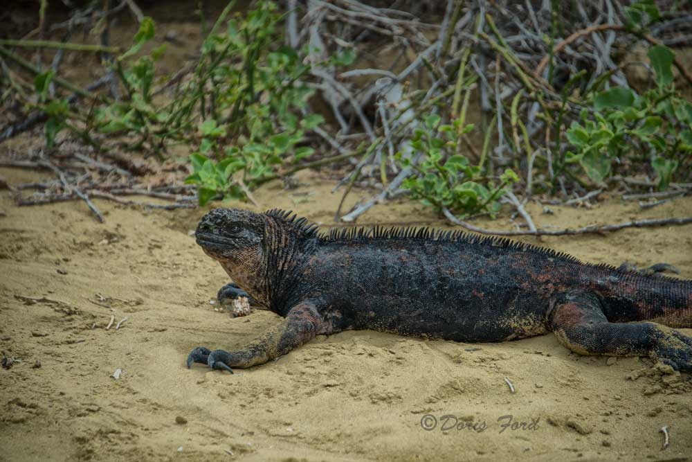
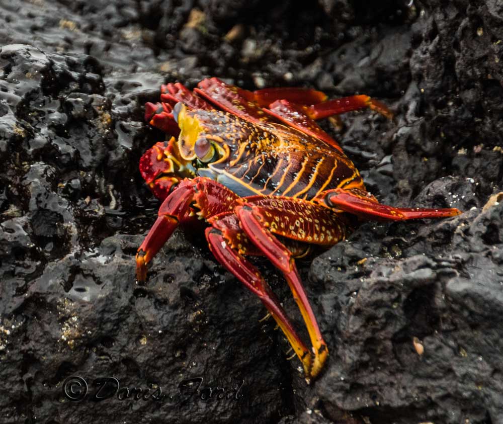
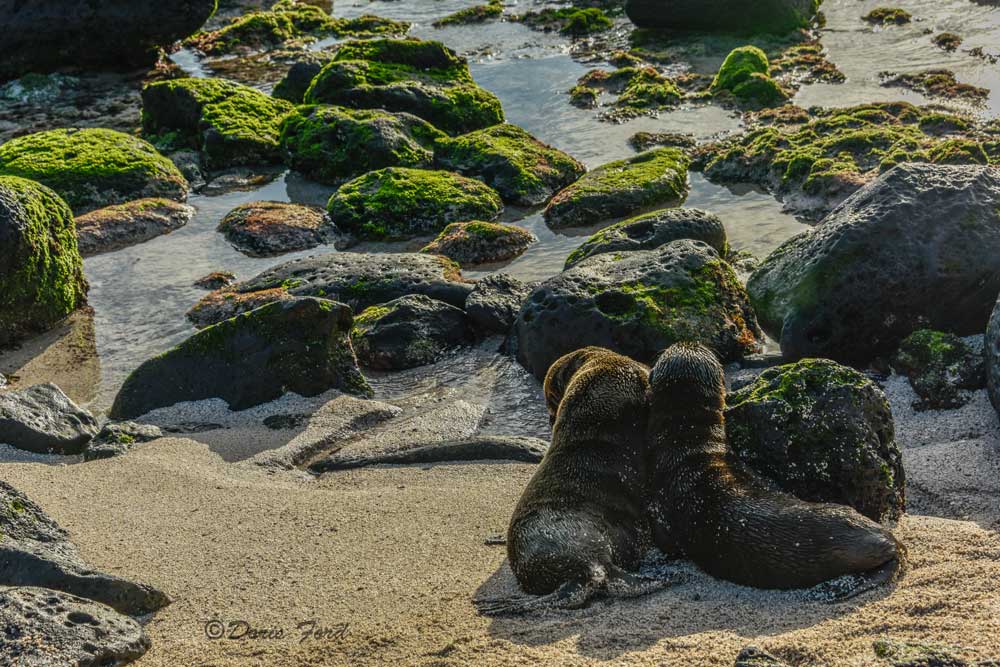
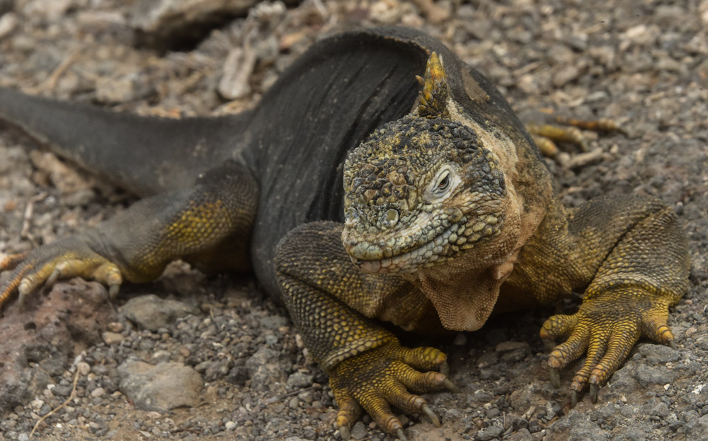
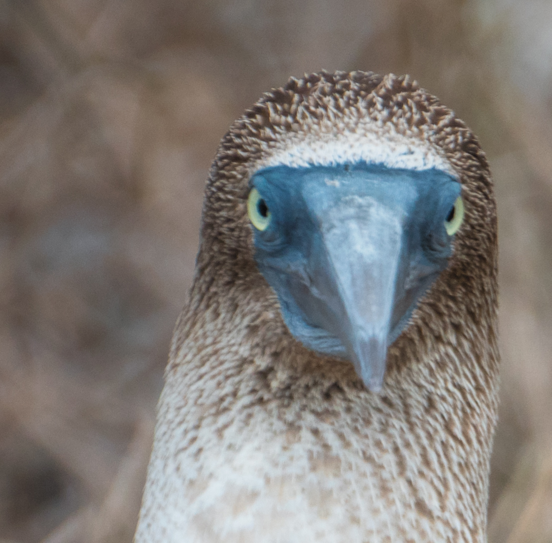
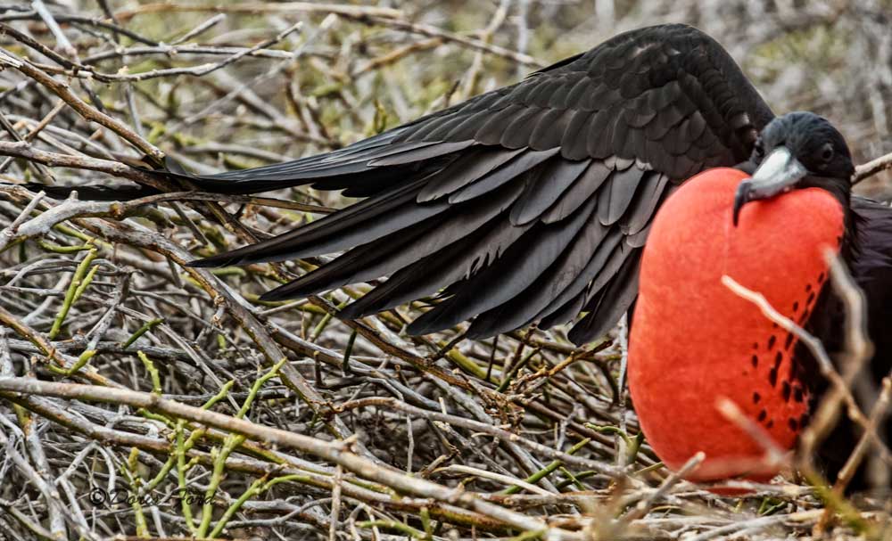
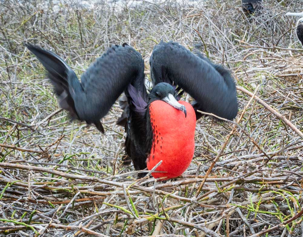
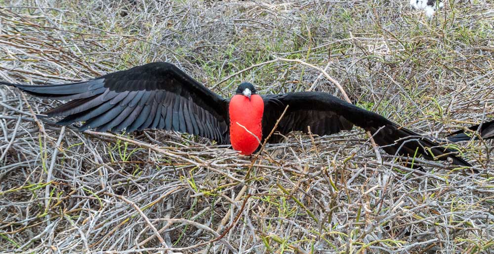
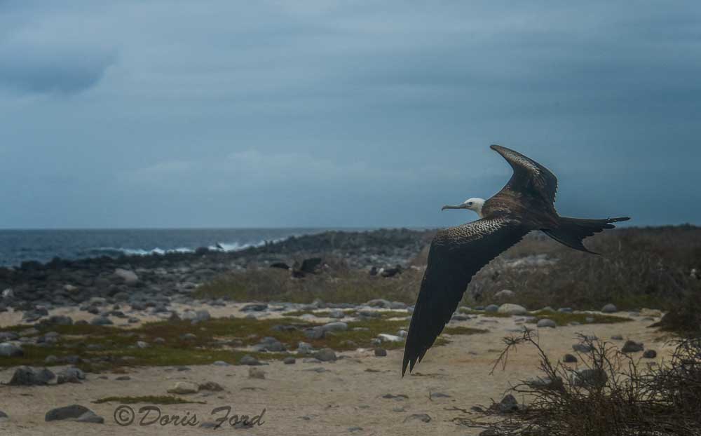
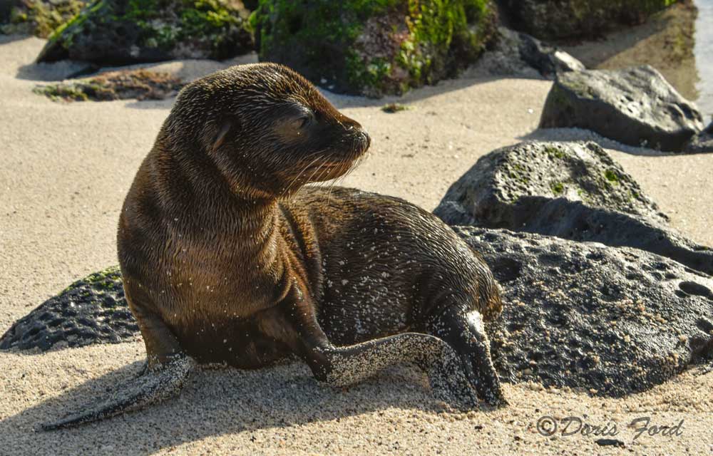
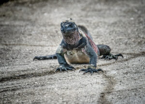
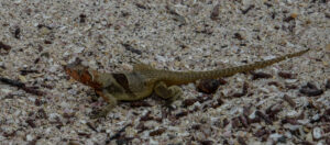
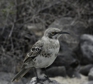
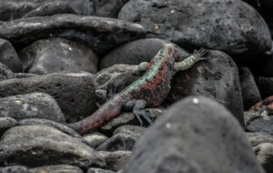
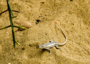
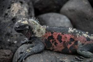
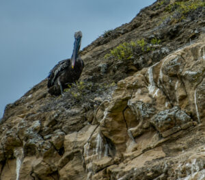
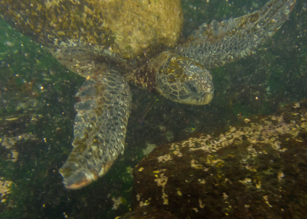
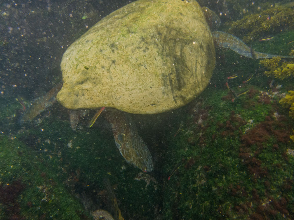
A visit to the Galapagos Islands is an amazing experience. Here are a few pictures from our recent trip. Some of the wildlife on the Galapagos are found nowhere else in the world, and vary even from island to island within the Galapagos area. For instance one type of iguana are found on one island, and not on others. The huge tortoise that has been found to live over 100 years, are found on one island and not on others.
a volcanic archipelago in the Pacific Ocean, is a province of Ecuador, lying about 1,000km off its coast, and considered one of the world’s foremost destinations for wildlife-viewing. Its isolated terrain shelters a diversity of plant and animal species, many found nowhere else. Charles Darwin visited in 1835, and his observation of Galápagos’ species later inspired his theory of evolution.
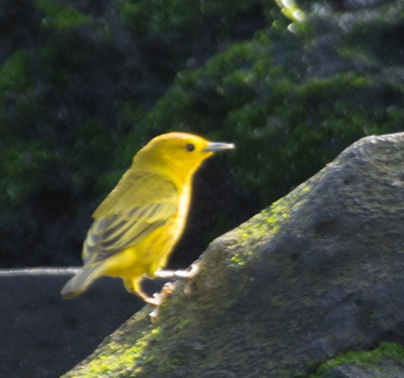
The Finches : Darwin’s finches
Darwin’s finches
Bird
Darwin’s finches are a group of about fifteen species of passerine birds. They are often classified as the subfamily Geospizinae or tribe Geospizini. They belong to the tanager family and are not closely related to the true finches. Wikipedia
Kicker Rock (a.k.a. Leon Dormido), a vertical tuff cone formation that juts up nearly 500 feet from the sea.
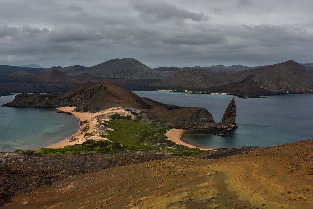
The view from the summit of Bartolome Island
Area: 17,375 mi²
Population: 25,000 (2010)
Capital: Puerto Baquerizo Moreno
Galapagos is located on the Nazca tectonic plate. This perpetually moving plate is heading eastward over the Galapagos hot spot and has formed the chain of islands. The islands were formed through the layering and lifting of repeated volcanic action. This geographic movement is correlated to the age of the islands, as the eastern islands (San Cristóbal and Española) are millions of years older than the western islands (Isabela and Fernandina).
Most of the islands have a distinctive conical shape that is often associated with volcanic action. The mountainous islands have been formed through continuing eruption, building layer upon layer. Due to this volcanic formation, the islands are characterized by many steep slopes, with heights ranging from a few meters above sea level to more than 5000 feet above sea level.
Each major island, with the exception of the largest island, Isabela, consists of a single large volcano. Isabela was formed when six volcanoes joined above sea level. Geologically, the Galapagos Islands are quite young, probably no more than five million years old. Some of the westernmost islands, which are the most volcanically active, may only be hundreds of thousands of years old and are still being formed today.
www.galapagos.com
https://en.wikipedia.org/wiki/Galápagos_Islands


]
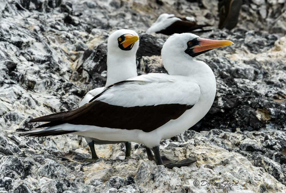
[caption id="attachment_4671" align="alignright" width="300"]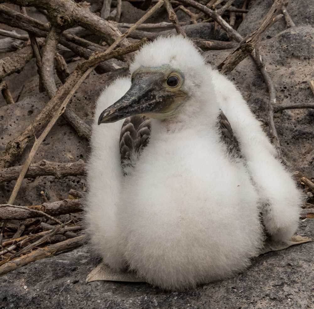 Baby-Nasca-Boobie
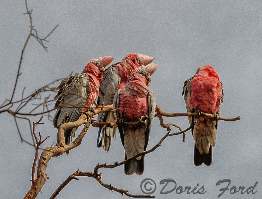
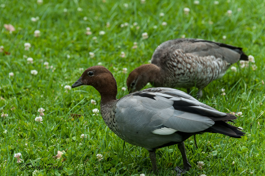
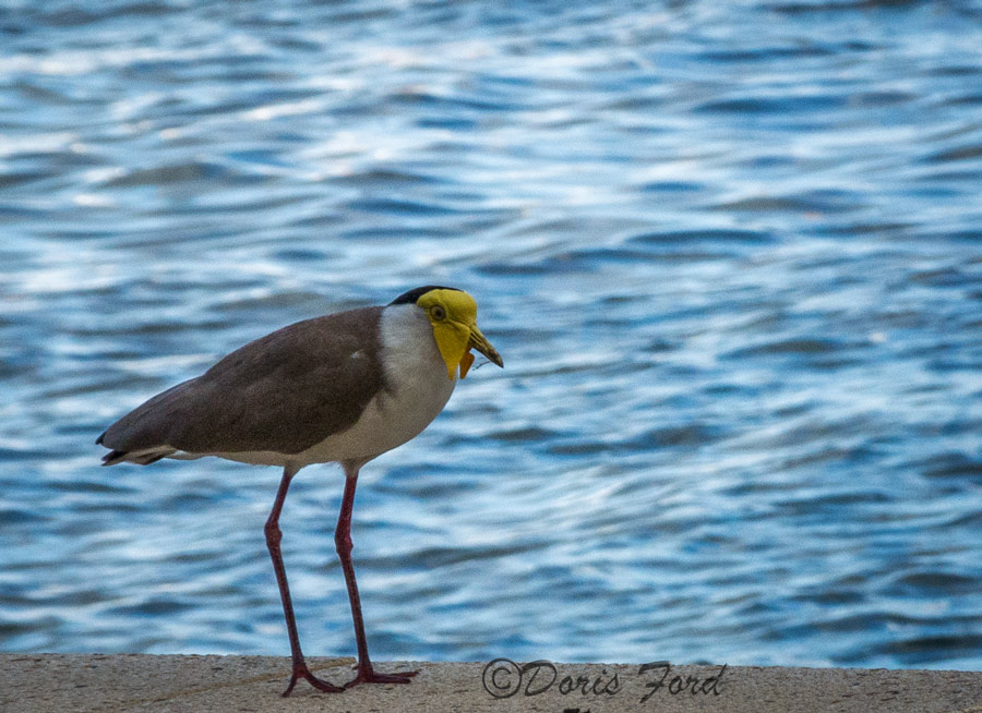
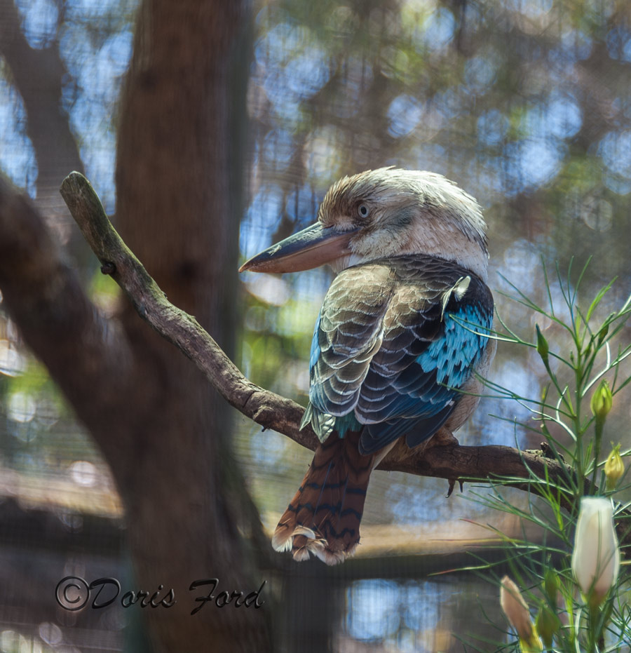
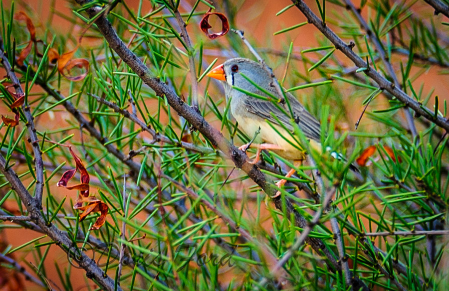
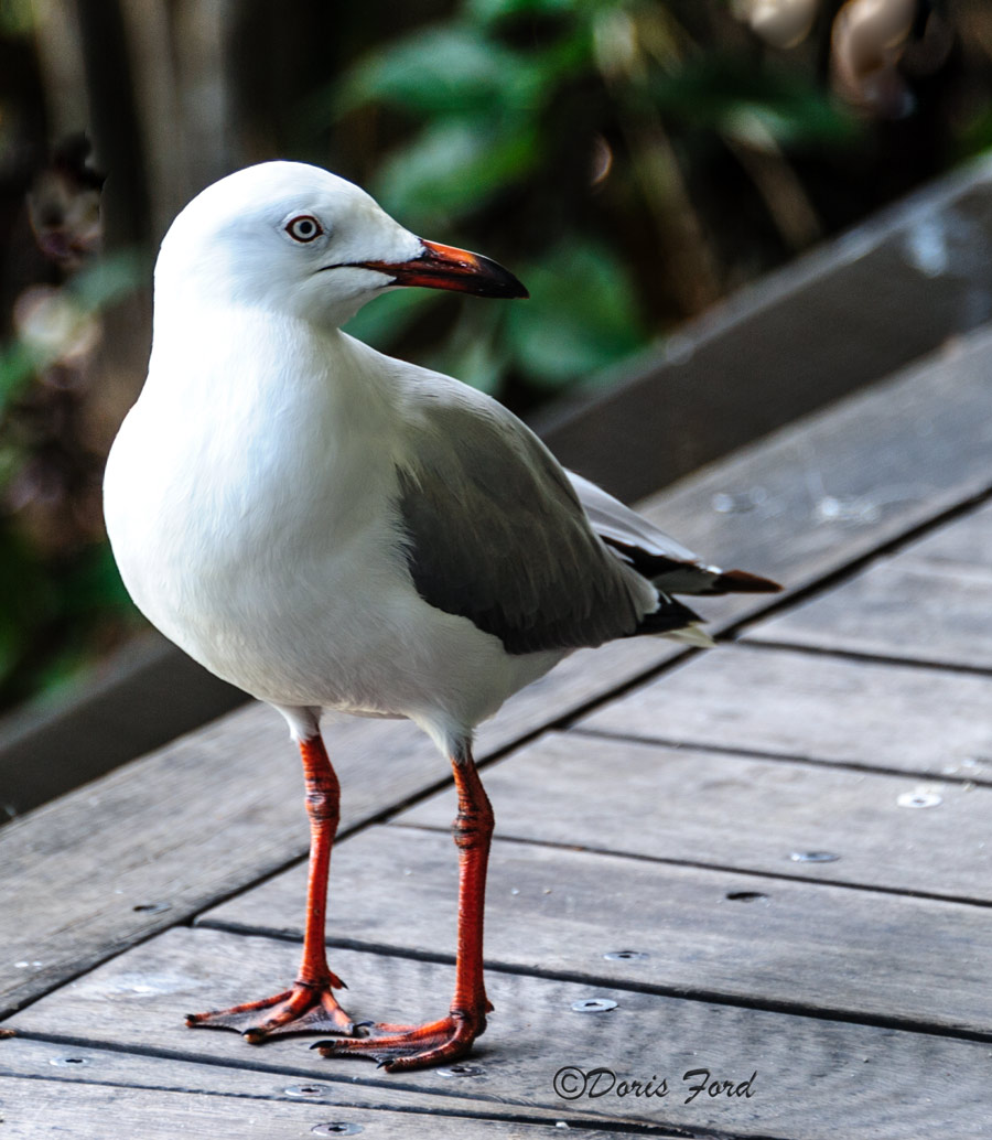
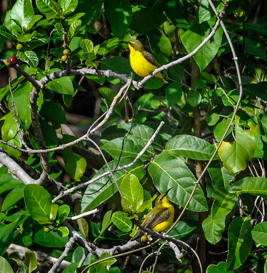
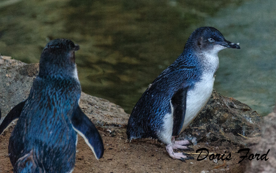
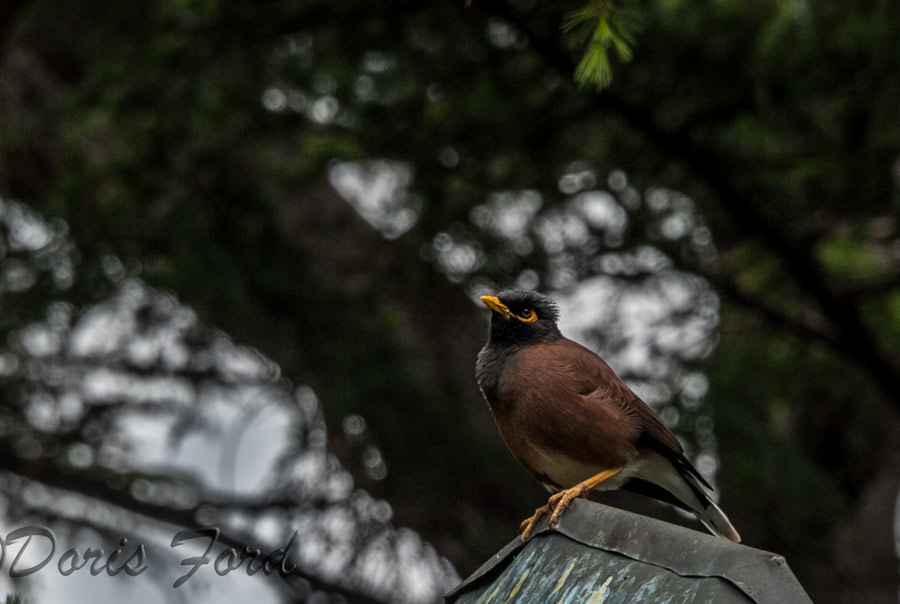
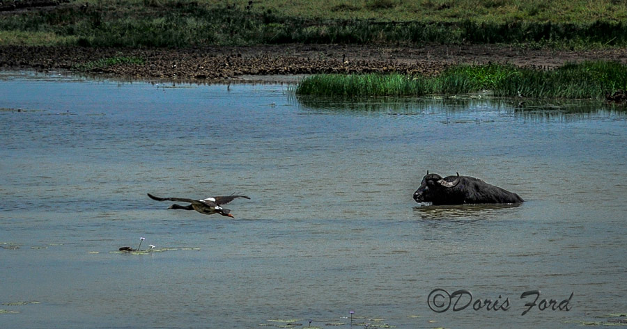
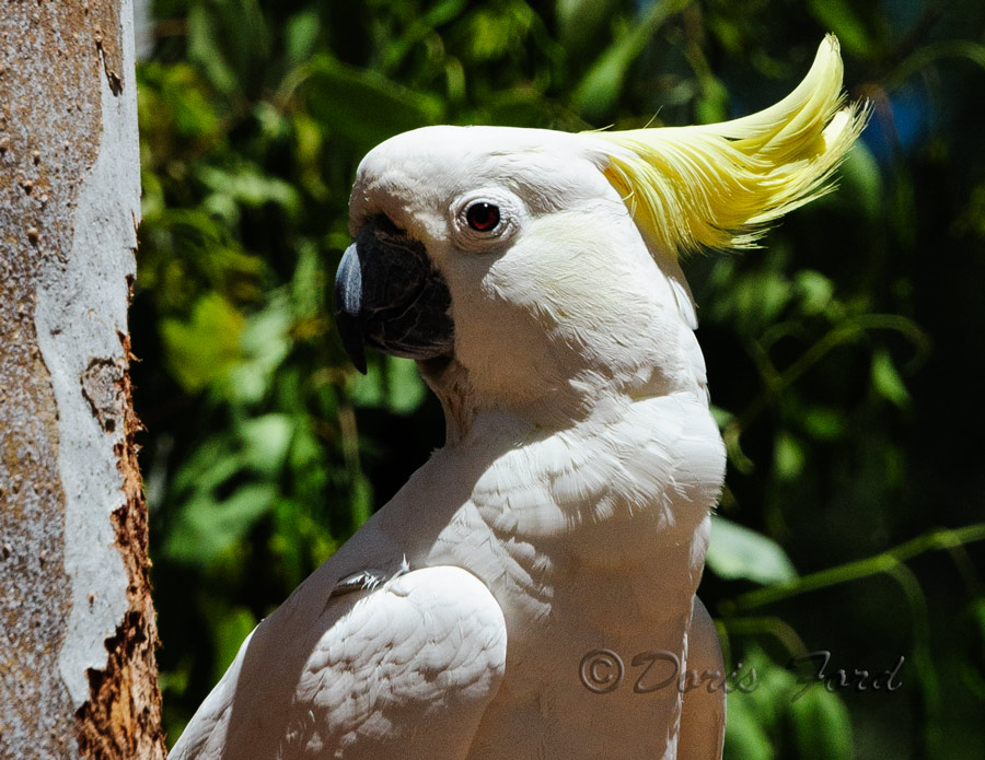
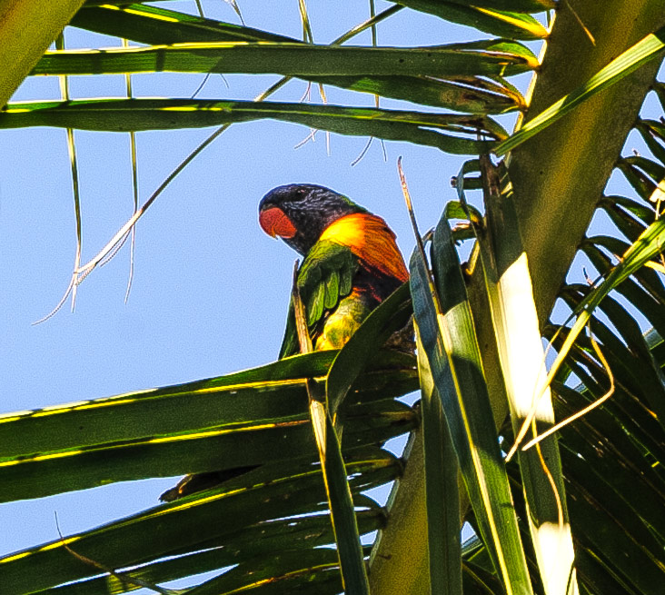
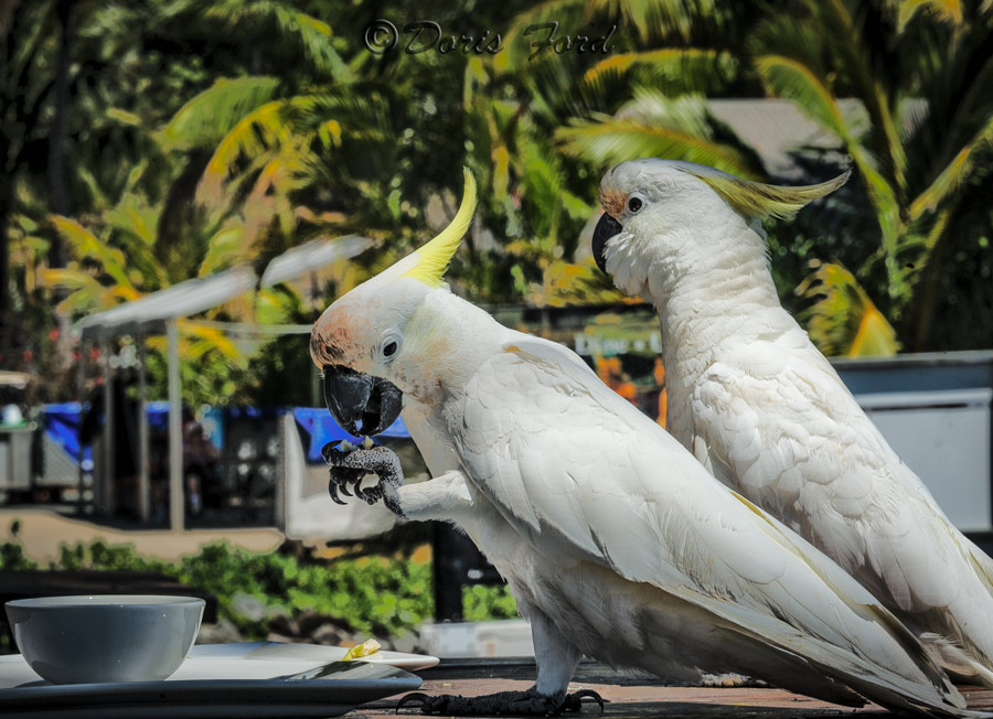
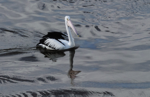
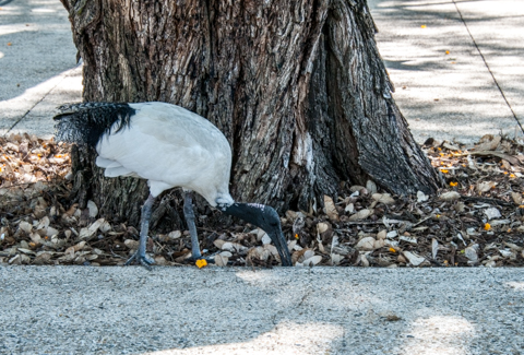
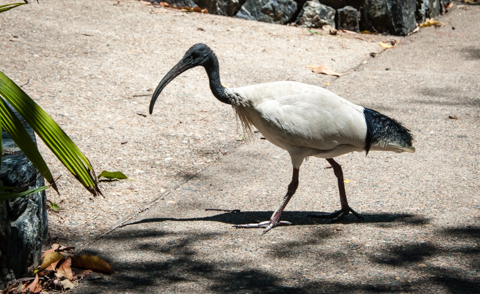
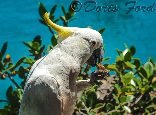
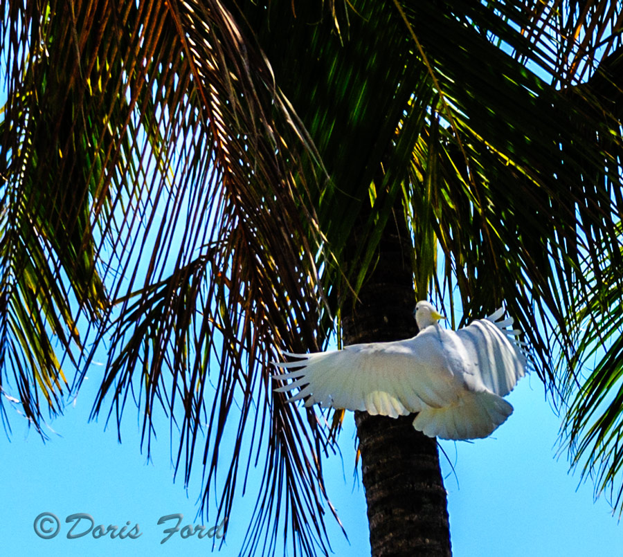
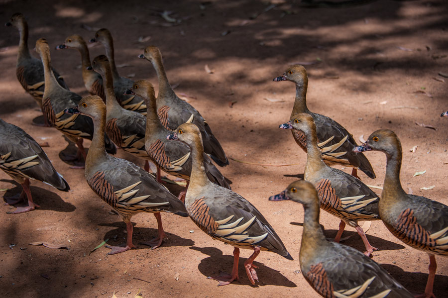
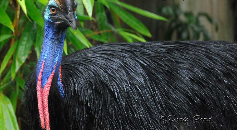
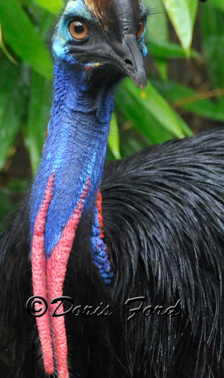
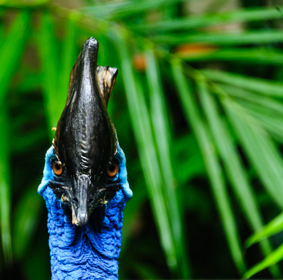
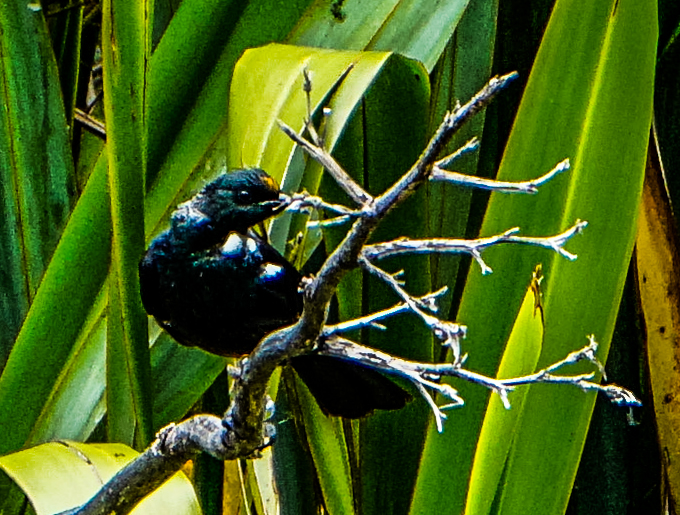
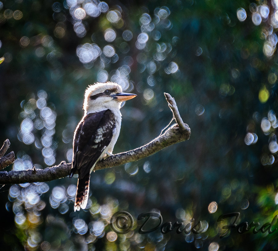
Birds of Australia
Please enjoy viewing Kookaburras, Tawney frog mouth, black and white pelicans, pink Galahs, cockatoos (as pests) lorikeets, white ibis, penguins,and other interesting birds. The fairy Penguins are also called Blue Penguins, and they actually have a blue look to their fur. They are the smallest penguins in the World. The Kookaburras were very exciting for me to see and hear. I heard them first, and actually recognized the “laugh”,then later saw several pairs flying around quite close to where we were in Yanchep National Park. The pink Galahs were also a delight to see, but we did get a bit tired of them as they are very noisy. I had never seen nor heard of a bird called the tawney frogmouth, so another new Australian experience. It is often mistakenly thought to be a type of owl and is found throughout Australia mainland and Tasmania. Luckily we did not meet any cassowaries in the wild, but as we walked through the rainforest we kept a look out!