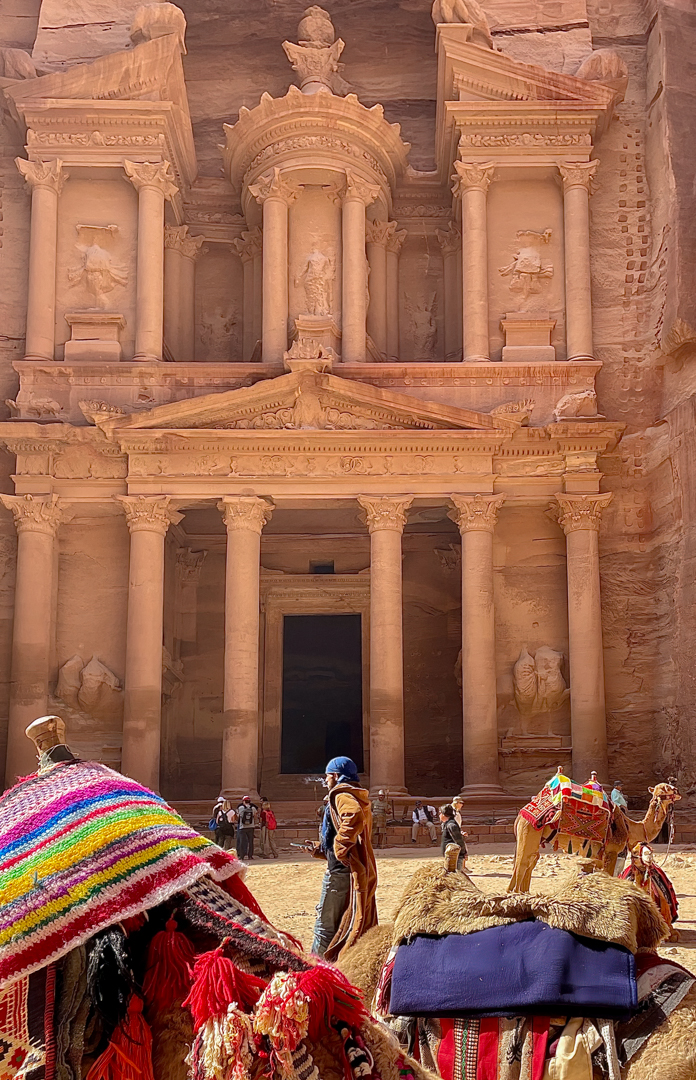
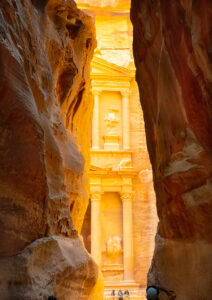
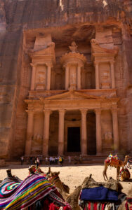
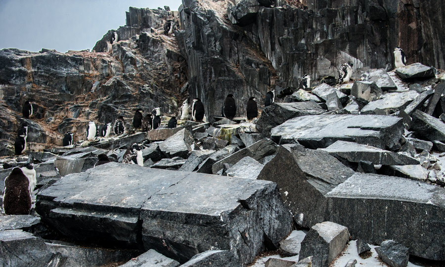
Petra Jordan, an historic and archaeological site in southern Jordan, dating to around 300 B.C. Photos of the Treasury, and the first view After walking down the canyon to the first view called Al Siq. It is thought that the Nabataeans might have settled as early as the 4th century BC Petra fell to the Romans in 106 AD.
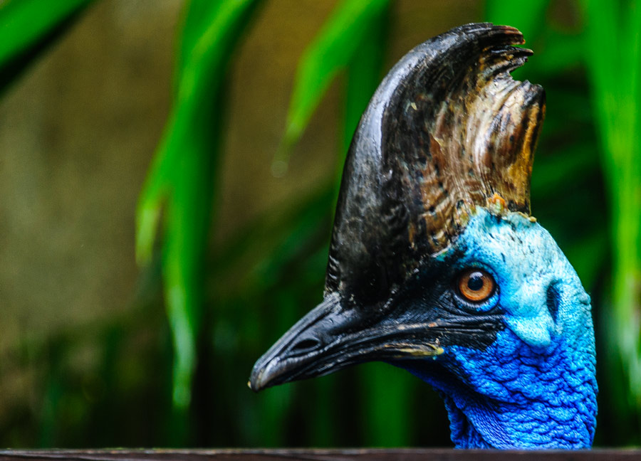
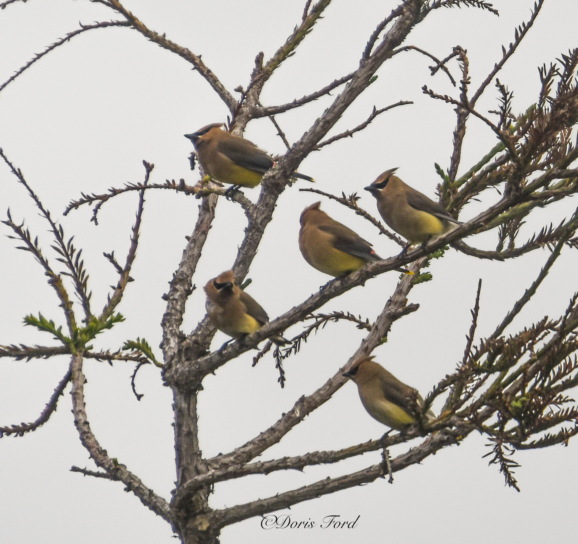
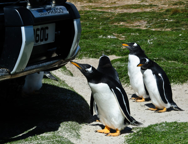
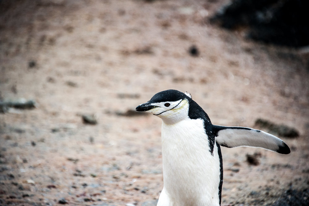
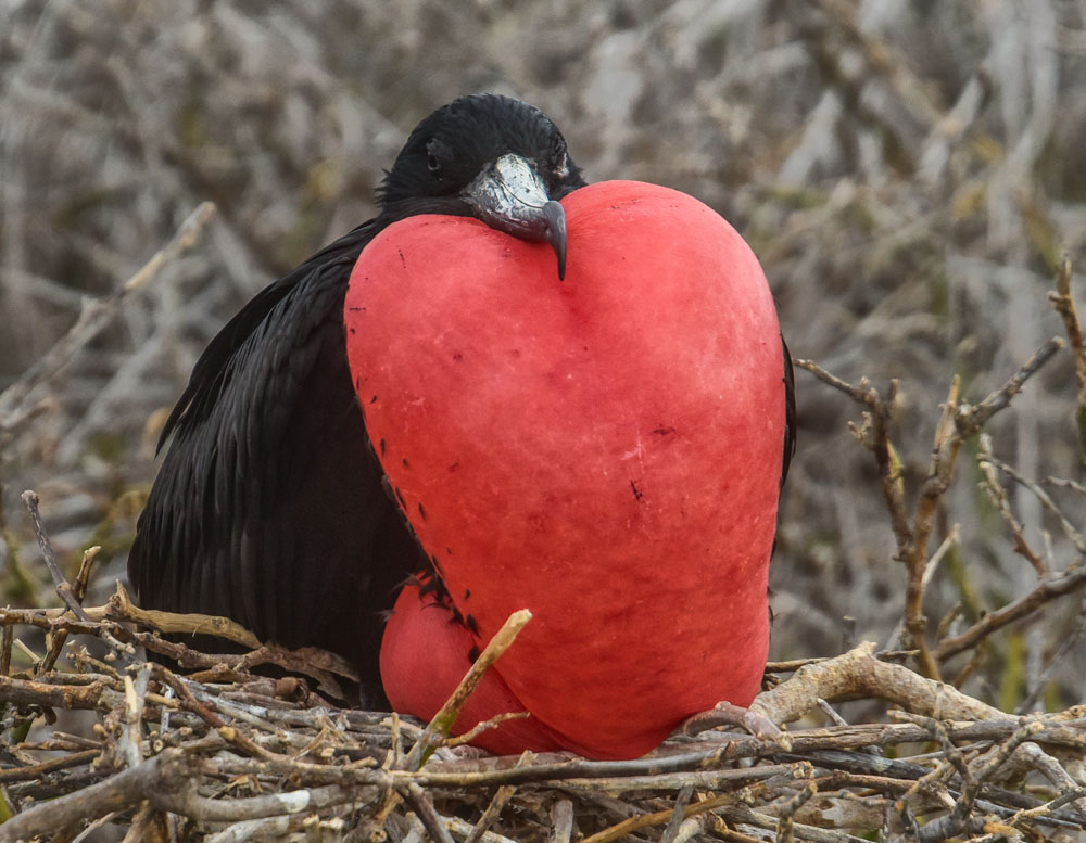
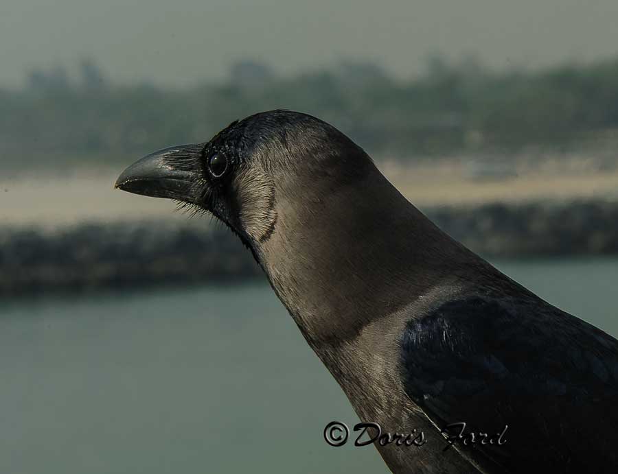
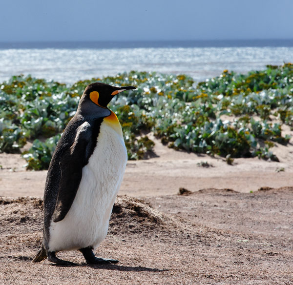
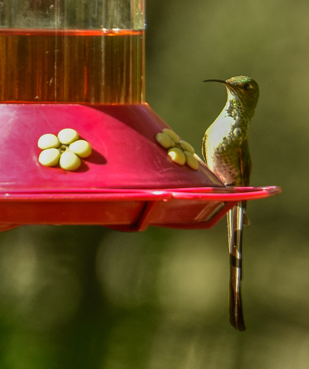
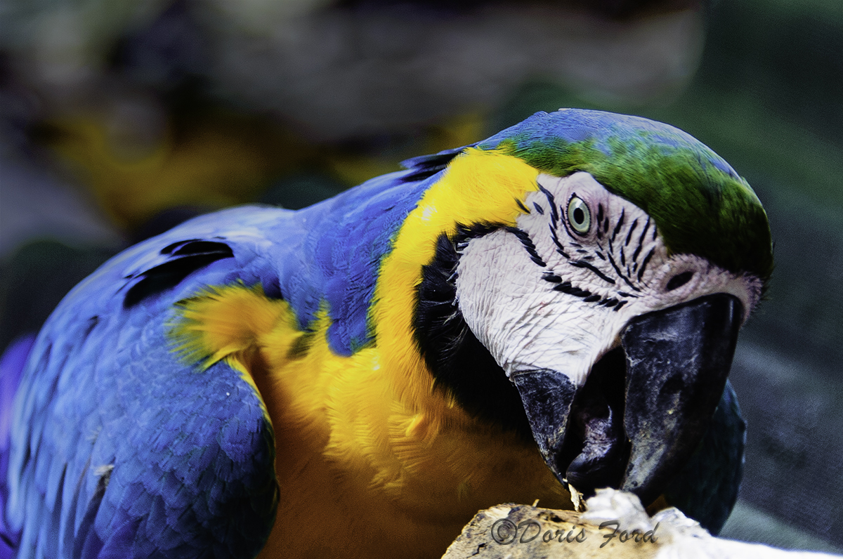
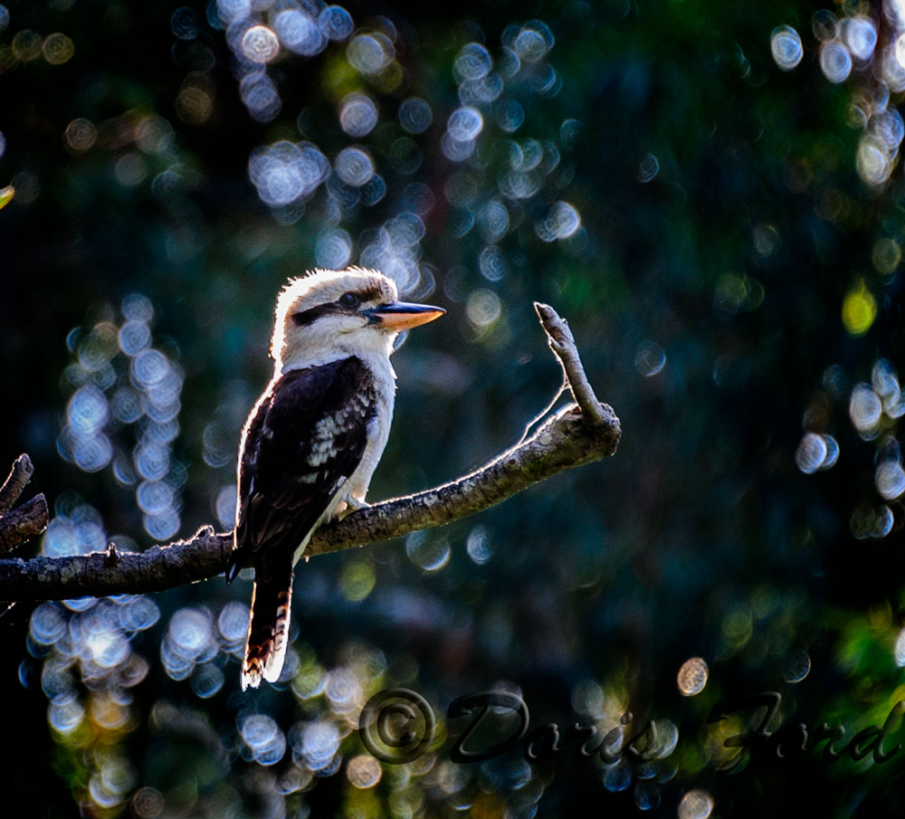
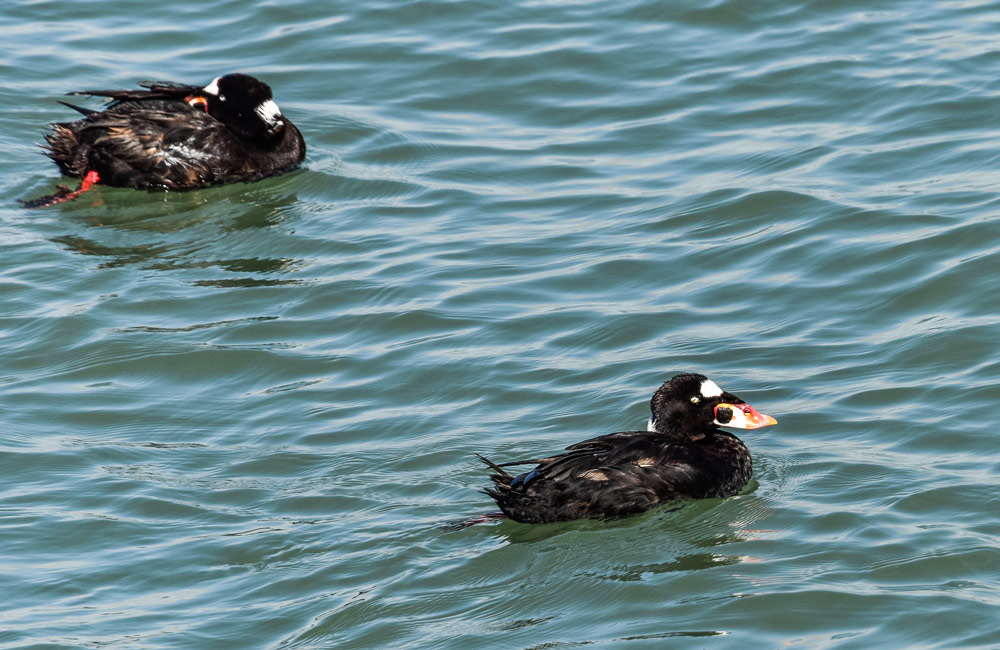
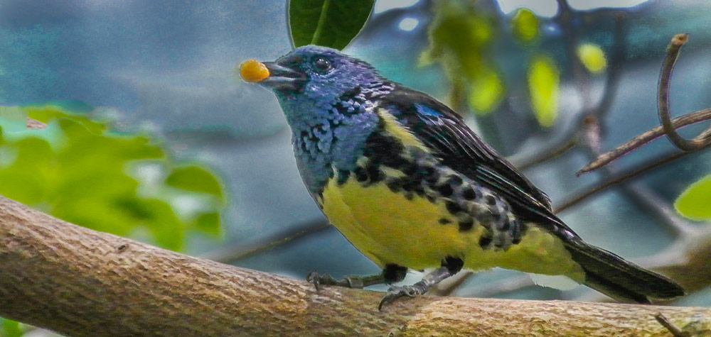
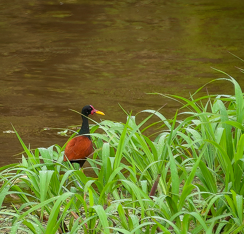
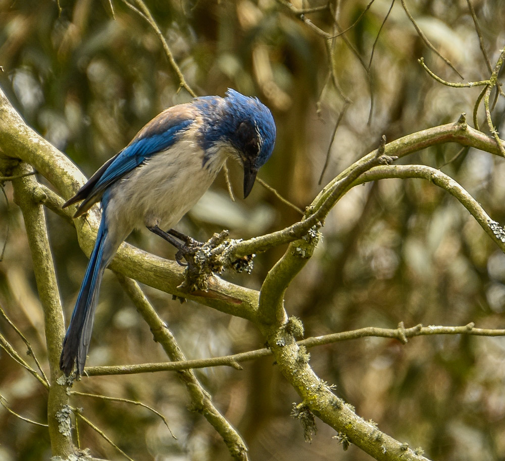
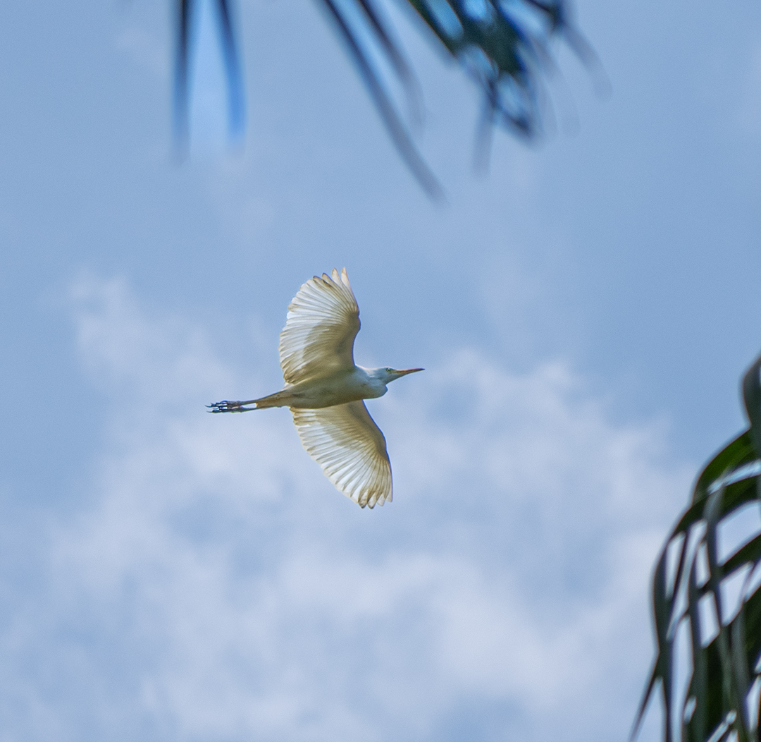
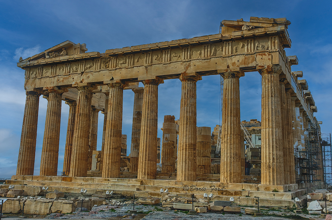
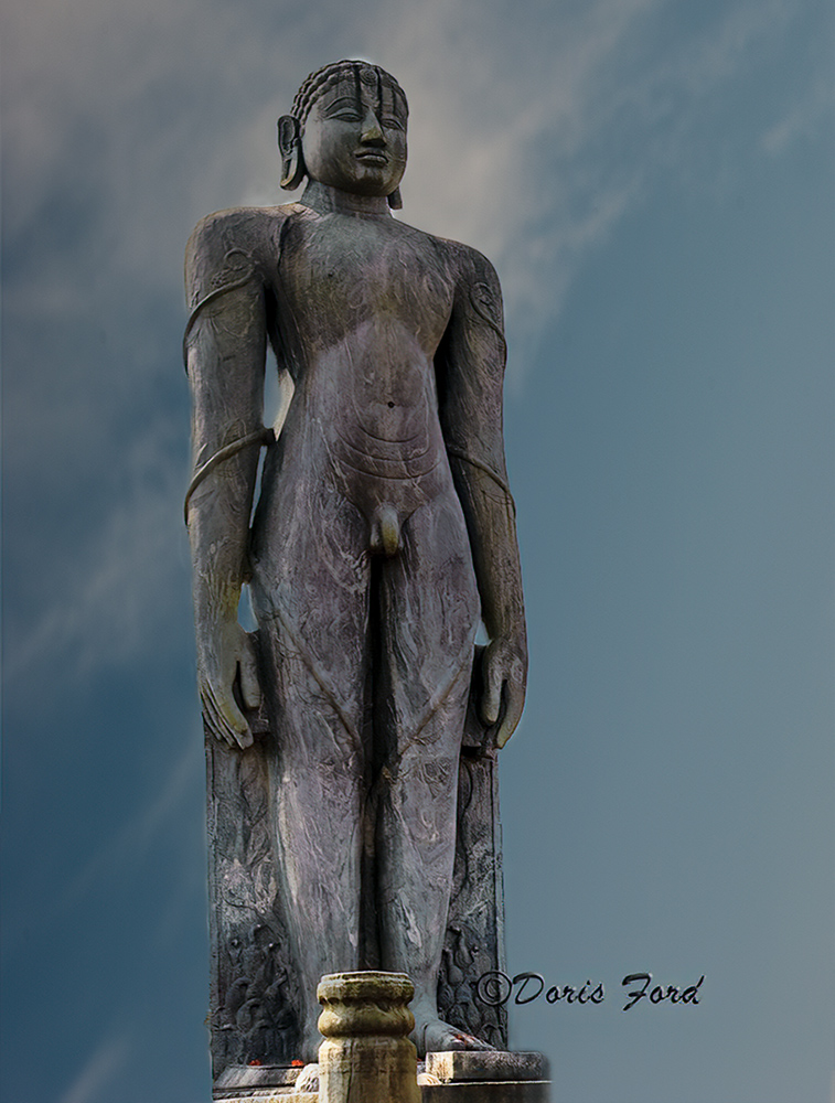
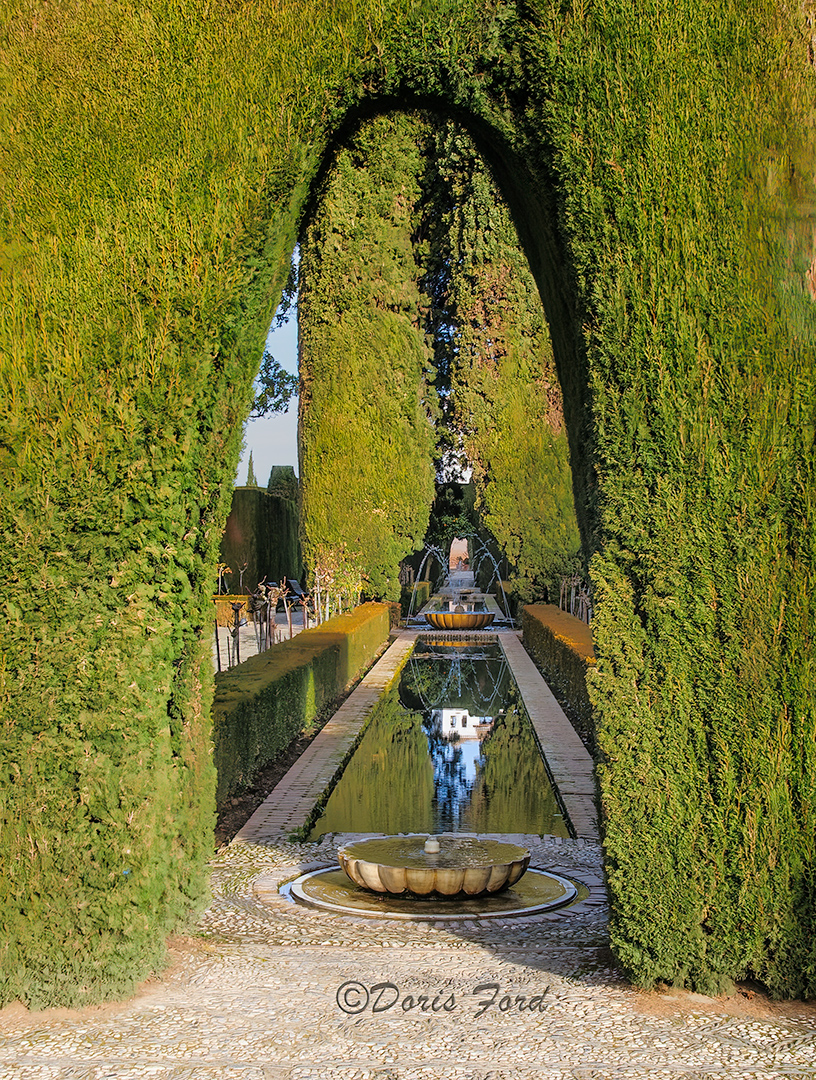
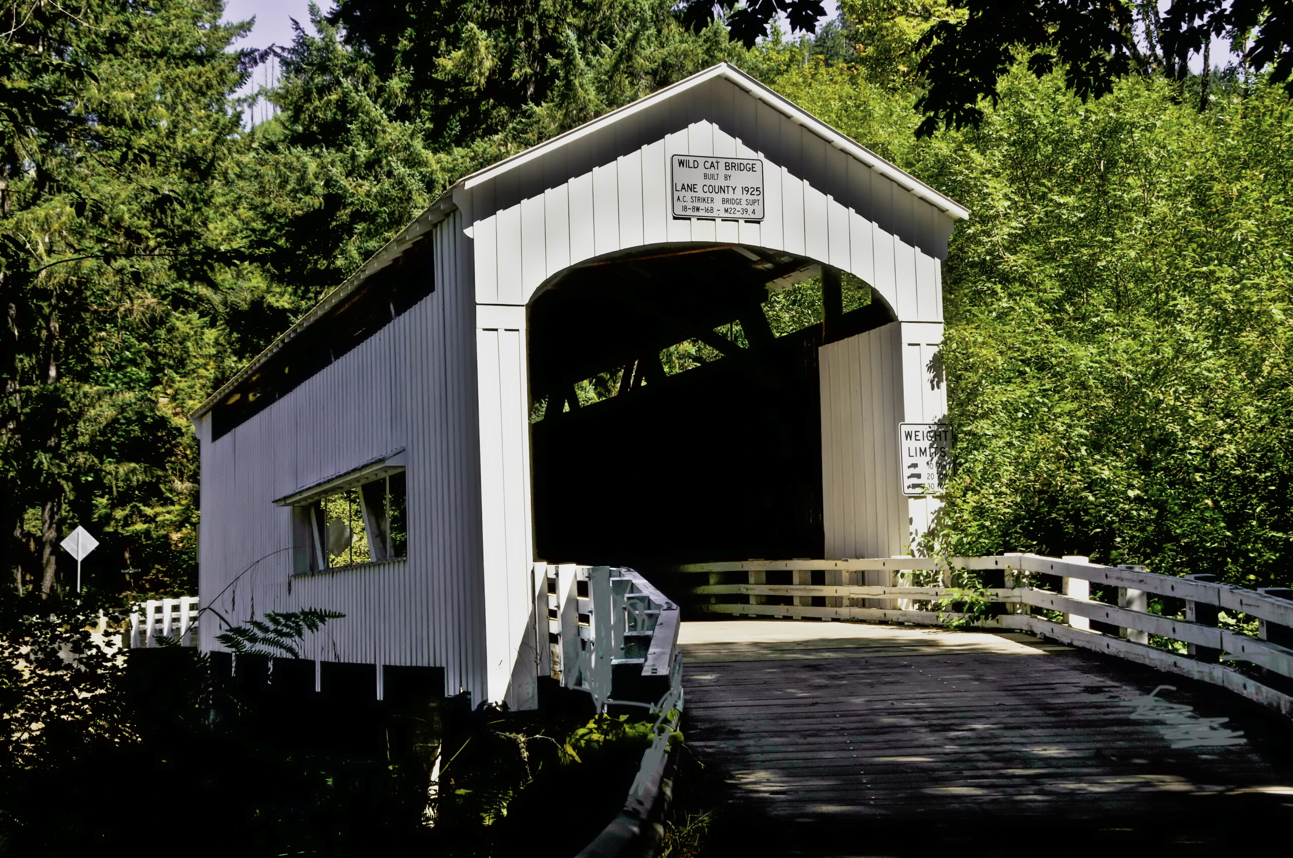
For the month of September I plan to publish a different photo every day on Instagram and invite everyone to comment where the photo was taken. These are some of the photos that I will be featuring! Come along and join the fun and guess with the others! Some of these photos have been published before on; https://FordsFotos.net. Check them out to help you guess! You are invited to comment on this site or email me at Doris@FordsFotos.net The first is a freebie- Have fun!
Did you have fun identifying where the photos were taken?
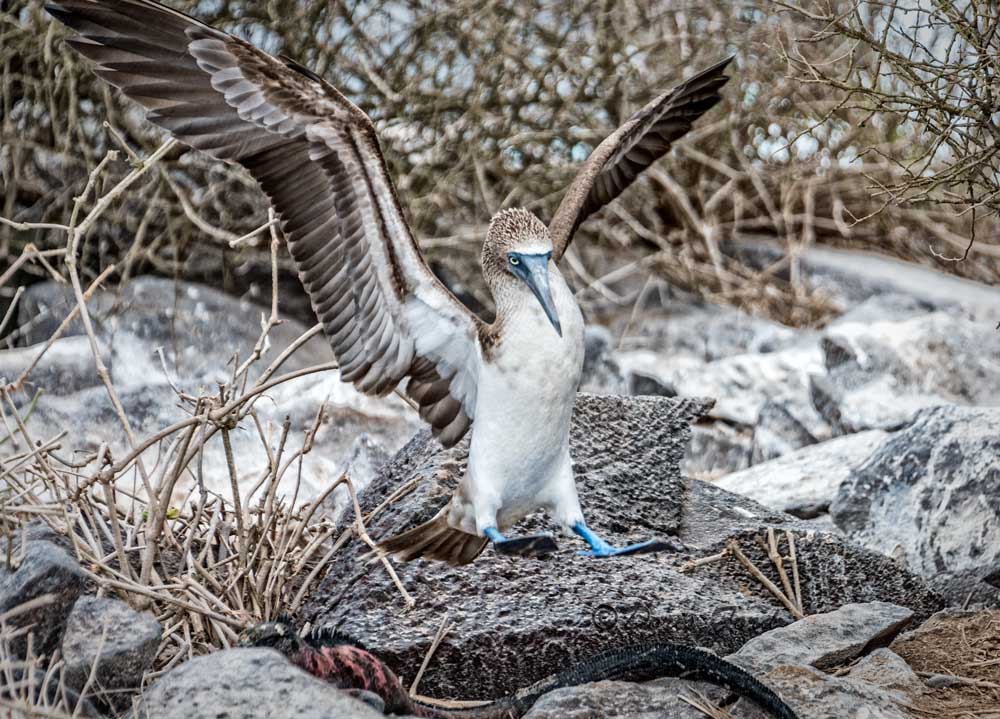
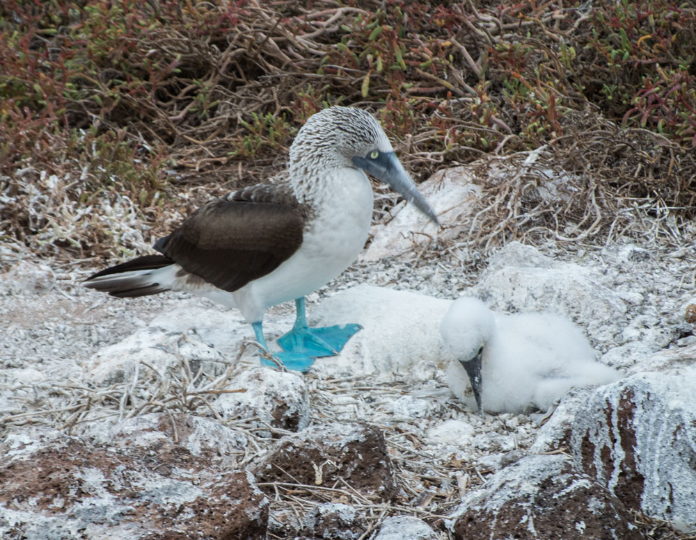
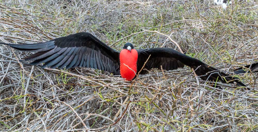
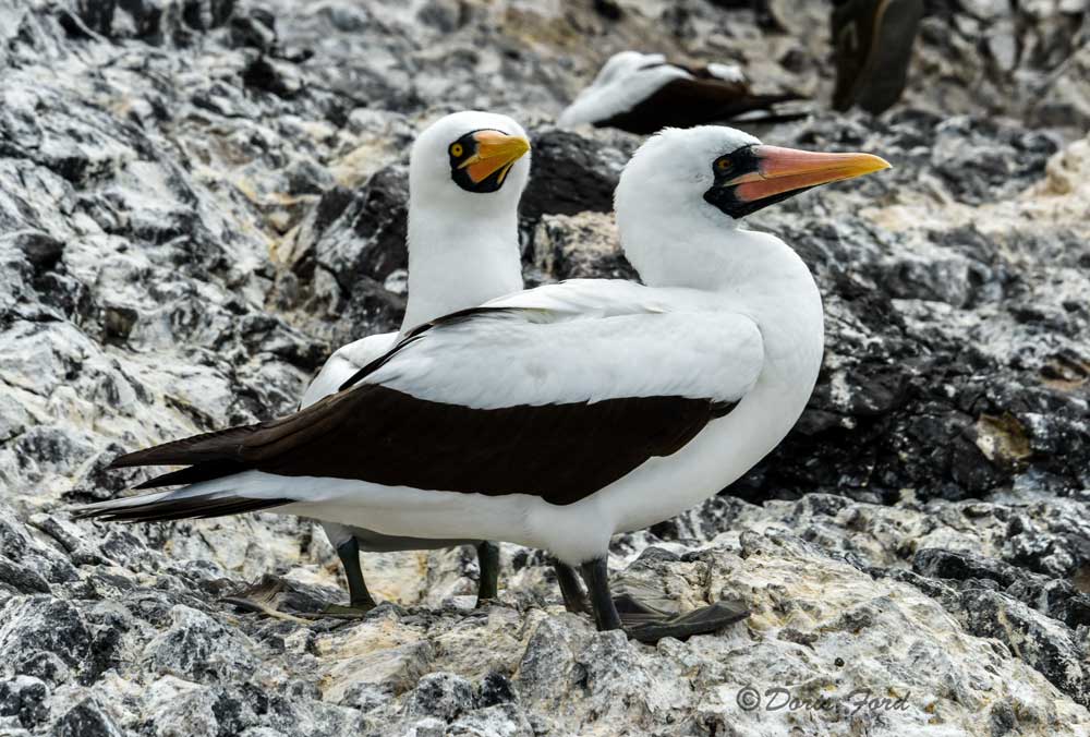
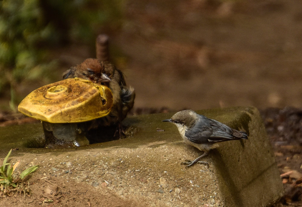
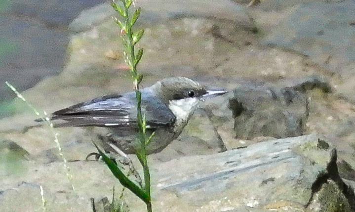
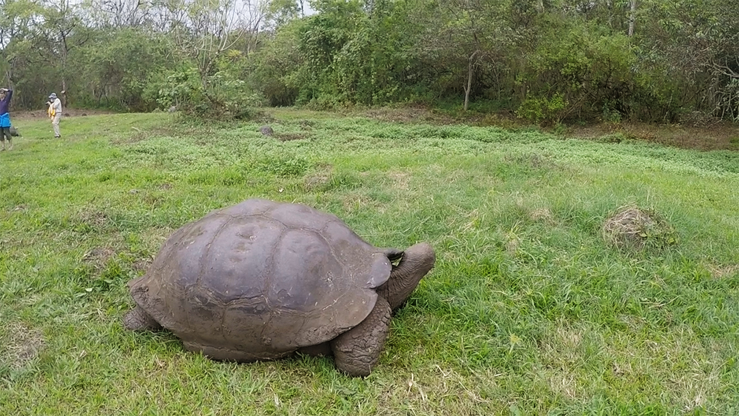
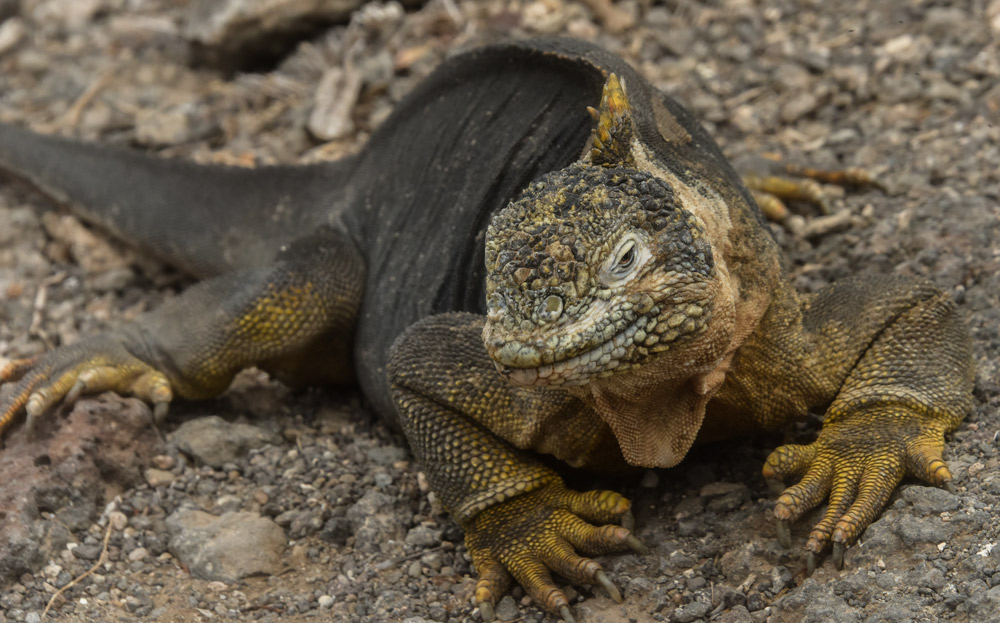
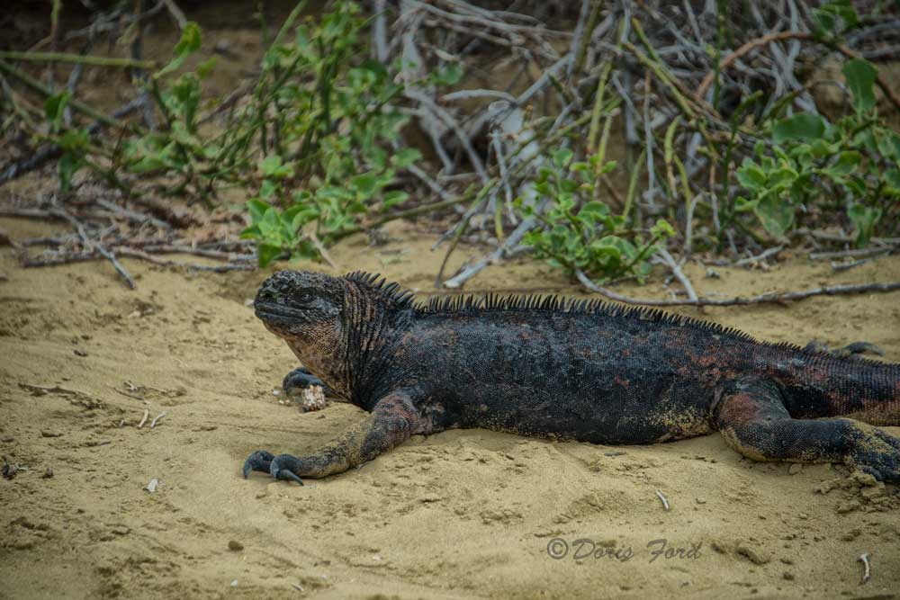
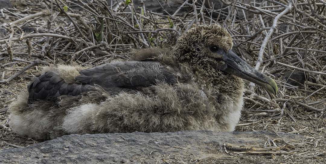
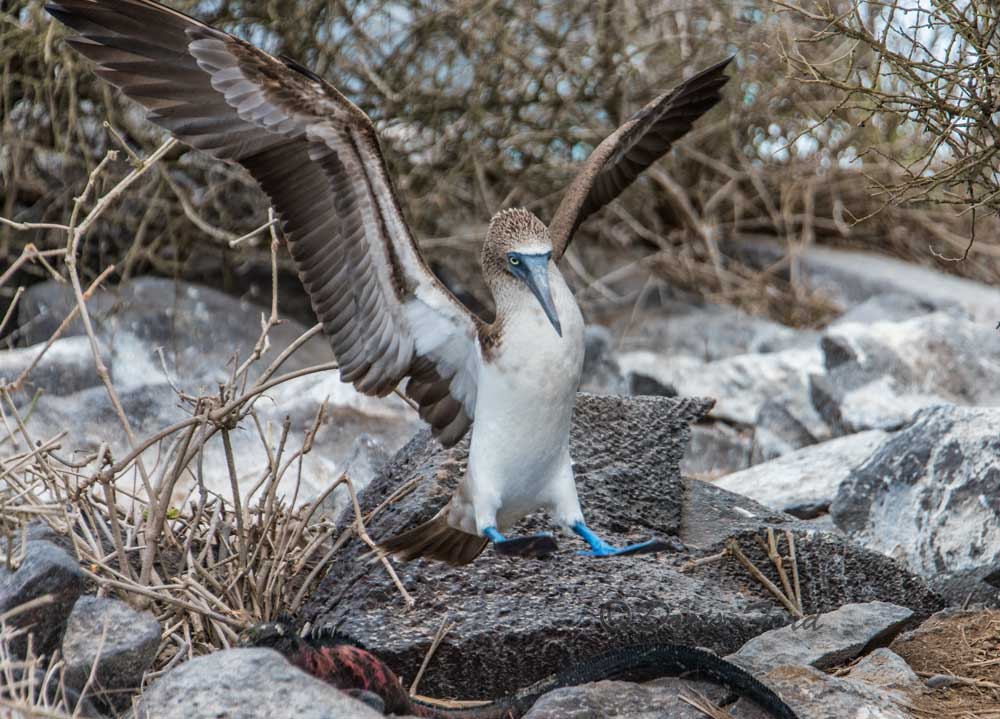
Galapagos Tortoise eating grassLand-IguanaSea IguanaBaby BirdSea iguana with Blue backBlue-Footed-Booby wings up and can you see the iguana?Blue Footed Booby and a chick
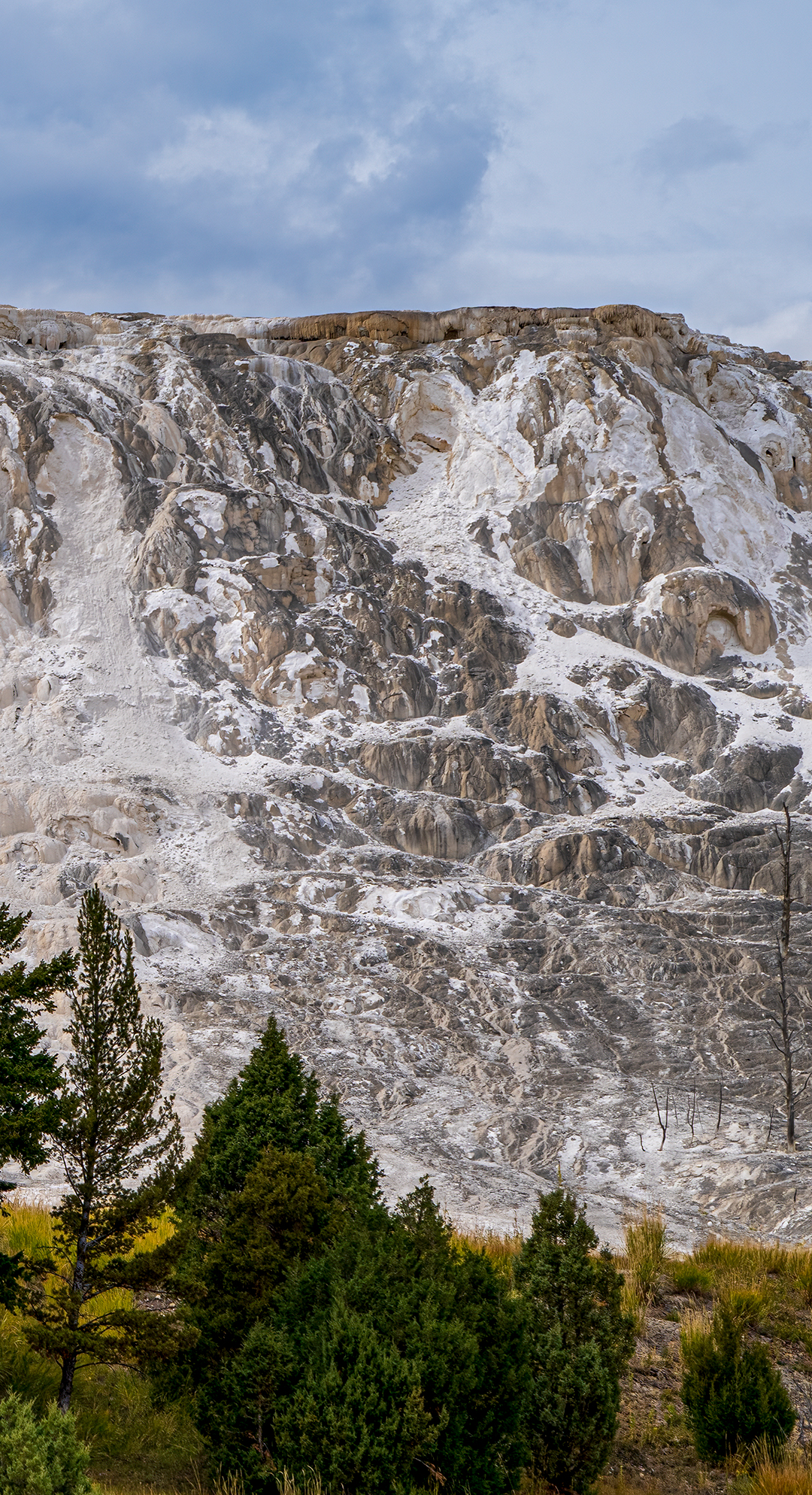
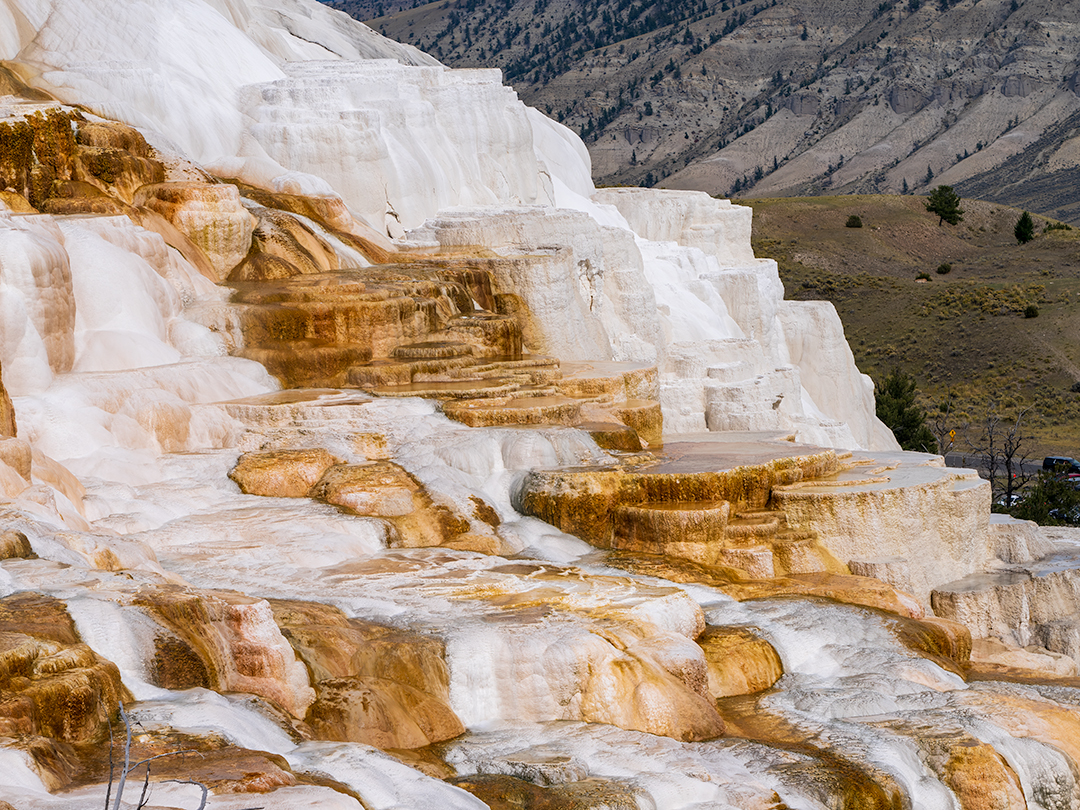
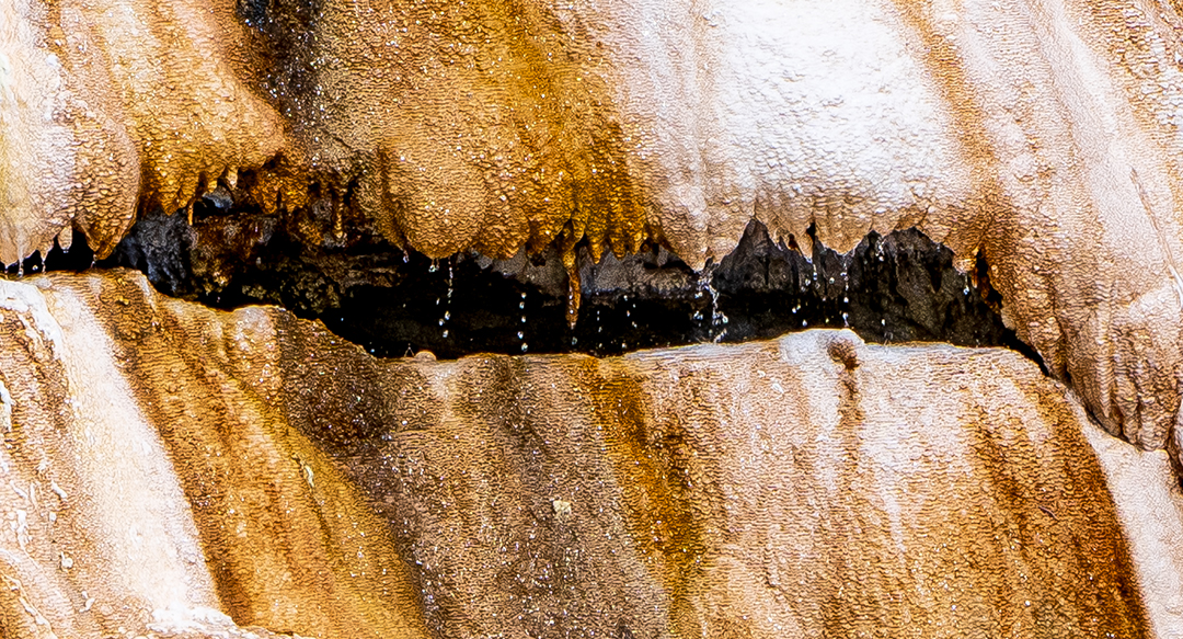
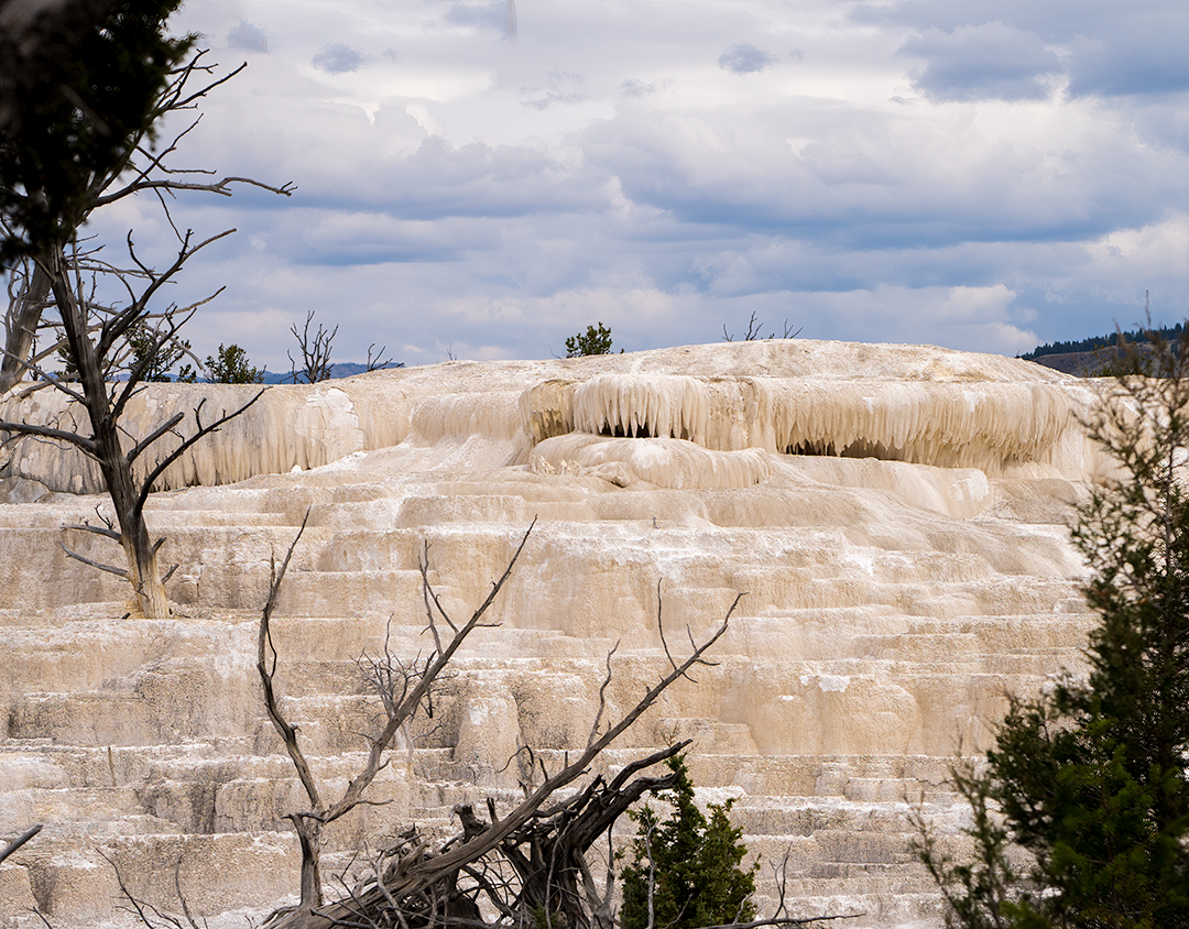
The Mammoth Springs Travertine area of Yellowstone is in the Northern area of the Park. I don’t know if this area is open yet since the floods closed this area of Yellowstone. As you can see the springs look a bit different than other areas of the Park. Just a few photos showing active as well as springs not active at this time. Note the beautiful colors from the minerals. calcium, magnesium, bicarbonate and sulfate. The chemical properties of this area is different then the alkaline-chloride waters of Old Faithful.
An limestone area of Mammoth Hot Springs that looks like the Spring is no longer flowing.
An active area of the Springs as the hot water trickles down the terraces forming puddles in some areas and beautiful colors from the minerals.
A close-up of an area with the dripping hot springs. White terraces that look like layers of snow. This colored area as well as the white area of Mammoth Hot Springs cliff appears still flowing, but another area looks dead.
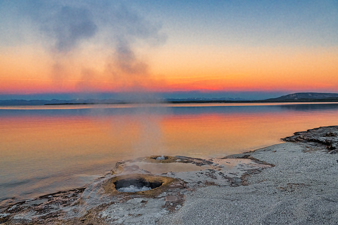
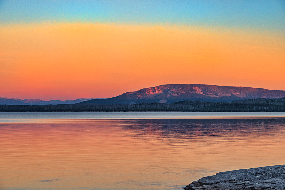
We visited Yellowstone National Park West Thumb Geyser Basin at Sunset, and watched in Awe as the colors of the sky and Yellowstone Lake changed. This small hot spring is called the Fishing Cone. The story goes that a fisherman was fishing nearby and his freshly caught fish got off the hook and fell into the hot spring. Yes he was subsequently boiled! Thus the label “Hook and Cook”! The fisherman and many other visitors have since performed this feat. A National magazine reported in 1903 that no visit to the park was complete without this experience! Be careful if you decide to cook your fish this way,the geyser has occasionally erupted as high as 40 feet and some fisherman have been burned.
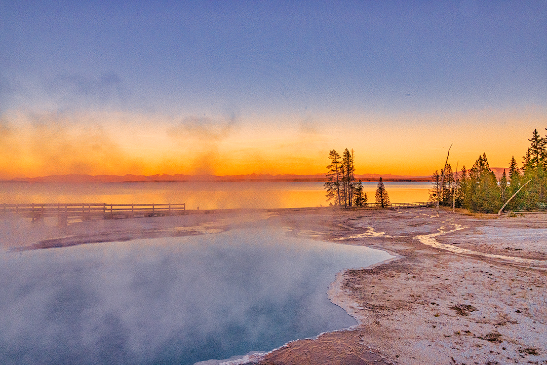
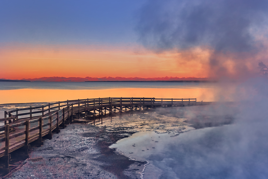
The two photos below are of the Abyss Spring at West Thumb Basin The bottom two feature scenes across the Lake to the mountains, with and without snow.
Arches is a very popular National Park in Utah. To avoid over crowding of the parking lots the Park often has to close for a few hours as early as 9:00am. We found the best time to visit was later in the afternoon and stay until after sundown. Better photography at the later hours! This is a small selection of the over 2000 natural sandstone arches as well as fin shapes and balanced rocks. Best to go in Spring or Fall to avoid the worst of the heat.
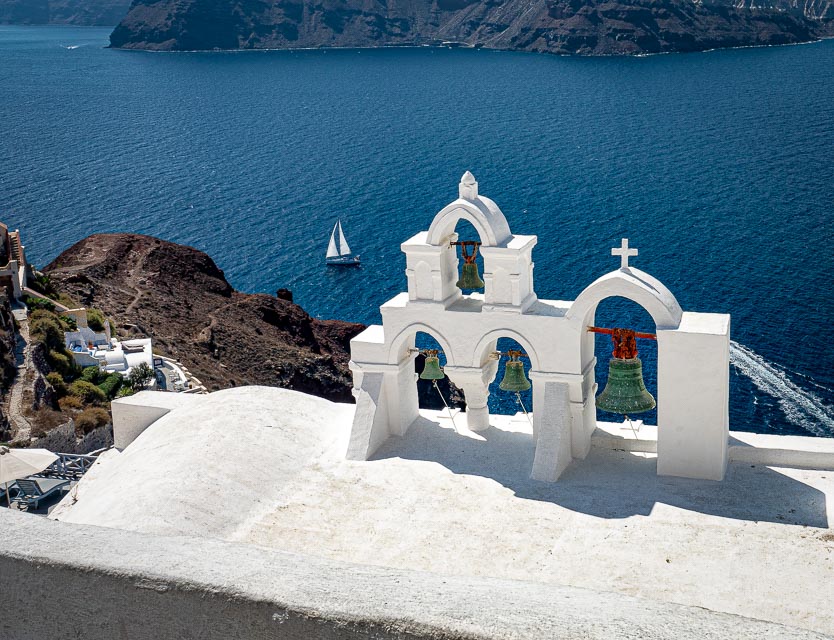
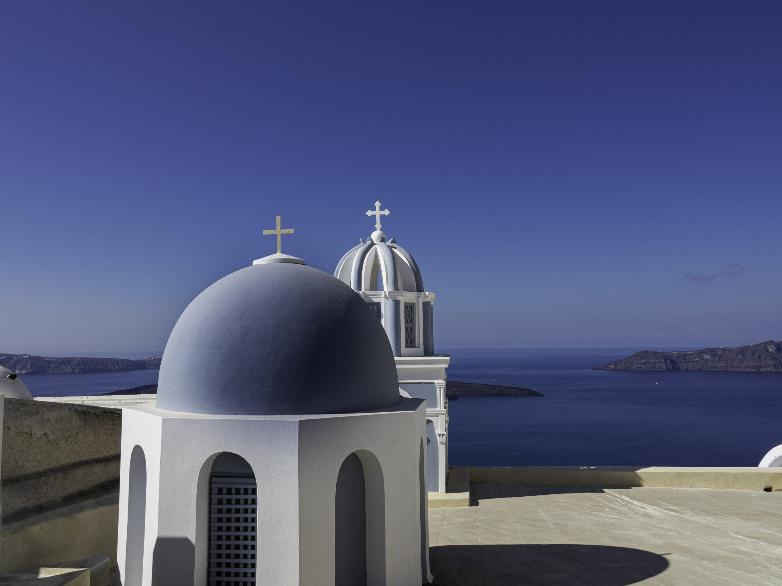
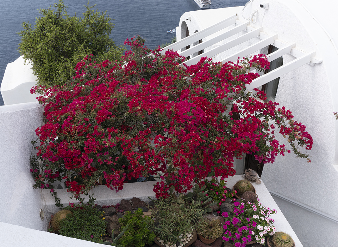
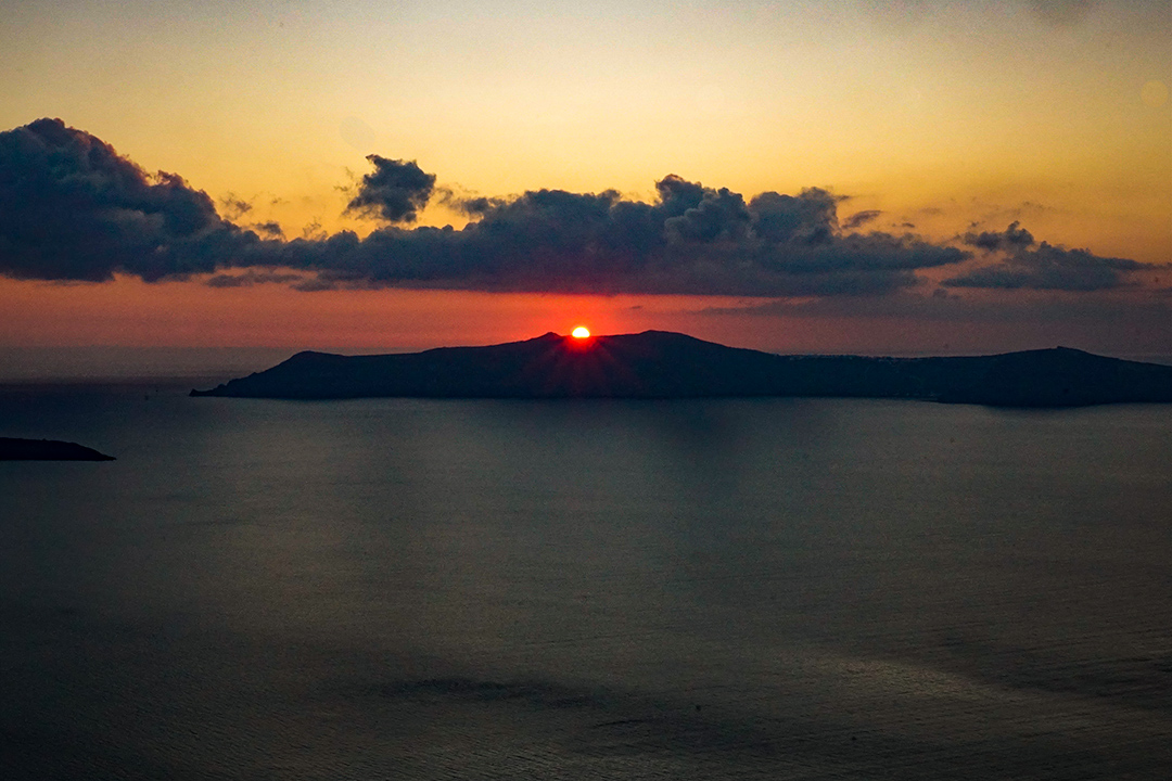
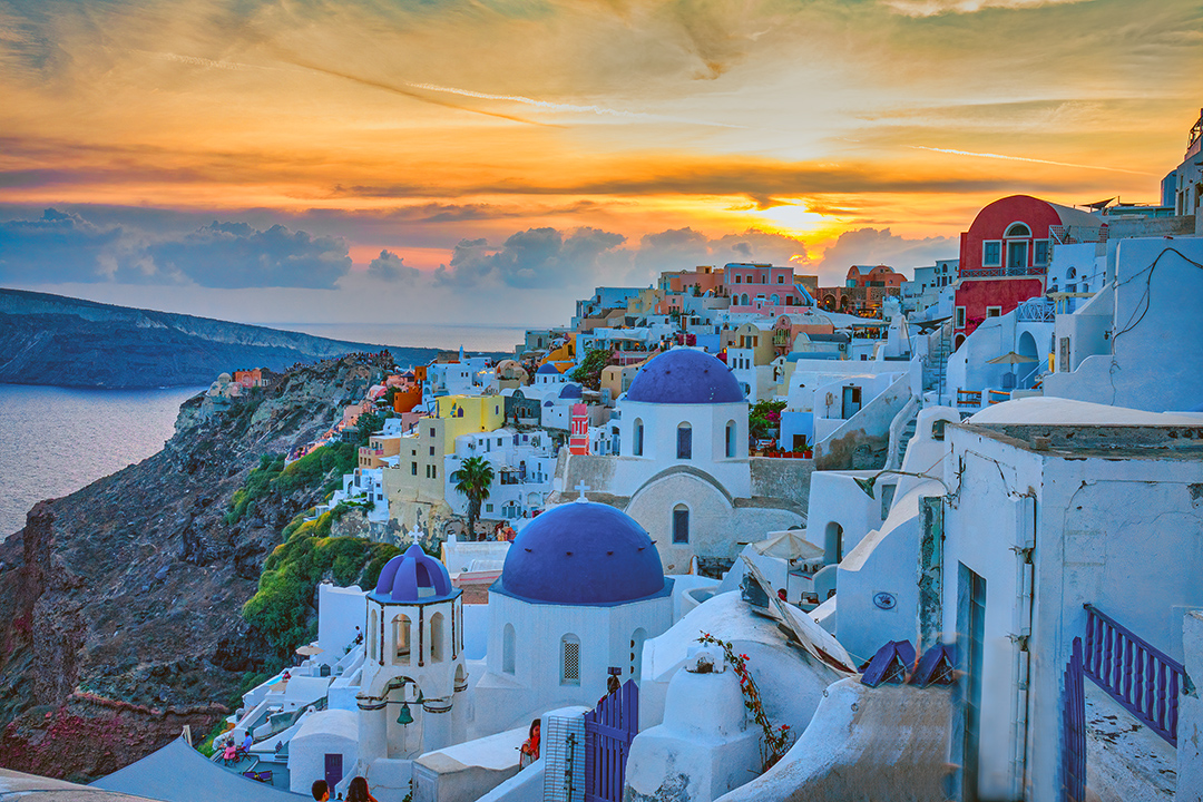
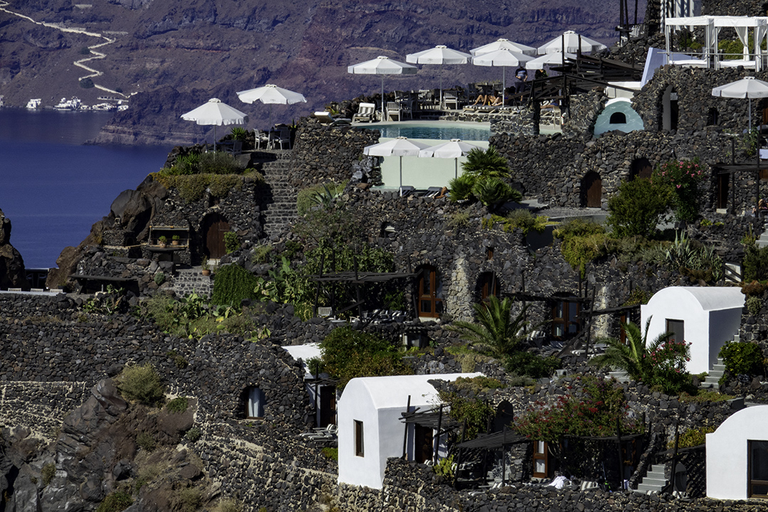
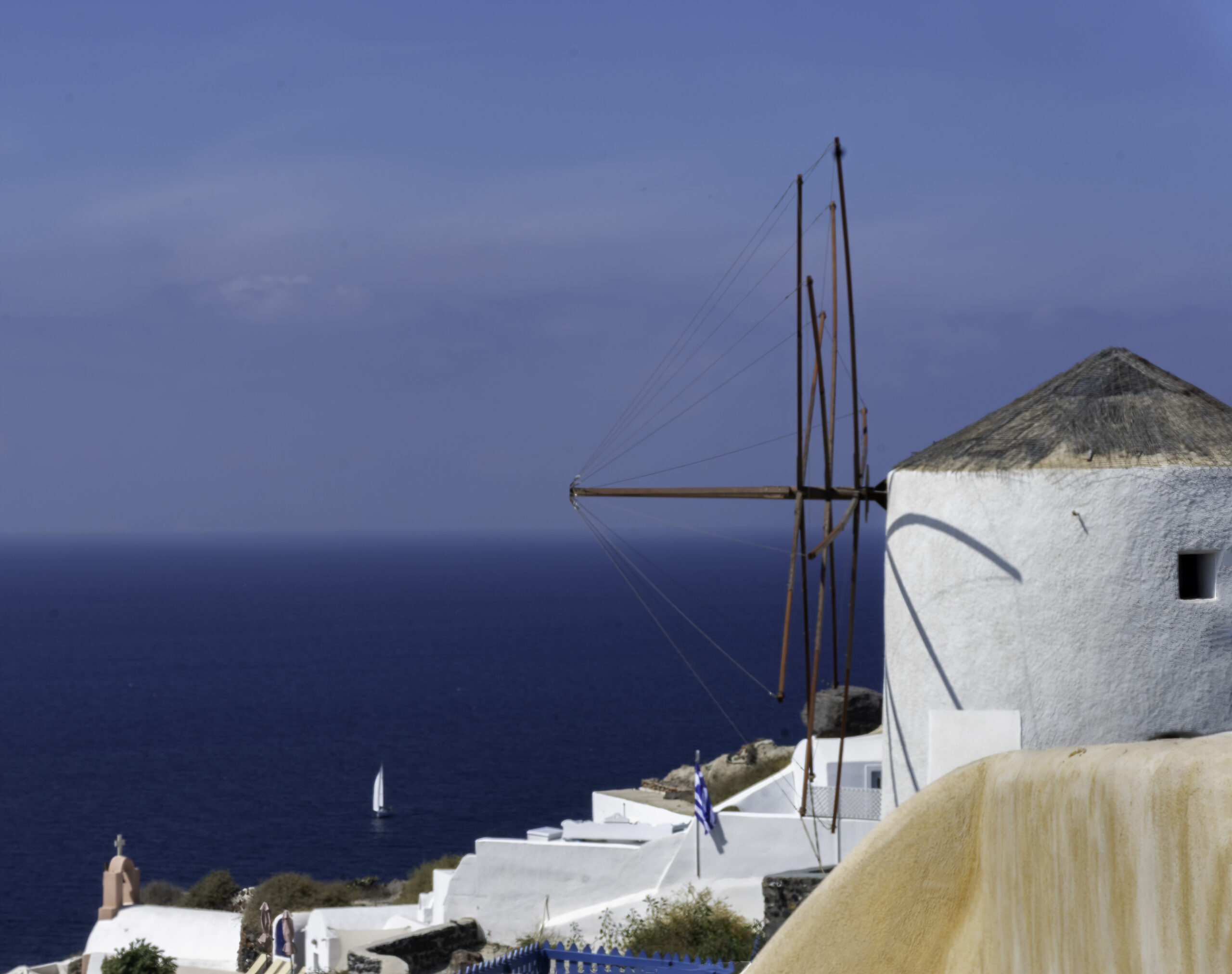
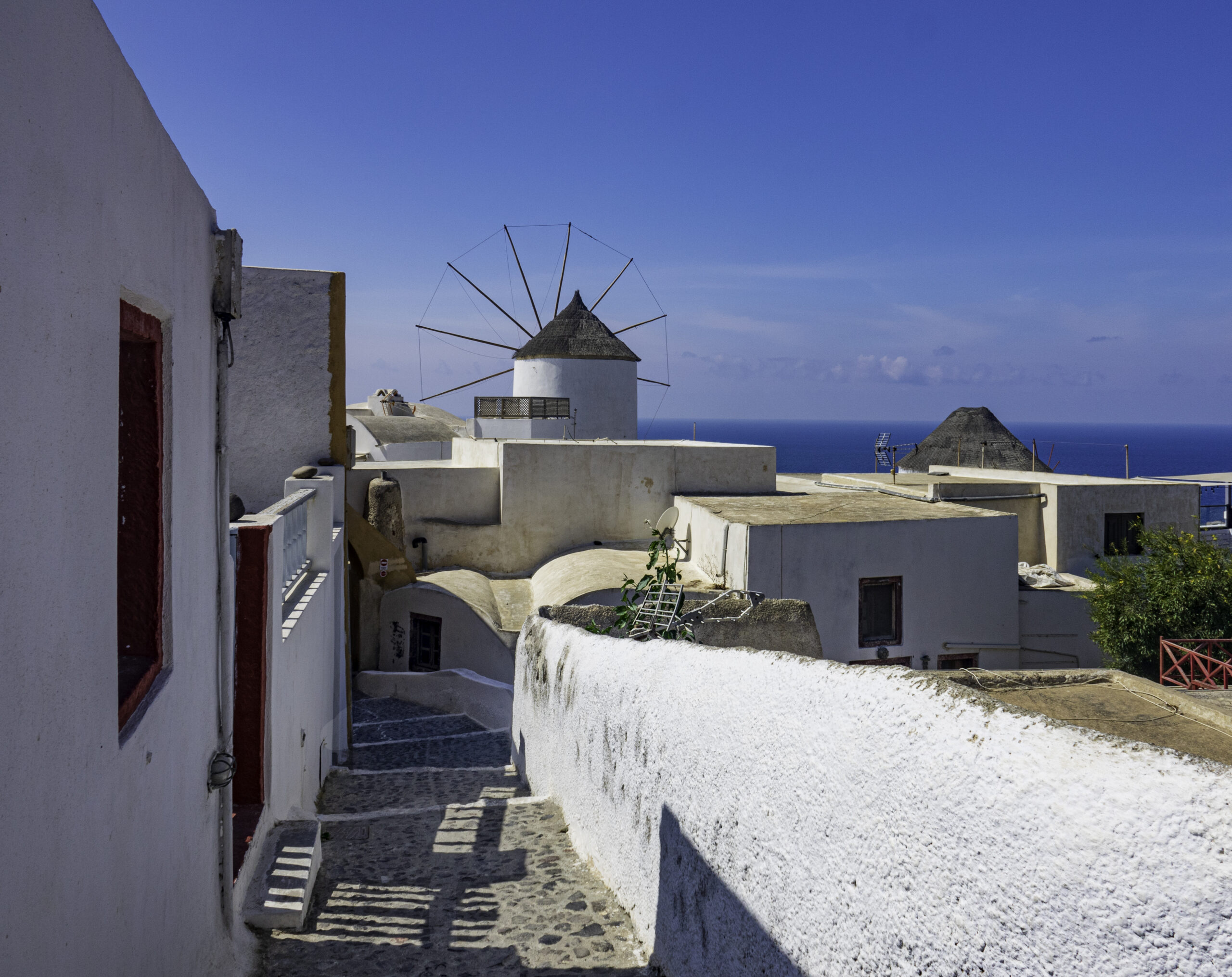
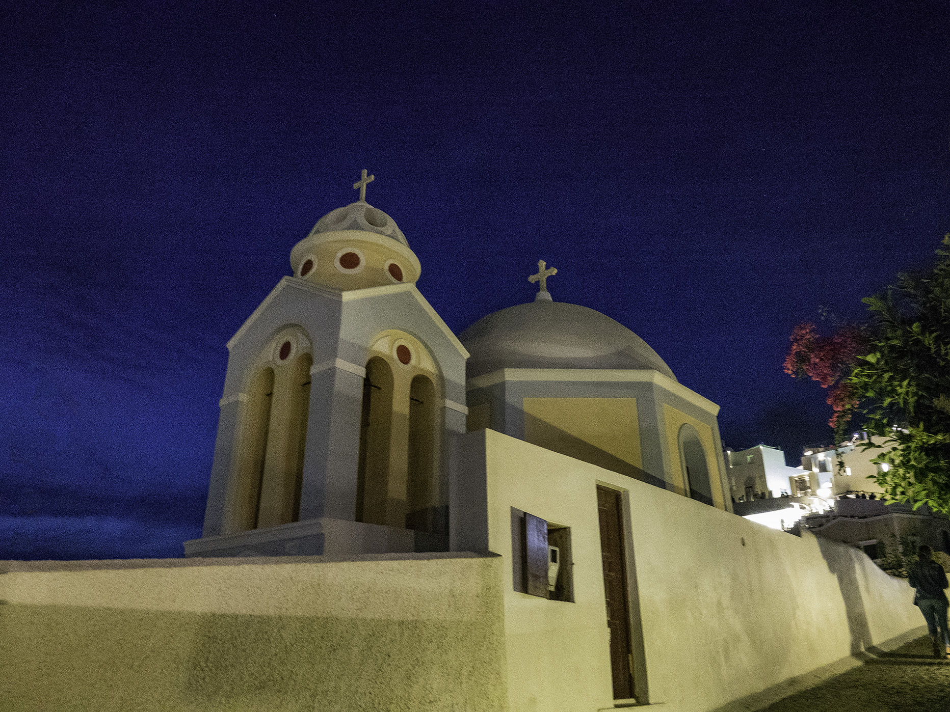
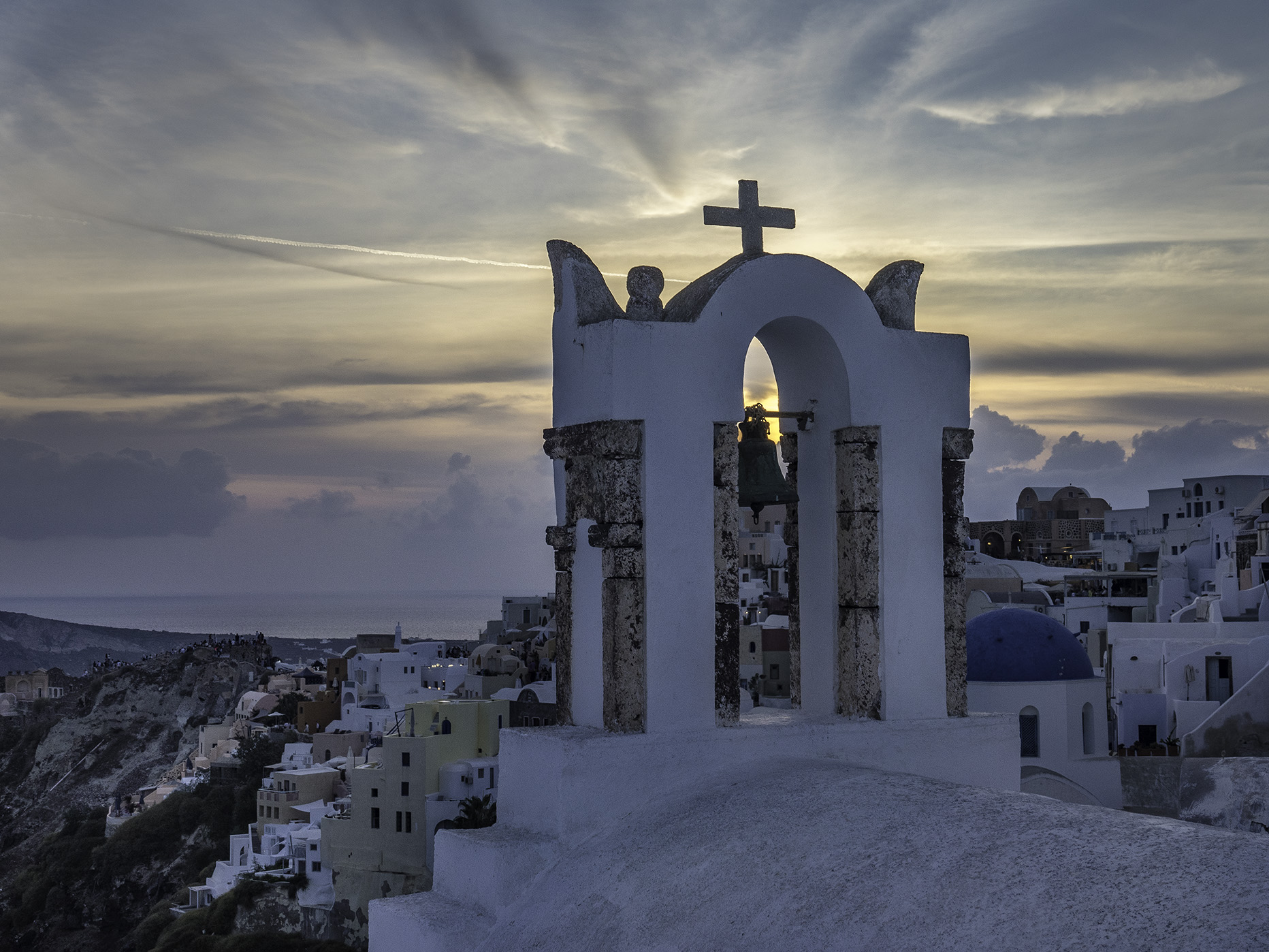
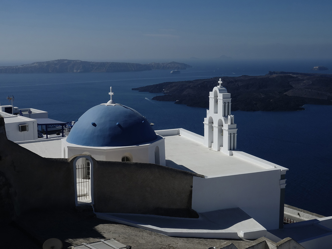
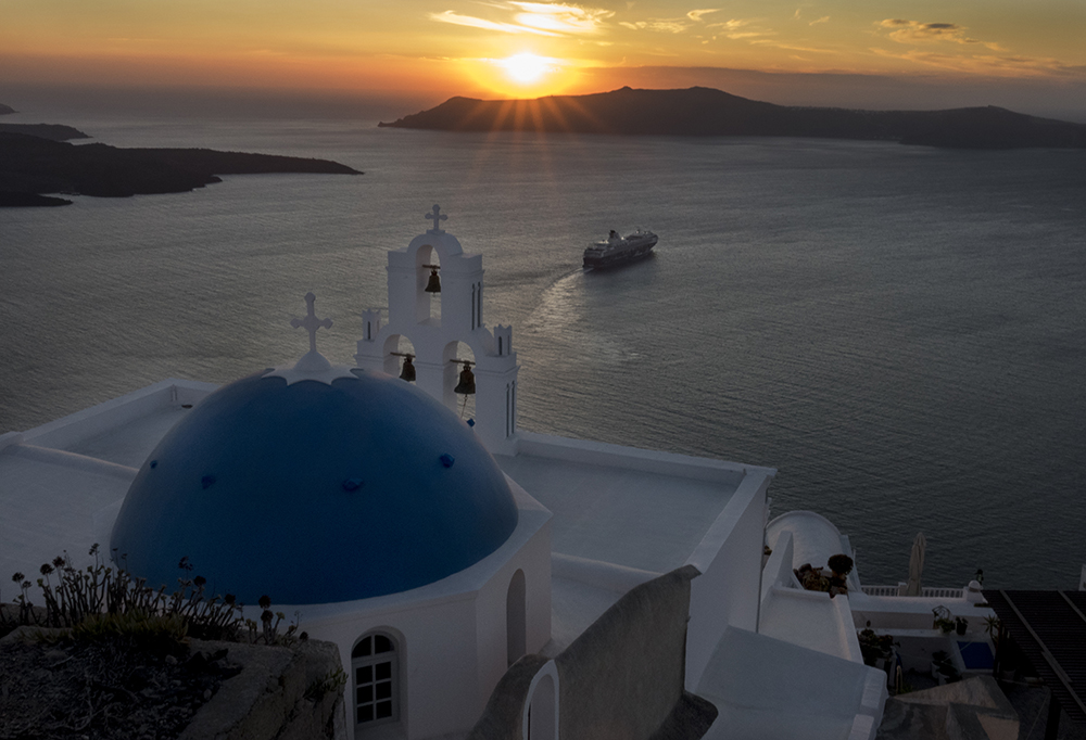
One of my favorite areas of Greece to visit. The bright blue sky, white wash houses, narrow walkways and steep cliffs and beautiful sunsets most every night!
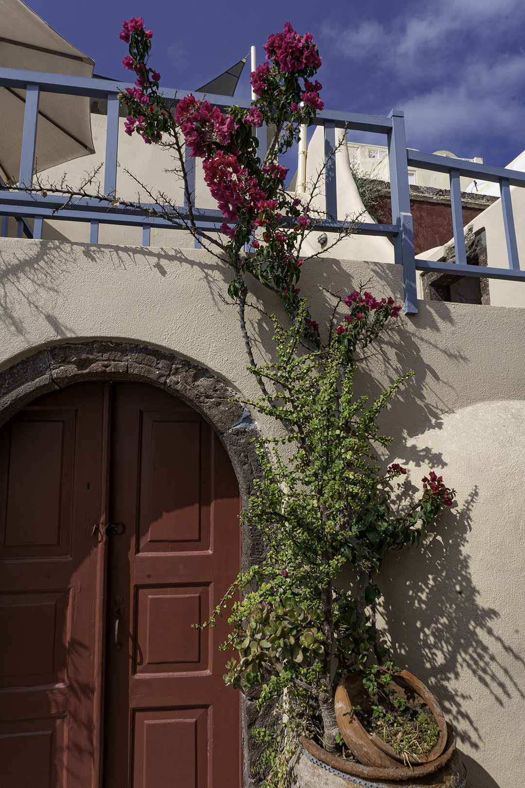
Santorini Blue DomeBougainvilla and Cactus gardenSunset in SantoriniSquare tower Round DomeThree Church domes sunsetSmall Houses on CliffsideSantorini windmillWalking Towards the windmillThrough the Window
Girl Posing in White SantoriniRed DoorsCat Posing at Sunset
Bell Tower and SunsetMan Painting Church domeSantorini church
Nara Park (奈良公園Nara Kōen) is a public park located in the city of Nara, Japan.. Established in 1880 it is one of the oldest parks in Japan. Nara is known for the oldest, largest and most interesting temples and the 1,200 wild sika deer (シカ or 鹿shika) that freely roam around in the park, protected as natural treasures. The official size of the park is about 1,240 acres, the area including the grounds of Tōdai-ji, Kōfuku-ji, and Kasuga Shrine, which are either on the edge or surrounded by Nara Park, is as large as 1,600 acres.
Nara’s temples include such world famous UNESCO World Heritage listed temples such as Kofukuji, Todaiji Kasuga Shrine and Yakushiji which will be featured in this website. Please click on the pictures for more information on the photos.
Kōfuku-ji has its origin as a temple that was established in 669 by Kagami-no-Ōkimi (鏡大君), the wife of Fujiwara no Kamatari, wishing for her husband’s recovery from illness. Its original site was in Yamashina, Yamashiro Province (present-day Kyoto). In 672, the temple was moved to Fujiwara-kyō, the first planned Japanese capital to copy the orthogonal grid pattern of Chang’an. In 710 the temple was dismantled for the second time and moved to its present location, on the east side of the newly constructed capital, Heijō-kyō, today’s Nara.
Tōdai-ji (東大寺, Eastern Great Temple)[1] is a Buddhist temple complex that was once one of the powerful Seven Great Temples, located in the city of Nara, Japan. Its Great Buddha Hall (大仏殿Daibutsuden) houses the world’s largest bronze statue of the Buddha[2]Vairocana,[3] known in Japanese as Daibutsu (大仏). The temple also serves as the Japanese headquarters of the Kegon school of Buddhism.
Kasuga Grand Shrine (春日大社Kasuga-taisha) is a Shinto shrine in the city of Nara, in Nara Prefecture, Japan.[1] Established in 768 CE and rebuilt several times over the centuries, it is the shrine of the Fujiwara family. The interior is famous for its many bronze lanterns, as well as the many stone lanterns that lead up the shrine
The path to Kasuga Shrine passes through Deer Park where the deer are able to roam freely and are believed to be sacred messengers of the Shinto gods that inhabit the shrine and surrounding mountainous terrain. Kasuga Shrine and the deer have been featured in several paintings and works of art of the Nambokucho Period.[2] Over three thousand stone lanterns line the way.
The original Yakushi-ji was built in Fujiwara-kyō, Japan’s capital in the Asuka period, commissioned by Emperor Tenmu in 680 to pray for recovery from illness for his consort, who succeeded him as Empress Jitō. This act of building temples in devotion to Buddhist figures was a common practice among Japanese nobility when Buddhism was first imported from China and Korea. Emperor Tenmu had died by the time Empress Jitō completed the complex around 698; and it was disassembled and moved to Nara eight years after the Imperial Court settled in what was then the new capital.
These are a few sample pictures from our travels in 2017. These are a selection of pictures taken in Greenland, Iceland, Italy, Greece, Wales, Scotland and England. Please check back for Photographic additions in one or all of the visited Countries.
Greenland is an interesting country ans has just recently started receiving the tourist trade. I bought a fun t-shirt in Greenland on our first visit that says “Lost in Greenland” such fun!
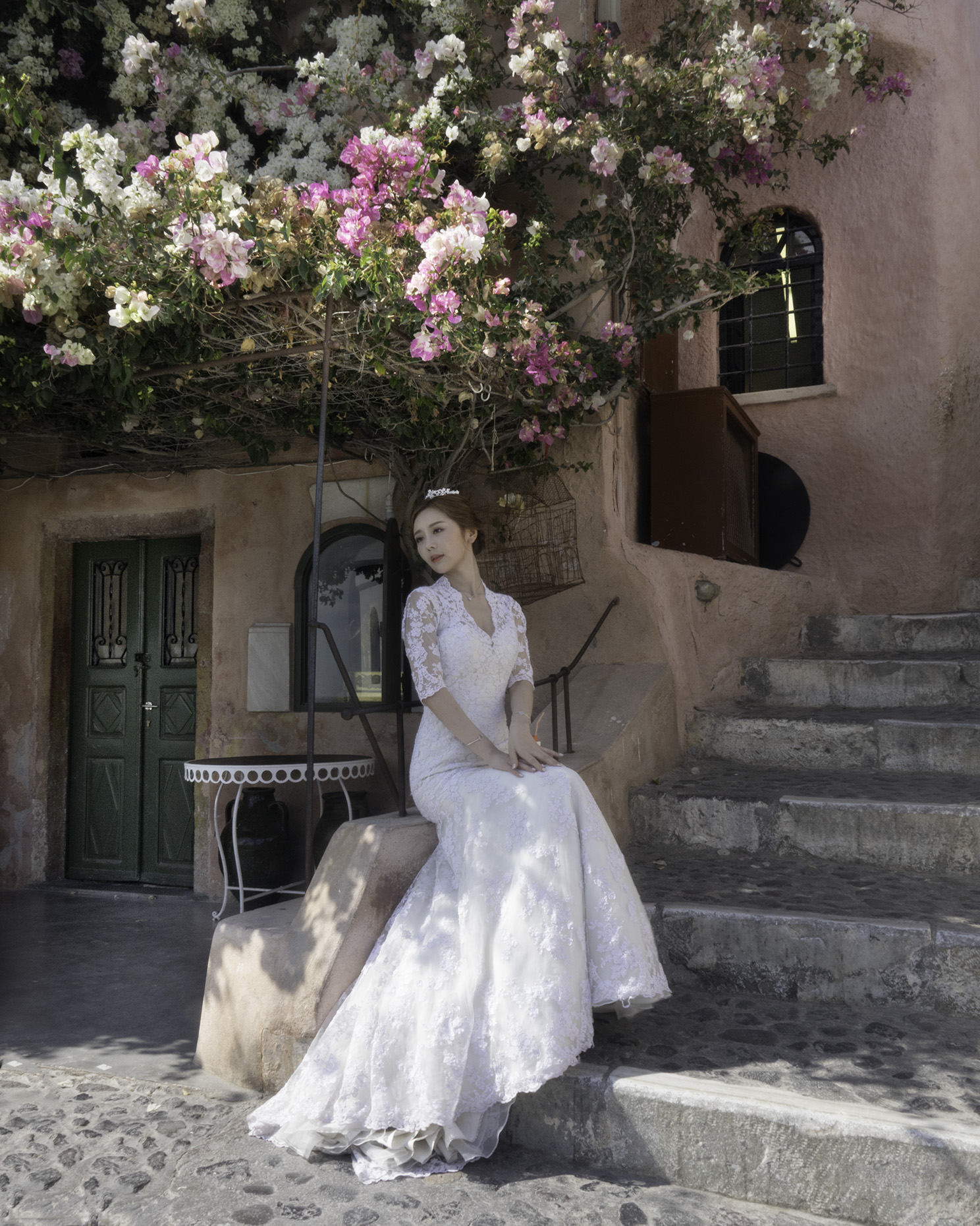
Venice is great for photography; the Gondolas, the canals, Rialto Bridge and the historic Buildings. Burano Italy is just a water taxi away from Venice famous for its colorful houses, and beautiful lace work. Santorini and Mykonis are beautiful Greek Islands, and very popular with the tourist crowd. Many Chinese women come to Santorini to pose in their wedding gowns.
Wales, Ireland and the Islands off Scotland have many interesting Neolithic sites such as Skara Brae and several Henge sites, Standing Stones of Stennes, and Ring of Bodgar near Kirkwell Orkney.
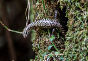
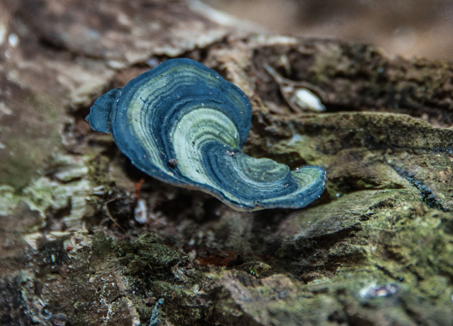
Mushrooms and Tree Lizard
Near Cairns Australia we took a hike in a Rainforest. On the way to view the Josephine waterfall we spied these mushrooms, and the very interesting little tree lizard. This was the first time I had ever seen a blue mushroom. After I “Googled” blue mushroom I found out there are several blue mushrooms!
We Americans on the hike were very interested in the tree lizard, but our guide seemed surprised that we were so interested.
More pictures from Townsville. After we left the Billabong Sanctuary we drove back to Townsville and went to the top of Mt Spec. The views of Townsville and the surrounding area including Magnetic Island, were wonderful. Beautiful flowers abound, as well as great beaches and cute children.
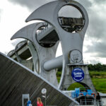
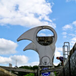
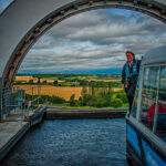
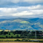
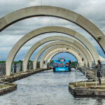
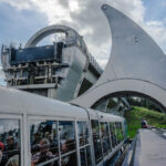
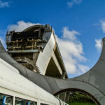
The next time you visit Scotland take a trip on the Falkirk Wheel, and view Archimedes principle of displacement in action! On our Narrow boat Canal trip we went through the Wheel several times, here are some photos of our experience.
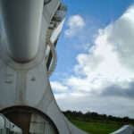
Looking down on the countryside from the top of the wheel.
History
The Millennium Link was an ambitious £84.5m project with the objective of restoring navigability across Scotland on the historic Forth & Clyde and Union Canals, providing a corridor of regenerative activity through central Scotland.
A major challenge faced, was to link the Forth and Clyde Canal, which lay 35m (115ft) below the level of the Union Canal. Historically, the two canals had been joined at Falkirk by a flight of 11 locks that stepped down across a distance of 1.5km, but these were dismantled in 1933, breaking the link.
What was required was a method of connecting these two canals by way of a boat lift. British Waterways (now Scottish Canals) were keen to present a visionary solution taking full advantage of the opportunity to create a truly spectacular and fitting structure that would suitably commemorate the Millennium and act as an iconic symbol for years to come.
The resultant, a perfectly balanced structure that is The Falkirk Wheel – the world’s first and only rotating boat lift – was the eventual outcome of our collaboration with a design team that combined international experience of joint venture contractor Morrison-Bachy-Soletanche with leading specialists from Ove Arup Consultants, Butterley Engineering and Scotland-based RMJM architects.
Completion of The Millennium Link project was officially marked by Her Majesty The Queen on 24 May 2002 at The Falkirk Wheel. How does it work?
The Falkirk Wheel lies at the end of a reinforced concrete aqueduct that connects, via the Roughcastle tunnel and a double staircase lock, to the Union Canal. Boats entering the Wheel’s upper gondola are lowered, along with the water that they float in, to the basin below. At the same time, an equal weight rises up, lifted in the other gondola.
This works on the Archimedes principle of displacement. That is, the mass of the boat sailing into the gondola will displace an exactly proportional volume of water so that the final combination of ‘boat plus water’ balances the original total mass.
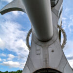
Each gondola runs on small wheels that fit into a single curved rail fixed on the inner edge of the opening on each arm. In theory, this should be sufficient to ensure that they always remain horizontal, but any friction or sudden movement could cause the gondola to stick or tilt. To ensure that this could never happen and that the water and boats always remain perfectly level throughout the whole cycle, a series of linked cogs acts as a back up.
Hidden at each end, behind the arm nearest the aqueduct, are two 8m diameter cogs to which one end of each gondola is attached. A third, exactly equivalent sized cog is in the centre, attached to the main fixed upright. Two smaller cogs are fitted in the spaces between, with each cog having teeth that fit into the adjacent cog and push against each other, turning around the one fixed central one. The two gondolas, being attached to the outer cogs, will therefore turn at precisely the same speed, but in the opposite direction to the Wheel.
Given the precise balancing of the gondolas and this simple but clever system of cogs, a very small amount of energy is actually then required to turn the Wheel. In fact, it is a group of ten hydraulic motors located within the central spine that provide the small amount, just 1.5kw, of electricity to turn it.
“All the pathos and irony of leaving one’s youth behind is thus implicit in every joyous moment of travel: one knows that the first joy can never be recovered, and the wise traveler learns not to repeat successes but tries new places all the time.” Paul Fussell
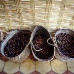
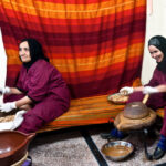
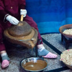
One woman cracking the Argan nuts, and The other grinding
The historical way of obtaining Argan oil
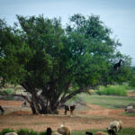
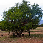
Goats in the tree Sheep on the ground
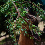
Climbing Goat out on a limb
Goats in the tree Sheep on the ground
Goats-in-Tree
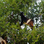
Black and White Goat in the Argan tree
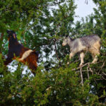
Two Climbing Goats in the Argan tree
Climbing Goat out on a limb
Goat in the Argan tree
Climbing Goat out on a limb
7 Incredible Natural Phenomena you’ve never seen
Published on 11/16/2007 under Weird Science –
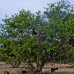
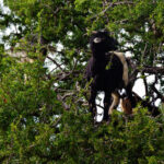
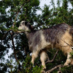
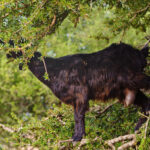
“Morocco’s Climbing Goats
Goats on trees are found mostly only in Morocco. The goats climb them because they like to eat the fruit of the argan tree, which is similar to an olive. Farmers actually follow the herds of goats as they move from tree to tree. Not because it is so strange to see goats in trees and the farmers like to point and stare, but because the fruit of the tree has a nut inside, which the goats can’t digest, so they spit it up or excrete it which the farmers collect. The nut contains 1-3 kernels, which can be ground to make argan oil used in cooking and cosmetics. This oil has been collected by the people of the region for hundreds of years, but like many wild and useful things these days, the argan tree is slowly disappearing due to over-harvesting for the tree’s wood and overgrazing by goats.
As a result a group of people and organizations have banded together to try to save the tree. To do so one of the primary locations where the trees grow has been declared a biosphere preserve. It was also decided that by making the world aware of the oil, it’s great taste and supposed anti-aging properties, would create a demand for it. However, the people who planned to market the oil could not envision people wanting to put an oil on their food or their face that was collected from goat excrement. As a result, a campaign is being led to ban grazing on the trees by goats during certain parts of the year to allow the fruit to ripen and fall off on its own. The fruit is then collected and turned into oil by oil cooperatives.”
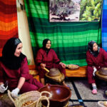
I was just there, and the coop seem to be working. Most argan sold today is produced by a Berber women’s cooperative that shares the profits among the local women earning money which provides health and education to them and the whole community. The cooperative has established an ecosystem reforestation project so that the supply of argan oil will not run out and the income that is currently supporting the women will not disappear. The goats are kept out of the trees from May to August thus the trees are looking much healthier than the pictures of trees taken in 2007.
According to the Department of Water and Forests, Argan oil provides income for 3 million people in the southern part of the kingdom. The oil provides a total of 20 million workdays per year. Its operation is an income-generating activity and has always had a socio-economic function.
Co-sponsored by the Social Development Agency (SDA) with the support of the European Union, the UCFA (Union des Cooperatives des Femmes de l’Arganeraie) is the largest union of cooperatives for argan in Morocco. It comprises twenty-two cooperatives that are found everywhere in the region (e.g., Coopérative Al Amal, Coopérative Amalou N’Touyag, Coopérative Tissaliwine, Coopérative ArganSense, Coopérative Maouriga). These women come together to be better organized and thus guarantee a fair income through cooperatives, allowing them a better living environment.
Argan oil is an oil produced from the kernels of the argan tree, endemic to Morocco, that is valued for its nutritive, cosmetic and numerous medicinal properties. The tree, a relict species from the Tertiary age, is extremely well adapted to drought and other environmentally difficult conditions of southwestern Morocco. The species Argania once covered North Africa and is now endangered and under protection of UNESCO. The Argan tree grows wild in semi-desert soil, its deep root system helping to protect against soil erosion and the northern advance of the Sahara. This biosphere reserve, the Arganeraie Biosphere Reserve, covers a vast intramontane plain of more than 2,560,000 hectares, bordered by the High Atlas and Little Atlas Mountains and open to the Atlantic in the west. Argan oil remains one of the rarest oils in the world due to the small and very specific growing areas.
Before modern times, the Berbers (also known as the Amazighs) of Morocco would collect undigested Argan pits from the waste of goats which climb the trees to eat their fruit. “Amlou” a thick brown paste with a consistency similar to peanut butter is produced by stone grinding roasted almond and Argan oil and is considered a favorite local bread dip. However, the oil used in cosmetic and culinary products available for sale today has most likely been harvested directly from the tree and processed with machines. The unroasted oil is traditionally used as a treatment for skin diseases, and has found favour with the cosmetics industry.
I have so much fun geotagging my pictures and then, from Lightroom, placing the locations on the Google map. I use a Nikon GP-1 that attaches to my Nikon D3 (or D300). As we travel it is interesting to note our longitude and latitude as well as the altitude. Sometime at sea level it registers as a minus elevation!
The GP-1 also elicits much interest from other travelers, as they wonder what is that little unit on the camera accessory shoe? The unit can also be mounted on the camera strap with the included strap adapter mount. A cable from the unit connects to the camera through the 10 pin terminal. GPS data will be recorded when the GP-1 is able to detect three or more satellites. The data is recorded in the metadata of each photograph, and can be seen on the camera display immediately.
I wish I had had the unit for trips taken years ago so my map would be more complete!
No matter what kind of camera you have this is a great addition.
This tiny locomotive on a short-track in the research station town of Ny-Ålesund on the Kongsfjorden of Spitsbergen in the Svalbard Archipelago of Arctic Norway is no longer active—but does retain the title of ‘northernmost train in the world’